Hyperspectral Imaging for Algal Bloom Monitoring: Advanced Detection, Analysis, and Biomedical Implications
This article provides a comprehensive examination of hyperspectral imaging (HSI) as a transformative tool for monitoring harmful algal blooms (HABs), with particular relevance for researchers and drug development professionals.
Hyperspectral Imaging for Algal Bloom Monitoring: Advanced Detection, Analysis, and Biomedical Implications
Abstract
This article provides a comprehensive examination of hyperspectral imaging (HSI) as a transformative tool for monitoring harmful algal blooms (HABs), with particular relevance for researchers and drug development professionals. It explores the foundational principles of HSI technology and its superiority over traditional monitoring methods. The scope covers advanced methodological applications across satellite, aerial, and drone platforms, and details the integration of machine learning for precise algae classification and toxin detection. The article further addresses critical challenges in data processing and validation, synthesizing current research to highlight HSI's potential in mitigating public health risks associated with cyanotoxins and informing biomedical research avenues.
Understanding Hyperspectral Imaging and the Escalating Threat of Harmful Algal Blooms
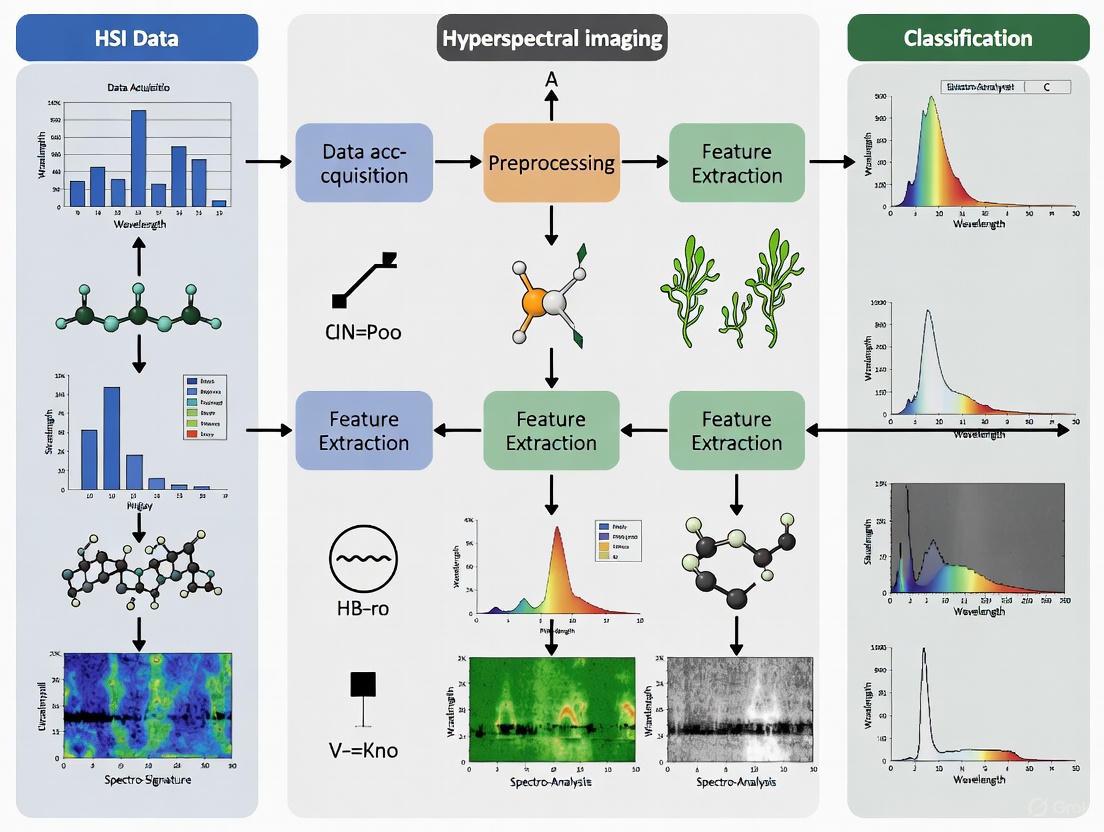
Hyperspectral Imaging (HSI) is an advanced optical sensing technique that integrates spectroscopy and digital photography into a single system [1]. This integration enables the simultaneous acquisition of spatial and spectral information, capturing images of a scene across numerous narrow, contiguous spectral bands. The fundamental data structure generated by HSI is a three-dimensional dataset known as a hypercube [2]. This cube combines two spatial dimensions (x, y) with one spectral dimension (λ), thereby bridging conventional imaging and spectroscopy to provide a unique spectral "fingerprint" for every pixel in the captured scene [1]. In the context of algal bloom research, this rich spectral detail allows researchers to move beyond mere detection to precise identification of algal species and quantification of pigment concentrations, which is critical for distinguishing harmful from non-harmful blooms [3] [4].
The following diagram illustrates the fundamental structure of a hyperspectral data cube and the pushbroom imaging principle, a common method for its acquisition.
Figure 1: Pushbroom Scanning Builds a Hypercube. A single spatial line (y) is imaged onto a slit. Light from this line is spectrally dispersed, forming a 2D image (y × λ) on the detector. Scanning over the second spatial dimension (x) sequentially builds the final three-dimensional (x, y, λ) hypercube.
Core Principles of Data Acquisition
The creation of a hypercube relies on specific hardware configurations and physical principles. A typical HSI system comprises an optical assembly, an imaging spectrometer, and a detector array [1]. The process begins with light reflected or emitted from the target scene. The optical assembly (lenses, mirrors) collects this incident radiation and directs it toward the imaging spectrometer, which is the core component responsible for spectral dispersion [1].
Spectral dispersion is achieved using dispersion optics such as diffraction gratings, prisms, or electronically tunable filters [1]. These components split the incoming light from each spatial point into its constituent wavelengths. In a common method like pushbroom scanning (shown in Figure 1), the system captures a two-dimensional image for each step in the scanning process—one spatial dimension and one full spectral dimension for each pixel in that line [2]. By scanning across the entire scene, the system compiles these 2D slices into the final 3D hypercube. This process results in data that typically covers wavelengths from visible light (∼400-700 nm) to the short-wave infrared (up to 2500 nm) at high spectral resolutions of 5-10 nm, far exceeding the capabilities of standard RGB or multispectral imaging [1].
Quantitative Data and Sensor Performance
The performance of HSI systems in environmental monitoring is quantified by key spectral, spatial, and analytical metrics. The following table summarizes the core capabilities of HSI and its performance in algal bloom applications.
Table 1: Key Performance Metrics of Hyperspectral Imaging for Algal Bloom Monitoring
| Parameter | Typical Specification / Performance | Application Relevance in Algal Bloom Research |
|---|---|---|
| Spectral Range [1] | 380–2500 nm (Visible, NIR, SWIR) | Enables detection of pigment-specific absorption features (e.g., Chlorophyll-a, Phycocyanin). |
| Spectral Resolution [1] | 5–10 nm | Allows discrimination between subtle spectral signatures of different algae species [4]. |
| Spectral Bands [1] | Hundreds of contiguous bands | Creates a continuous, diagnostic spectrum for each pixel, enabling precise material identification. |
| Classification Accuracy [4] | Up to 90% for algae species | Facilitates reliable mapping and monitoring of harmful algal blooms (HABs). |
| Chlorophyll-a Estimation (R²) [4] | Frequently > 0.80 | Provides a quantitative measure of algal biomass, crucial for assessing bloom intensity. |
HSI systems can be deployed on various platforms, each offering distinct advantages for spatial coverage and resolution. The table below compares these platforms, highlighting their use in HAB monitoring.
Table 2: Comparison of HSI Deployment Platforms for Algal Bloom Monitoring
| Platform | Spatial Resolution | Key Advantages | Example Use Case in HAB Monitoring |
|---|---|---|---|
| Satellite [5] | Tens of meters | Broad spatial coverage, regular revisit times | Large-scale bloom detection and tracking over open waters and large lakes [3]. |
| Manned Aircraft [3] | ~1 meter | High-resolution, targeted data collection | High-frequency monitoring of specific critical zones, like water intakes [3]. |
| UAV / Drone [6] [5] | Sub-centimeter to ~1 meter | Unprecedented spatial detail, access to difficult areas | Detailed mapping of shoreline blooms and calibration/validation of other data sources [6]. |
| In Situ Sensors [4] | Point measurements (non-imaging) | Continuous, real-time data at a fixed location | Early warning systems at sensitive locations (e.g., drinking water intake pipes) [3]. |
Experimental Protocols for Algal Bloom Monitoring
Protocol: Airborne HSI Survey for HAB Detection and Mapping
Objective: To distinguish harmful algal blooms (HABs) from non-harmful blooms, determine HAB concentrations, and track bloom movement with enhanced spatial and temporal resolution [3].
Workflow Overview: The following diagram outlines the end-to-end workflow for an airborne HSI campaign, from mission planning to data delivery for management actions.
Figure 2: End-to-end HSI Data Processing Workflow. This protocol involves careful planning, data acquisition, and a series of processing steps to convert raw sensor data into actionable maps for water resource managers.
Materials and Reagents:
- Hyperspectral Imager: Airborne-grade pushbroom sensor (e.g., similar to NASA's AVIRIS) covering visible to near-infrared wavelengths [3] [1].
- Platform: Manned aircraft (e.g., NASA's S3 Viking) capable of carrying the sensor payload [3].
- GPS/IMU System: High-precision integrated system for accurate georeferencing of each scan line.
- Calibration Targets: Ground-based reflectance panels of known spectral properties for radiometric calibration.
- Field Validation Kit: Water sampling equipment, filters, and a portable fluorometer or spectrophotometer for measuring chlorophyll-a and phycocyanin concentrations in water samples collected concurrently with the flight [4].
Methodology:
- Pre-flight Calibration: Sensor radiometric and spectral calibration is performed in the lab. Pre-flight mission plans define flight lines for complete area coverage.
- Aerial Survey: Conduct flights during optimal sun-angle conditions to maximize signal-to-noise ratio. Simultaneously, ground crews collect water samples from pre-determined locations within the survey area for validation [3].
- Data Pre-processing: Apply radiometric correction to convert raw digital numbers to radiance. Use GPS/IMU data for geometric correction and georeferencing. Perform atmospheric correction to derive surface reflectance [1].
- Spectral Analysis and Algorithm Application: Process the corrected hypercube using specialized algorithms. This can include:
- Product Generation and Delivery: Generate next-day georeferenced maps of HAB concentration and distribution. Distribute these products to shoreline water resource managers to inform public health responses [3].
Protocol: UAV-Based Hyperspectral Monitoring of Near-Shore Algal Blooms
Objective: To detect and map harmful algal blooms at very high spatial resolution along affected shorelines using a compact HSI system mounted on a drone [6] [3].
Materials and Reagents:
- Miniaturized HSI Sensor: A compact, low Size, Weight, and Power (SWaP) hyperspectral payload suitable for UAV deployment (e.g., systems like HyDRUS) [3].
- UAV Platform: A fixed-wing or multi-rotor drone with sufficient payload capacity and flight time (e.g., Altavian NOVA F6500) [3].
- Field Calibration Panel: A small, portable reflectance standard.
Methodology:
- Sensor Integration and Payload Testing: Integrate the HSI sensor with the UAV, ensuring stable mounting and proper configuration of the data logging system.
- Flight Operation: Execute automated flight plans at low altitudes to achieve sub-meter ground resolution. Focus on specific areas of concern along the shoreline.
- Data Processing: Due to the lower flight altitude, atmospheric correction is minimal. Focus on radiometric calibration and geometric correction using the drone's navigation data. The high spatial resolution allows for the detection of small-scale algal scum patterns that might be missed by airborne surveys [6] [3].
- Validation: Conduct concurrent in-situ water sampling and visual observation to validate the hyperspectral classifications.
The Scientist's Toolkit: Essential Research Reagents and Materials
Table 3: Essential Materials and Analytical Tools for HSI-based Algal Bloom Research
| Item | Function | Application Notes |
|---|---|---|
| Hyperspectral Sensor (VNIR/SWIR) [1] | Captures the fundamental 3D hypercube (x, y, λ). | VNIR (400-1000 nm) is most common for algal pigments; SWIR can be useful for dissolved organic matter. |
| Radiometric Calibration Panel | Converts raw sensor data to absolute radiance/reflectance. | Critical for quantitative analysis and for comparing data acquired at different times or by different sensors. |
| Spectral Library of Algal Species [4] | Reference database of known spectral signatures. | Enables classification algorithms to identify specific harmful algae species based on their unique "fingerprint". |
| Chlorophyll-a Fluorescence Sensor [6] | Provides direct measurement of chlorophyll concentration. | Used for ground-truthing and validating chlorophyll estimates derived from hyperspectral data. |
| Deep Learning Classification Algorithms [7] [4] | Analyzes hypercube to classify pixels and quantify abundances. | CNNs and other models can achieve high accuracy in species classification and concentration estimation [7]. |
| Spectral Unmixing Software [1] | Decomposes mixed pixels into constituent endmembers. | Vital for determining the fractional abundance of cyanobacteria in water pixels containing multiple materials. |
Hyperspectral Imaging (HSI) represents a paradigm shift in remote sensing, moving beyond the capabilities of traditional RGB and multispectral systems by capturing light across hundreds of narrow, contiguous spectral bands. This creates a continuous spectrum for each pixel in an image, enabling precise identification of materials based on their unique biochemical composition [8] [4]. Whereas RGB imaging captures only three broad channels (red, green, blue) and multispectral imaging typically collects 4-36 discrete, broader bands, hyperspectral sensors can measure hundreds of bands with spectral widths less than 10 nm, creating a detailed "chemical map" of the observed scene [8] [9]. This fundamental difference in data acquisition provides HSI with unparalleled capabilities for environmental monitoring, particularly in complex applications like harmful algal bloom (HAB) research where subtle spectral features must be distinguished for accurate species identification and concentration quantification [4] [3].
The technological superiority of HSI stems from its ability to detect unique spectral signatures - often called "spectral fingerprints" - that result from how materials absorb, reflect, and emit electromagnetic energy at specific wavelengths [8] [10]. In algal bloom monitoring, different phytoplankton species possess distinct pigment compositions (chlorophyll-a, phycocyanin, phycoerythrin) that interact with light in characteristic ways, creating spectral features that multispectral systems with their broader channels cannot resolve [4] [11]. This granular spectral information enables researchers to move beyond simply detecting bloom presence to precisely classifying bloom composition, determining harmful versus non-harmful species, and quantifying pigment concentrations with high accuracy - critical capabilities for effective water quality management and public health protection [12] [3].
Technical Comparison: HSI Versus Other Imaging Modalities
Table 1: Fundamental characteristics of RGB, multispectral, and hyperspectral imaging technologies
| Characteristic | RGB Imaging | Multispectral Imaging | Hyperspectral Imaging |
|---|---|---|---|
| Number of Bands | 3 broad channels (Red, Green, Blue) [9] | Typically 4-36 discrete bands [8] | Hundreds of narrow, contiguous bands [8] [4] |
| Spectral Resolution | Very low (~100 nm bandwidth per channel) | Low to medium (broad bandwidth, 20+ nm) [13] | Very high (<10 nm bandwidth) [8] |
| Spectral Coverage | Visible only (400-700 nm) | Visible to infrared (discrete regions) [9] | Continuous from UV to SWIR or beyond [8] [4] |
| Data Output per Pixel | 3 values (R, G, B intensity) | 4-36 values (intensity per band) | Entire continuous spectrum (hundreds of values) [8] [10] |
| Primary Strength | Low-cost visualization | Cost-effective for specific indices (e.g., NDVI) [13] | Detailed material identification and quantification [4] [9] |
| Limitations | Limited analytical capability | Cannot detect subtle spectral features [4] | High data volume, processing complexity [4] |
Table 2: Performance comparison for algal bloom monitoring applications
| Parameter | Multispectral Performance | Hyperspectral Performance | Application Significance |
|---|---|---|---|
| Bloom Detection Accuracy | ~70-80% for dense surface blooms [4] | Up to 90% classification accuracy [4] | Earlier warning of developing bloom events |
| Species Discrimination | Limited to major functional groups | High differentiation of phytoplankton taxa [4] [11] | Identification of toxic vs. non-toxic species |
| Pigment Quantification (R²) | R² ~0.4-0.7 for chlorophyll-a [4] | R² >0.80 frequently achieved [4] | More accurate biomass estimation |
| Vertical Distribution Mapping | Surface information only | Can estimate vertical profiles to 5m depth [12] | Understanding bloom structure and dynamics |
| Early Detection Capability | Once visual symptoms appear | Pre-visual detection via biochemical changes [4] [13] | More time for management interventions |
The contiguous nature of hyperspectral data enables the application of advanced analytical techniques that are impossible with multispectral data. For instance, derivative spectroscopy can be used to highlight subtle absorption features in HSI data that would be obscured within the broad bands of multispectral systems [4]. Similarly, full spectral matching algorithms and spectral unmixing techniques require the continuous sampling provided by HSI to accurately distinguish between multiple algal species that may coexist in a bloom, each with their own characteristic spectral signature [4] [3]. This capability is particularly valuable for monitoring harmful algal blooms, where the ability to distinguish toxin-producing species like Karenia brevis and Microcystis aeruginosa from non-toxic varieties has significant implications for public health risk assessment and water resource management [3] [11].
Experimental Protocols for HSI in Algal Bloom Research
Protocol: Drone-Based Vertical Profiling of Algal Pigments
This protocol details the methodology for monitoring the vertical distribution of algal pigments using drone-borne hyperspectral imagery and deep learning models, adapted from Hong et al. (2021) [12].
Research Objectives:
- Quantify vertical distribution of chlorophyll-a (Chl-a), phycocyanin (PC), and turbidity (Turb) in water columns
- Develop predictive models for pigment concentrations at different depths (0-5m with 0.05m intervals)
- Identify influential spectral bands for vertical profile estimation
Materials and Equipment:
- Hyperspectral imager mounted on UAV/drone (400-1000 nm range recommended)
- In-situ spectrophotometer for water sample validation
- Meteorological station for recording ambient conditions
- Deep learning workstation with GPU capability
- Software: Python with TensorFlow/PyTorch, spectral analysis tools
Procedure:
- Site Selection and Flight Planning: Identify representative sampling areas within the water body. Establish flight transects covering areas with varying bloom intensity.
- Hyperspectral Data Acquisition: Conduct drone flights at optimal solar geometry (e.g., 10:00-14:00 local time to minimize sun glint). Maintain consistent altitude and overlap between flight lines.
- In-situ Validation: Collect concurrent water samples at various depths (0-5m with 0.05m intervals). Analyze for Chl-a, PC, and turbidity using laboratory standards.
- Data Preprocessing: Apply radiometric calibration to convert raw digital numbers to reflectance. Perform atmospheric correction using appropriate models. Georeference all imagery.
- Model Development: Implement deep neural network architectures (e.g., ResNet-18, ResNet-101, GoogLeNet, Inception v3). Train models using hyperspectral data cubes as input and measured pigment concentrations as output.
- Model Interpretation: Apply Gradient-weighted Class Activation Mapping (Grad-CAM) to identify influential wavelength ranges contributing to vertical estimation accuracy.
- Validation: Reserve 20-30% of data for independent validation using k-fold cross-validation. Calculate performance metrics (R², RMSE, MAE).
Expected Outcomes: The ResNet-18 model has demonstrated best performance in original research (R² = 0.70) [12]. Grad-CAM analysis typically identifies informative reflectance bands near 490 nm and 620 nm as particularly influential for vertical pigment estimation [12].
Protocol: Satellite HSI Data Fusion for HAB Speciation
This protocol describes a self-supervised framework for fusing multi- and hyperspectral satellite data for HAB monitoring, based on LaHaye et al. (2025) [14].
Research Objectives:
- Detect and map HAB severity and speciation using multi-sensor satellite data
- Develop a self-supervised learning framework that operates without per-instrument labeled datasets
- Validate against in-situ measurements of total phytoplankton and specific HAB species
Materials and Equipment:
- Satellite data from multiple sensors (VIIRS, MODIS, Sentinel-3, PACE OCI, TROPOMI)
- In-situ HAB monitoring data for validation
- High-performance computing infrastructure for deep learning
- Software: Python with deep learning frameworks (TensorFlow/PyTorch), geospatial processing libraries
Procedure:
- Data Collection: Acquire hyperspectral data from PACE OCI (~1.2 km resolution, 5 nm spectral resolution from 350-800 nm) and PRISMA (30 m resolution, 12 nm spectral resolution). Supplement with multispectral data from VIIRS, MODIS, and Sentinel-3.
- Data Preprocessing: Perform cross-sensor calibration to ensure radiometric consistency. Apply atmospheric correction using NASA's SeaDAS or similar processing chains. Spatially and temporally match all satellite datasets.
- Representation Learning: Implement self-supervised learning to extract meaningful features from the multi-sensor data without requiring manually labeled examples for each instrument.
- Hierarchical Deep Clustering: Apply deep clustering algorithms to segment phytoplankton concentrations and speciations into interpretable classes based on the learned representations.
- Product Generation: Generate HAB severity products (biomass concentration) and HAB speciation products (dominant species identification) from the clustered outputs.
- Validation: Compare satellite-derived products with in-situ data from monitoring programs (e.g., water sample microscopy, pigment analysis, toxin assays). Calculate accuracy metrics for total phytoplankton and specific HAB species.
Expected Outcomes: The SIT-FUSE framework has demonstrated strong agreement with in-situ measurements of total phytoplankton, Karenia brevis, Alexandrium spp., and Pseudo-nitzschia spp. [14]. This approach enables exploratory analysis via hierarchical embeddings and represents a critical step toward operationalizing self-supervised learning for global aquatic biogeochemistry.
Workflow Visualization: HSI Data Processing for Algal Bloom Monitoring
Diagram 1: HSI data processing workflow for algal bloom monitoring.
The Scientist's Toolkit: Essential Research Reagents & Materials
Table 3: Essential research reagents and materials for HSI-based algal bloom studies
| Item | Specification/Type | Function/Application |
|---|---|---|
| Hyperspectral Sensors | Drone-borne (e.g., HyDRUS), Airborne (e.g., AVIRIS), Satellite (e.g., PACE OCI, PRISMA, EnMAP) [12] [8] [3] | Data acquisition across spatial scales (sub-meter to km resolutions) |
| Spectral Libraries | USGS Spectral Library, National Spectral Database (NSD) [8] | Reference spectra for material identification and classification |
| Radiative Transfer Models | MODTRAN, HySIMU simulator [11] | Atmospheric correction and sensor performance simulation |
| Deep Learning Frameworks | ResNet-18, GoogLeNet, Inception v3, Custom architectures [12] [15] [14] | Pigment concentration estimation and species classification |
| Validation Instruments | In-situ spectrophotometers, Fluorometers, Water sampling kits [12] [11] | Ground-truth data collection for algorithm validation |
| Spectral Analysis Software | ENVI, Python spectral libraries (e.g., Scikit-learn, PyTorch) [4] | Data preprocessing, spectral unmixing, and feature extraction |
The transition from multispectral to hyperspectral monitoring represents a fundamental advancement in algal bloom research capabilities, enabling a shift from simply detecting bloom presence to precisely characterizing bloom composition, toxicity potential, and vertical structure. The contiguous spectral sampling of HSI reveals biochemical information that remains hidden within the broad channels of multispectral systems, providing researchers and water managers with the data resolution needed to address increasingly complex HAB challenges in a changing climate [4] [11]. As hyperspectral technology continues to evolve with smaller, more affordable sensors and advanced analytical approaches like the deep learning and self-supervised methods detailed in these protocols, HSI is poised to become an increasingly accessible and powerful tool for the global research community [13] [3].
For research teams implementing HSI for algal bloom studies, success depends on carefully matching sensor capabilities to monitoring objectives, recognizing that each platform - whether handheld, drone-borne, airborne, or satellite-based - offers distinct advantages for specific applications [8] [3]. The protocols and methodologies presented here provide a foundation for designing rigorous HSI-based monitoring campaigns that leverage the technology's full potential while acknowledging current limitations related to data volume, processing complexity, and the need for robust validation [4]. As the hyperspectral remote sensing landscape continues to expand with new satellite missions and analytical techniques, these implementation frameworks offer pathways for researchers to contribute to the growing body of knowledge that will ultimately improve our ability to understand, predict, and mitigate the impacts of harmful algal blooms on aquatic ecosystems and human communities.
Harmful Algal Blooms (HABs) represent a critical and escalating global threat to aquatic ecosystems, public health, and economic stability. These events occur when microscopic algae or cyanobacteria proliferate rapidly and dominate a water body, sometimes producing potent toxins or creating biomass in sufficient quantities to harm aquatic life, disrupt ecosystems, and impair human activities [16] [4]. The manifestations of these blooms are diverse, often termed "red tides," "brown tides," or "green tides" based on their appearance [4]. The increasing frequency, intensity, and geographic distribution of HABs are increasingly linked to factors such as nutrient pollution and climate change, including rising water temperatures and marine heatwaves [17] [4]. This document frames the HAB crisis within the context of advanced monitoring technologies, with a specific focus on the application of hyperspectral imaging for research and early warning systems.
Global Impact and Quantitative Data
The consequences of HABs are multifaceted, affecting environmental integrity, public health, and regional economies. The following tables summarize the global scope and quantitative impact of recent significant HAB events.
Table 1: Documented Impacts of Recent Major HAB Events
| Location | Date | Key Impacts | Economic & Ecological Cost |
|---|---|---|---|
| South Australia [17] | Mar 2025 - Ongoing | - Mass mortality of >500 marine species (fish, penguins, marine mammals)- Human health issues (asthma, skin/eye irritation, coughing)- Shellfish farm closures due to brevetoxins | - Severe impact on aquaculture, fishing, and tourism- Loss of kelp, seagrass, and shellfish reefs |
| Western Lake Erie, USA [18] | Annual (2025 Forecast) | - Production of microcystin (liver toxin)- Risks to human/animal health and drinking water treatment | - Estimated annual economic impact >$70 million for the region- Beach closures, impaired recreational use |
| Puerto Rico [16] | 2025 (State of Emergency) | - Record-breaking Sargassum inundation of coastlines | - Emergency response required; impacts on tourism and coastal ecosystems |
| Lake Victoria, Kenya [19] | 2015-2020 Study Period | - Cyanobacteria blooms causing high aquaculture mortality- Increased waterborne diseases, diminished aesthetic appeal | - Elevated drinking water treatment costs- Negative effects on tourism and GDP |
Table 2: Quantitative Parameters for HAB Detection via Remote Sensing
| Parameter | Role as HAB Proxy | Typical Values During Blooms | Measurement Platform Examples |
|---|---|---|---|
| Chlorophyll-a (Chl-a) [19] | Indicator of algal biomass | Lake Victoria: 31 to 57.1 mg/m³ (bloom) vs. -1.2 to 16.4 mg/m³ (non-bloom) | Landsat 8/9, PRISMA, PACE OCI, MODIS |
| Lake Surface Air Temperature (LSAT) [19] | Catalyst for algal growth | Lake Victoria: 35.1°C to 36.6°C (bloom) vs. 16.9°C to 28.7°C (non-bloom) | Landsat 8 TIRS, In-situ IoT Sensors |
| Spectral Resolution [4] | Enables species discrimination | Hyperspectral sensors with many contiguous bands (e.g., ~5nm bandwidth) achieve ~90% classification accuracy. | Airborne HSI, PACE OCI, PRISMA |
Hyperspectral Imaging for HAB Monitoring: Principles and Advantages
Hyperspectral imaging (HSI) is a powerful remote sensing technology that captures the spectral signature of a target across a wide range of narrow, contiguous wavelengths, generating a continuous spectrum for each pixel in an image [4]. This creates a three-dimensional data cube, with two spatial dimensions and one spectral dimension. Unlike multispectral imaging which uses a few broad bands, HSI's high spectral resolution enables the precise identification and classification of different algae species based on their unique spectral fingerprints, which are determined by their specific pigment compositions (e.g., chlorophyll, phycocyanin) [4].
The advantages of HSI for HAB monitoring are significant:
- Species Discrimination: Capable of distinguishing between toxic and non-toxic algal species, a critical factor for risk assessment and management [3] [4].
- Quantitative Concentration Estimation: Regression models applied to HSI data can estimate chlorophyll-a and other pigment concentrations with high accuracy (R² > 0.80) [4].
- Broad Spatial and Temporal Coverage: When deployed on satellite or aerial platforms, HSI can monitor large or inaccessible areas frequently, providing data for early warning systems [11] [3].
Experimental Protocols for HAB Monitoring
This section outlines detailed methodologies for monitoring HABs, integrating hyperspectral data with complementary approaches.
Protocol: Satellite-Based Hyperspectral Monitoring of Inland Water Blooms
This protocol leverages satellite-based hyperspectral sensors for broad-scale detection and mapping of HABs [11] [19].
1. Objective: To detect, monitor, and map harmful algal blooms in inland water bodies using satellite-borne hyperspectral imagery. 2. Materials & Equipment: - Primary Data Source: Hyperspectral satellite imagery (e.g., PRISMA, PACE OCI, EnMAP). - Reference Data: In-situ water quality measurements (Chl-a, phycocyanin) for validation. - Software: Image processing software (e.g., ENVI, ERDAS IMAGINE) with spectral analysis tools; GIS software (e.g., ArcGIS, QGIS). - Ancillary Data: Landsat 8/9 OLI/TIRS or Sentinel-2 MSI data for cross-comparison. 3. Experimental Workflow:
4. Procedure: 1. Data Acquisition & Pre-processing: Select and download a cloud-minimized hyperspectral scene covering the target water body. Perform atmospheric correction (e.g., using FLAASH, ACOLITE) to convert at-sensor radiance to surface reflectance. Apply geometric correction for spatial accuracy [11] [19]. 2. Masking and ROI Definition: Apply a land and cloud mask to isolate the water pixels. Define regions of interest (ROIs) for areas with known bloom conditions and clear water for calibration. 3. Spectral Analysis and Algorithm Application: - Chlorophyll-a Estimation: Apply band ratio algorithms (e.g., Red/NIR ratio) or fluorescence line height (FLH) algorithms to the hyperspectral data to derive chlorophyll-a concentration maps [11]. - Species Classification: Use spectral angle mapper (SAM) or machine learning classifiers to match the pixel spectra against a library of known algal species' spectral signatures [4]. 4. Product Generation & Validation: Generate final maps of chlorophyll-a concentration and algal species distribution. Validate these products by comparing them with concurrent in-situ measurements. A coefficient of determination (R²) above 0.8 is a common target for chlorophyll-a models [19] [4]. 5. Data Dissemination: Integrate validated maps into monitoring systems and distribute to stakeholders via web portals or alerts.
Protocol: Integrated In-Situ IoT and Remote Sensing for HAB Early Warning
This protocol combines real-time in-situ sensing with satellite data for near real-time HAB monitoring [19].
1. Objective: To establish an automated, near real-time HAB detection and alert system using a network of in-situ IoT sensors, validated with periodic satellite overpasses. 2. Materials & Equipment: - In-Situ IoT System: Low-cost sensor buoys measuring Lake Surface Air Temperature (LSAT), chlorophyll fluorescence, phycocyanin, pH, turbidity, and dissolved oxygen. - Data Telemetry: Cellular or satellite communication modules for data transmission. - Central Data Server: Cloud-based or local server for data ingestion, storage, and processing. - Satellite Data: As per Protocol 4.1. 3. Experimental Workflow:
4. Procedure: 1. Sensor Deployment and Calibration: Deploy a network of IoT sensor buoys at locations prone to early HAB occurrence. Calibrate all sensors (e.g., chlorophyll fluorometer) against laboratory standards before deployment [19]. 2. Continuous Data Collection and Transmission: Sensors autonomously collect and transmit water quality parameters at pre-defined intervals (e.g., hourly) to a central server. 3. Data Analysis and Alert Triggering: The server analyzes the incoming data stream in near real-time. Pre-defined thresholds (e.g., LSAT > 30°C combined with a rapid rise in chlorophyll fluorescence) trigger an automated alert to managers [19]. 4. Satellite Tasking and Validation: Upon receiving an alert from the IoT network, a request can be made to task a hyperspectral satellite (if possible) or the next available satellite overpass (e.g., Landsat, Sentinel, PRISMA) is used to acquire imagery over the affected area to validate the in-situ alert and map the full spatial extent of the bloom. 5. Mitigation Action: Water resource managers use the combined in-situ and satellite data to issue public health advisories, adjust water treatment processes, or initiate other mitigation strategies.
The Scientist's Toolkit: Key Research Reagent Solutions
Table 3: Essential Materials and Tools for HAB Research and Monitoring
| Item / Solution | Function / Application | Relevance to Hyperspectral Studies |
|---|---|---|
| Chlorophyll-a Standards | Calibration of fluorometers and validation of remote sensing Chl-a algorithms. | Critical for converting hyperspectral reflectance data into accurate concentration maps [19]. |
| Phycocyanin Antibodies / Assays | Specific detection and quantification of cyanobacteria. | Used for ground-truthing to validate the discrimination of cyanobacteria from other algae via HSI [19]. |
| Spectral Library of Algal Species | A curated database of unique spectral signatures for various algal species. | Essential reference for classifying and identifying species from hyperspectral image data [4]. |
| Hyperspectral Image Analysis Software (e.g., ENVI, SPECIM's Lumo) | Processing, analyzing, and visualizing hyperspectral data cubes. | Enables species classification, spectral unmixing, and chlorophyll-a estimation [11] [4]. |
| In-Situ IoT Sensor Buoys | Continuous, real-time measurement of water quality parameters (Chl-a, LSAT, pH). | Provides ground-truthing for satellite data and triggers early warnings for targeted HSI acquisition [19]. |
| Radiative Transfer Models (e.g., MODTRAN, HySIMU) | Simulates at-sensor radiance for various conditions and sensor configurations. | Toolkits like HySIMU allow researchers to test HAB detection algorithms before satellite launches or in lieu of extensive field campaigns [11]. |
The HAB crisis poses a complex and growing global challenge with significant environmental, health, and economic consequences. Advanced monitoring strategies, particularly those employing hyperspectral imaging, are essential for improving our understanding and management of these events. The protocols and tools outlined in this document provide a framework for researchers to leverage these technologies for precise detection, species-level discrimination, and timely response to harmful algal blooms, ultimately contributing to more resilient aquatic ecosystems and protected public health.
Harmful algal blooms (HABs) represent a critical and escalating threat to aquatic ecosystems, public health, and economic stability worldwide [4] [19]. These events, characterized by the rapid proliferation of toxin-producing cyanobacteria and other phytoplankton, compromise water quality and disrupt water-based economies [19]. Traditional monitoring methods, primarily relying on field sampling and laboratory analysis, have proven inadequate for providing the timely, comprehensive data necessary for effective bloom management [4] [19]. This document outlines the significant limitations of these conventional approaches and establishes the foundation for advanced monitoring solutions using hyperspectral imaging (HSI) technologies, providing application notes and detailed protocols for researchers and scientists.
Limitations of Traditional Methodologies
Traditional HAB assessment through in situ sampling and laboratory analysis, while providing precise point measurements, suffers from critical operational limitations that hinder effective monitoring and rapid response.
Table 1: Quantitative Limitations of Traditional HAB Monitoring Methods
| Limitation Factor | Impact on Monitoring Efficacy | Reference |
|---|---|---|
| Labor Intensiveness | Requires significant personnel time for sample collection and processing, limiting scope and frequency. | [19] |
| Temporal Inefficiency | Provides only a "snapshot" of conditions at a specific time and location, missing dynamic bloom evolution. | [4] |
| Spatial Inadequacy | Point measurements fail to capture the spatial heterogeneity and full extent of blooms, which can vary significantly over meters. | [11] [4] |
| Cost Constraints | High costs associated with personnel, laboratory analyses, and equipment limit large-scale or frequent monitoring. | [19] |
| Delayed Reporting | Time lag between sample collection, lab analysis, and result reporting prevents timely public health warnings. | [19] |
The spatial and temporal variability of algal blooms necessitates sensors with high spatial, temporal, and spectral resolutions [11]. As noted in research, blooms can exhibit significant spatial heterogeneity, with concentrations varying by orders of magnitude across lateral distances of just a few meters in disturbed waters or less than a kilometer in undisturbed waters [11]. These fine-scale dynamics are impossible to capture with sparse point sampling alone.
Hyperspectral Imaging as a Advanced Solution
Hyperspectral imaging (HSI) technology captures and processes information across a wide range of the electromagnetic spectrum, generating data cubes with two spatial dimensions and one spectral dimension (x, y, λ) [20] [1]. Unlike traditional RGB imaging or multispectral systems, HSI captures over hundreds of narrow, contiguous spectral bands, typically from visible to near-infrared regions (400-2500 nm) [1]. This allows each pixel to possess a unique spectral signature or "fingerprint," enabling precise identification and characterization of materials based on their chemical composition [4] [1].
The quantitative advantages of HSI over traditional methods are demonstrated in its application for algal bloom research.
Table 2: Performance Metrics of Hyperspectral Imaging in HAB Monitoring
| Application | Performance Metric | Reported Value / Range | Reference |
|---|---|---|---|
| Algae Species Classification | Accuracy | Up to 90% | [4] |
| Chlorophyll-a (Chl-a) Estimation | Coefficient of Determination (R²) | > 0.80 (often above 0.9) | [11] [21] [4] |
| Chl-a Estimation (via HYSIMU simulator) | R² | ~0.4 – 0.9 | [11] |
| Chl-a Estimation (via HYSIMU simulator) | RMSE | 2.4 – 41.8 μg/L | [11] |
| Non-destructive Fruit Quality Testing | R² (Test sets) | Up to 0.96 | [21] |
Application Notes & Experimental Protocols
Protocol 1: Airborne/Satellite HSI Data Acquisition for HAB Monitoring
This protocol describes the procedure for utilizing airborne or spaceborne HSI systems for large-scale HAB monitoring, based on operational frameworks from NASA and other research entities [11] [3].
I. Pre-Flight/Acquisition Planning
- Objective Definition: Determine primary monitoring objectives (e.g., bloom detection, species discrimination, chlorophyll-a concentration mapping) [4].
- Sensor Selection: Choose a sensor with appropriate spatial, spectral, and temporal resolution. For characterizing spatial heterogeneities in blooms like those in Lake Erie, a spatial resolution of ≤30 m is recommended, while finer resolutions are needed for smaller water bodies [11] [4].
- Temporal Planning: Schedule acquisitions to account for bloom dynamics. NASA's campaigns in Lake Erie involved twice-weekly flights during peak bloom season (August-September) [3].
II. Data Acquisition
- At-Sensor Radiance Capture: Collect raw radiance data from the platform (satellite, aircraft, UAV). Critical parameters include:
III. Data Preprocessing & Calibration
- Atmospheric Correction: Convert at-sensor radiance to water-leaving reflectance using radiative transfer models (e.g., MODTRAN) or empirical line methods [11].
- Geometric Correction: Geo-reference imagery to a standard coordinate system.
- Glint Correction: Remove sun glint effects from water surface [11].
IV. Product Generation & Analysis
- Spectral Analysis: Identify unique spectral signatures of algal pigments (e.g., chlorophyll-a, phycocyanin) [4].
- Algorithm Application: Derive biogeochemical parameters using established algorithms:
- Validation: Correlate HSI-derived products with coincident in situ measurements where available [3].
HSI Operational Workflow for HAB Monitoring
Protocol 2: Simulation of HSI Data via HySIMU Toolkit
For scenarios where extensive field data or satellite acquisitions are limited, simulation toolkits like HySIMU (HYperspectral SIMUlator) can generate synthetic at-sensor data to test algorithms and understand sensor potential [11].
I. Ground Truth Model Generation
- Objective: Create simulated or semi-realistic patterns of algal bloom targets.
- Procedure:
- Define Water Body Conditions: Specify inherent optical properties (IOPs) of the water body, including concentrations of chlorophyll, suspended sediments, and colored dissolved organic matter (CDOM) [11].
- Populate Distribution Models: Generate six ground truth models that range from simulated to semi-realistic algal bloom patterns, using various sets of spectral records [11].
- Spatial Pattern Assignment: Define the spatial distribution of algal concentrations within the scene, accounting for potential fine-scale heterogeneities [11].
II. Forward Modeling to At-Sensor Radiance
- Sensor Parameterization: Configure the simulator for specific hyperspectral sensors (e.g., PACE OCI, PRISMA) by defining their spatial resolution, spectral response functions, and orbital characteristics [11].
- Radiative Transfer Modeling: Use a radiative transfer model (RTM) to simulate the propagation of light from the ground target through the atmosphere to the sensor. This accounts for atmospheric absorption and scattering [11].
- Image Generation: Execute HySIMU to produce simulated at-sensor radiance images for the chosen satellite sensors [11].
III. Product Derivation & Validation
- Algorithm Application: Apply standard algorithms (e.g., red-NIR 2-band ratio, FLH) to the simulated radiance images to estimate chlorophyll-a concentration [11].
- Performance Assessment: Evaluate the derived products against the known input "ground truth." Metrics such as R² and RMSE should be calculated to quantify performance [11].
- Sensor Comparison: Compare the utility of different simulated sensors (e.g., PRISMA vs. PACE OCI) in resolving fine-scale features and accurately estimating biogeochemical parameters [11].
The Scientist's Toolkit: Essential Research Reagent Solutions
Table 3: Key Research Tools and Technologies for HSI-based HAB Monitoring
| Tool/Technology | Function/Description | Application Example in HAB Research |
|---|---|---|
| Imaging Spectrometer | Core sensor that spectrally disperses light into contiguous bands via diffraction gratings or prisms. | Captures spectral signatures for distinguishing algal species based on pigment composition [1]. |
| Radiative Transfer Models (RTM) | Mathematical models simulating light propagation through the atmosphere and water. | Used in data preprocessing for atmospheric correction and in simulators like HySIMU [11]. |
| Spectral Unmixing Algorithms | Computational methods decomposing mixed pixels into constituent endmembers and their abundances. | Quantifies the proportion of different phytoplankton taxa within a single pixel [1]. |
| Bio-optical Algorithms | Empirical or analytical relationships relating water-leaving reflectance to biogeochemical parameters. | Estimates Chlorophyll-a concentration (e.g., FLH, band ratios) [11] [4]. |
| Convolutional Neural Networks (CNN) | Deep learning models for processing spatial-spectral data patterns. | Non-destructive prediction of biochemical traits; achieves high accuracy in regression tasks [21]. |
| HySIMU Simulator | Toolkit for simulating at-sensor hyperspectral data from ground truth images. | Tests sensor performance and retrieval algorithms prior to satellite launch or field campaign [11]. |
Monitoring Approach Comparison
Harmful Algal Blooms (HABs), particularly those formed by toxin-producing cyanobacteria (cyanoHABs), represent a significant and growing threat to global public health. These blooms are intensifying in frequency, duration, and geographic spread due to a combination of anthropogenic nutrient pollution and climate change, which alters water temperature and stratification patterns [22] [23] [24]. Cyanobacteria produce a diverse array of potent cyanotoxins, including hepatotoxins, neurotoxins, and cytotoxins, which are responsible for a spectrum of human diseases [22] [25]. The strategic integration of advanced hyperspectral imaging (HSI) technologies into environmental monitoring frameworks is pivotal for the early detection and identification of specific cyanobacterial species, thereby serving as a critical early warning system to mitigate human exposure and associated health impacts [4] [3]. This application note synthesizes the current understanding of cyanotoxin exposure pathways and their linked diseases, providing researchers and public health professionals with structured data, experimental protocols, and visual tools to enhance surveillance and diagnostic efforts.
Cyanotoxin Exposure Pathways and Human Health Effects
Human exposure to cyanotoxins occurs through several distinct routes, each associated with specific health risks. Understanding these pathways is essential for risk assessment and the development of targeted public health interventions.
Primary Exposure Pathways
The major routes of human exposure are summarized in the table below.
Table 1: Human Exposure Pathways for Cyanotoxins and Associated Health Risks
| Exposure Pathway | Description | Key Cyanotoxins Involved | Acute Health Effects |
|---|---|---|---|
| Ingestion of Contaminated Water | Accidental ingestion during recreational activities (e.g., swimming) or consumption of contaminated drinking water [26] [25]. | Microcystins, Cylindrospermopsin [25] | Gastrointestinal illness (nausea, vomiting, diarrhea), acute liver damage [25]. |
| Consumption of Contaminated Food | Eating fish, shellfish, or other aquatic organisms that have accumulated cyanotoxins [26] [22]. | Microcystins, Saxitoxins, Domoic Acid, Brevetoxins [22] [25] | Paralytic Shellfish Poisoning (neurological symptoms), gastrointestinal illness, seizures, memory loss [23] [25]. |
| Dermal Contact | Direct skin contact with water containing cyanobacterial cells during recreational activities. Toxins can also concentrate in bathing suits [26]. | Not Specified | Dermatological reactions (rashes, irritation) [4]. |
| Inhalation | Breathing in aerosols or water droplets containing cyanotoxins, generated by wave action or showers [26] [25]. | Brevetoxins (e.g., from Karenia brevis) [25] | Respiratory irritation, bronchoconstriction; particularly hazardous for asthmatics [26] [25]. |
Cyanotoxin Classes and Mechanisms of Pathogenesis
Different cyanotoxin classes target specific organs and cellular processes, leading to a range of diseases.
Table 2: Major Cyanotoxin Classes, Mechanisms of Action, and Associated Diseases
| Cyanotoxin Class | Primary Target Organ | Mechanism of Action | Associated Human Diseases & Health Effects |
|---|---|---|---|
| Microcystins (MCs) [22] | Liver | Potent inhibition of protein phosphatases 1 and 2A, leading to cytoskeleton disruption, oxidative stress, and hepatocyte apoptosis [22]. | Acute liver failure, gastrointestinal illness; potential role in promoting liver cancer with chronic, low-dose exposure [22] [25]. |
| Anatoxins (ATXs) [27] | Nervous System | Agonist of nicotinic acetylcholine receptors (Anatoxin-a) or inhibitor of acetylcholinesterase (Anatoxin-a(s)), causing persistent neuronal excitation and paralysis [27]. | Neurological impairment, seizures, respiratory paralysis [22] [27]. |
| Cylindrospermopsins (CYNs) [22] [25] | Liver, Kidneys | Inhibition of protein synthesis and genotoxicity, leading to widespread organ damage [22]. | Nausea, vomiting, diarrhea, abdominal tenderness, and acute liver failure [25]. |
| Saxitoxins (STXs) [27] | Nervous System | Blockage of voltage-gated sodium channels in nerve cells, preventing propagation of action potentials [27]. | Paralytic Shellfish Poisoning (PSP): tingling, numbness, muscle paralysis, and respiratory failure [23] [25]. |
| Domoic Acid [25] | Nervous System | Excitotoxin that agonizes glutamate receptors, leading to neuronal cell death, particularly in the hippocampus. | Amnesic Shellfish Poisoning: vomiting, seizures, permanent short-term memory loss, and can be fatal [25]. |
The following diagram illustrates the primary exposure routes and the pathophysiological pathways through which major cyanotoxins affect human organs.
Figure 1: Cyanotoxin Exposure Pathways and Human Health Impacts. This diagram traces the routes of human exposure from HABs to specific toxins and their subsequent target organs and clinical effects.
The Role of Hyperspectral Imaging in HAB and Cyanotoxin Risk Management
Hyperspectral imaging (HSI) transcends traditional monitoring by providing high-resolution data across contiguous spectral bands, enabling precise identification of algal species based on their unique spectral signatures [4]. This capability is foundational for proactive health risk management.
- Species-Level Identification and Early Warning: HSI can distinguish between toxic and non-toxic cyanobacterial species, such as identifying the spectral signature of microcystin-producing Microcystis [4] [3]. This allows for early warnings to be issued to public health authorities and water treatment plants before toxin concentrations reach critical levels, enabling source water management and pre-emptive treatment adjustments [3] [24].
- Quantitative Monitoring of Bloom Proxies: HSI algorithms are highly effective at estimating chlorophyll-a (Chl-a) concentrations, a key proxy for algal biomass. Studies using HSI for regression-based Chl-a estimation frequently achieve coefficients of determination (R²) above 0.80, providing reliable data on bloom intensity and spatial distribution [4]. Coupling this with data on lake surface temperature, which can also be derived from satellite sensors, significantly improves bloom prediction and monitoring models [19].
- Multi-Platform Deployment for Comprehensive Coverage: HSI systems are deployed on a variety of platforms to create a robust monitoring network. Satellites (e.g., Landsat 8, CubeSats) offer broad-scale, repeated coverage; aircraft (e.g., NASA's S3 Viking) provide high-resolution data for targeted regions; and Unmanned Aerial Vehicles (UAVs) equipped with compact HSI sensors (e.g., HyDRUS) allow for rapid, on-demand assessment of shoreline areas and water intakes, facilitating rapid response [4] [3] [19].
The typical workflow for HSI-based risk assessment integrates data from multiple sources to inform public health decisions.
Figure 2: HSI-Based HAB Monitoring and Public Health Risk Mitigation Workflow. This diagram outlines the process from data acquisition via multiple platforms to the generation of actionable public health guidance.
Experimental Protocols for Cyanotoxin Research and Monitoring
Protocol: In-situ IoT Sensor Deployment for HAB Precursor Monitoring
This protocol outlines the deployment of a low-cost Internet of Things (IoT) system for continuous, near real-time monitoring of water quality parameters that serve as proxies for HAB formation [19].
- Sensor Calibration and Configuration: Prior to deployment, calibrate sensors for Lake Surface Air Temperature (LSAT), pH, turbidity, and salinity according to manufacturer specifications. Configure the sensor node's data logger to record measurements at 15–30 minute intervals.
- Deployment Site Selection: Identify deployment sites in consultation with local environmental agencies (e.g., Kenya Marine and Fisheries Research Institute - KMFRI). Prioritize areas with a history of early HAB occurrence, proximity to water intakes, or important shellfish harvesting beds [19].
- Field Deployment: Securely mount the sensor node on a fixed buoy or piling, ensuring sensors are positioned at a standardized depth (e.g., 0.5 m below the surface) to maintain data consistency. Verify the functionality of the wireless communication system (e.g., cellular, LoRaWAN) for data transmission.
- Data Acquisition and Validation: Collect transmitted data on a centralized server. Cross-validate in-situ LSAT and turbidity readings with concurrent satellite remote sensing data from platforms like Landsat 8 TIRS or MODIS to ensure accuracy and scale point measurements to a broader area [19].
- Alert Triggering: Program an automated alert system to notify relevant authorities via email or SMS when parameters exceed predefined thresholds (e.g., LSAT rises abnormally above 30°C concurrent with a spike in turbidity), indicating a potential bloom initiation [19].
Protocol: Hyperspectral Data Analysis for Chlorophyll-a and Cyanobacteria Mapping
This protocol describes the processing and analysis of hyperspectral imagery to map chlorophyll-a concentration and identify cyanobacterial blooms [4] [19].
- Image Preprocessing: Acquire Level-1 data from satellite (e.g., Landsat 8 OLI) or aerial platforms. Perform atmospheric correction using dedicated software (e.g., ACOLITE, 6S) to convert raw digital numbers to surface reflectance values. Georeference the imagery using provided metadata.
- Algorithm Application for Chlorophyll-a: Apply a ocean color algorithm suitable for inland waters. For Landsat 8 OLI, a common approach is to use a band ratio algorithm, such as the Ocean Colour 2 (OC2) algorithm, which utilizes reflectances in the green (Band 3: ~560 nm) and red (Band 4: ~655 nm) regions of the spectrum to compute Chlorophyll-a concentration [19].
- Spectral Signature Analysis for Species Identification: Extract spectral profiles from pixels of interest. Compare these unknown spectra to validated spectral libraries of known cyanobacteria (e.g., Microcystis, Anabaena) using classification algorithms, such as spectral angle mapper (SAM) or machine learning classifiers (e.g., convolutional neural networks). This enables discrimination of harmful species from non-harmful phytoplankton [4].
- Map Generation and Validation: Generate spatial distribution maps of Chlorophyll-a concentration and cyanobacterial dominance. Validate these maps against concurrent in-situ water sampling data, which involves cell counting via microscopy and/or toxin analysis via Liquid Chromatography-Mass Spectrometry (LC-MS). Aim for a coefficient of determination (R²) of >0.80 between estimated and measured Chl-a values [4] [19].
The Scientist's Toolkit: Key Research Reagent Solutions
Table 3: Essential Reagents and Materials for HAB and Cyanotoxin Research
| Research Reagent / Material | Function / Application |
|---|---|
| Hyperspectral Imaging Sensors (e.g., Nano HP VNIR, HABSat-3) [3] [6] | Captures high-fidelity, contiguous spectral data for identifying algal species and quantifying pigments like chlorophyll-a and phycocyanin from aerial or satellite platforms. |
| In-situ IoT Sensor Probes (for LSAT, pH, Turbidity, Salinity) [19] | Enables continuous, real-time monitoring of physicochemical water quality parameters that are precursors to HAB formation. |
| Liquid Chromatography-Mass Spectrometry (LC-MS) [22] | The gold-standard analytical technique for the precise identification and quantification of specific cyanotoxin variants (e.g., MC-LR, anatoxin-a) in water and tissue samples. |
| Enzyme-Linked Immunosorbent Assay (ELISA) Kits | Provides a high-throughput, sensitive, and relatively rapid method for screening water samples for the presence of specific toxin classes (e.g., microcystins). |
| Pre-oxidants for Water Treatment (e.g., ozone, permanganate) [24] | Used in moderate, controlled doses in drinking water treatment plants to enhance the removal of intact cyanobacterial cells via coagulation without causing cell lysis and toxin release. |
| Spectral Libraries of Cyanobacteria [4] | Curated databases of unique spectral signatures for various cyanobacterial species; essential for calibrating and validating HSI data analysis algorithms. |
Deployment Platforms and Analytical Techniques for HAB Detection and Mapping
The effective monitoring of harmful algal blooms (HABs) requires a multi-scale sensing strategy that integrates complementary platforms, from satellite constellations providing synoptic views to in-situ devices delivering real-time, point-based measurements. Hyperspectral imaging (HSI), with its capacity to capture continuous, fine-resolution spectral data, has emerged as a pivotal technology across these platforms for the precise identification and quantification of algal species [4]. This framework enables researchers to correlate diagnostic spectral signatures of cyanobacteria, such as phycocyanin absorption features around 620 nm, with critical biogeochemical parameters including Chlorophyll-a (Chl-a) and lake surface temperature [4] [28]. By strategically deploying these platforms, scientists can establish robust early warning systems, validate remote sensing data, and develop predictive models that are essential for mitigating the public health and ecological risks posed by HABs [19].
Platform Capabilities and Quantitative Comparison
The selection of an appropriate sensing platform is dictated by the specific research objective, balancing spatial coverage, spectral resolution, and temporal frequency. The following section and comparative table delineate the operational parameters and capabilities of current state-of-the-art platforms used in HAB research.
Table 1: Performance Specifications of Multi-Scale Sensing Platforms for HAB Monitoring
| Platform Category | Example Systems | Spatial Resolution | Spectral Capabilities | Key Agronomic Use Cases | Cost & Operational Considerations |
|---|---|---|---|---|---|
| Satellites | Sentinel-2 (MSI), Landsat 8/9 (OLI), PACE (OCI), PRISMA | 10 m (Sentinel-2) to 1.2 km (PACE) | Multispectral to Hyperspectral (e.g., PRISMA: ~30m, 400-2500 nm) [4] | Regional-scale bloom mapping, long-term trend analysis, Chl-a concentration retrieval [29] [19] | Low cost per area, free data access, but limited by cloud cover and revisit times [29] |
| Manned Aircraft | Advanced hyperspectral or LiDAR sensors | Sub-meter to several meters | Very High (Hyperspectral) | High-resolution mapping of large estates or districts; targeted campaigns for algorithm development [30] | High operational cost, complex logistics, suited for large-area coverage (>5,000 ha) [30] |
| UAVs / Drones | Cubert, other hyperspectral payloads [31] | 2–10 cm [30] | High (Hyperspectral, e.g., 400-1700 nm) [31] | Ultra-high-resolution field scouting, disease/patch detection, canopy structure, validation of coarser data [30] [4] | Moderate cost, high flexibility, on-demand deployment; limited by battery life and payload capacity [30] |
| In-Situ Devices | Cyanosense 2.0, WISP, buoy-based sensor arrays | Point-based measurement | Hyperspectral (e.g., Cyanosense 2.0) [28] | Real-time validation of satellite models, continuous water quality parameter monitoring (LSAT, turbidity, pH) [19] [28] | Low-cost (e.g., ~$1300 for CS2.0 [28]) to high-cost for professional buoys; essential for ground-truthing. |
Experimental Protocols for Multi-Scale HAB Monitoring
Protocol: Satellite-Based Bloom Mapping and Trend Analysis
Objective: To detect, map, and analyze the spatiotemporal dynamics of HABs in inland waters or coastal areas using satellite multispectral or hyperspectral imagery.
Materials & Reagents:
- Imagery Source: Landsat 8/9 OLI/TIRS, Sentinel-2 MSI, or PRISMA hyperspectral data [19] [4].
- Software: GIS software (e.g., QGIS, ArcGIS) with spectral analysis tools or programming environments (Python, R).
- Reference Data: In-situ measured Chl-a, phycocyanin, or lake surface temperature data for validation [19].
Methodology:
- Site Selection & Data Acquisition: Define the area of interest (e.g., Lake Victoria [19]). Download cloud-free or minimally cloud-covered satellite images corresponding to historical or reported bloom events from platforms like USGS EarthExplorer or Copernicus Open Access Hub.
- Data Preprocessing:
- Atmospheric Correction: Apply algorithms (e.g., ACOLITE, 6S) to raw satellite data to convert top-of-atmosphere radiance to water-leaving reflectance, removing the effects of atmospheric aerosols and gases [29].
- Masking: Use cloud masks and water/land boundary masks to isolate the water pixels for analysis.
- Spectral Index Calculation: Compute established spectral indices known to correlate with algal biomass or specific pigments.
- Chlorophyll-a Estimation: Apply the Ocean Colour 2 (OC2) algorithm or the Normalized Difference Chlorophyll Index (NDCI) using bands in the red and near-infrared (NIR) regions [19] [32]. For Landsat 8, this utilizes bands 4 (Red) and 5 (NIR) [19].
- Cyanobacteria Detection: Calculate the Phycocyanin Index (PCI) or the Three-Band PC algorithm (PC3), which leverage the specific absorption features of phycocyanin around 620 nm [28]. This requires sensors with fine spectral bands in the orange-red region.
- Lake Surface Temperature Retrieval: Use the mono-window algorithm with the Thermal Infrared (TIR) band (e.g., Band 10 of Landsat 8 TIRS) to estimate Lake Surface Air Temperature (LSAT), a key environmental driver of blooms [19].
- Validation & Analysis:
- Ground-Truthing: Validate the satellite-derived Chl-a or PC concentrations against coinciding in-situ measurements from field campaigns [19] [28]. Calculate statistical metrics (e.g., Coefficient of Determination, R²; Root Mean Square Error, RMSE).
- Spatiotemporal Analysis: Create time-series maps of Chl-a concentration or PCI to visualize bloom initiation, proliferation, and senescence. Correlate these patterns with simultaneously recorded LSAT data.
Protocol: UAV-Based Hyperspectral Mapping of Bloom Patches
Objective: To acquire ultra-high spatial resolution hyperspectral data for species-level classification and patch-scale heterogeneity analysis of HABs.
Materials & Reagents:
- Platform: UAV (e.g., quadcopter or fixed-wing) capable of carrying a hyperspectral payload.
- Sensor: Snapshot or push-broom hyperspectral camera (e.g., Cubert) covering visible to near-infrared (400-1000 nm) [31].
- Field Accessories: Calibration reflectance panel, GPS, and ground control targets.
Methodology:
- Mission Planning: Define the flight area within the water body showing visual signs of scum or discoloration. Program the UAV for a autonomous grid flight path with high forward and side overlap (>80%) to ensure complete coverage and facilitate data orthorectification.
- In-Flight Data Acquisition:
- Calibration: Capture images of a calibration panel before and after the flight to convert raw digital numbers to reflectance.
- Data Capture: Execute the flight mission, ensuring the hyperspectral sensor captures data in real-time. Modern snapshot sensors can do this without motion artifacts, even during dynamic maneuvers [31].
- Data Processing:
- Hypercube Generation: Use vendor-specific software to convert raw data into a geometrically corrected hyperspectral data cube (hypercube), where each pixel contains a continuous spectrum [4].
- Spectral Signature Extraction: Identify and extract the spectral signatures from pixels representing different visual features (e.g., dense scum, turbid water, clear water).
- Classification & Modeling:
- Machine Learning Classification: Apply advanced classification models, such as the Progressive Multi-Scale Multi-Attention Fusion (PMMF) network [33] or other convolutional neural networks (CNNs), to the hypercube. These models can leverage the rich spatial-spectral information to classify each pixel into categories like "cyanobacteria bloom," "green algae," or "clear water" with high accuracy (studies report up to 90% [4]).
- Pigment Quantification: Develop regression models (e.g., using Random Forest or ANN) to map the spatial distribution of Chl-a or phycocyanin concentration at the centimeter scale, revealing fine-scale bloom structures.
Protocol: In-Situ Validation and Continuous Monitoring with IoT Systems
Objective: To collect real-time, in-situ hyperspectral data for validating satellite/UAV products and for autonomous, continuous monitoring of key HAB proxies.
Materials & Reagents:
- Core System: Low-cost, autonomous hyperspectral system (e.g., Cyanosense 2.0) integrating spectrometers, microcontroller, and power supply [28].
- Deployment Setup: Weatherproof housing, solar panel, and satellite modem (e.g., Iridium 9603) for data transmission from remote areas.
Methodology:
- System Deployment: Deploy the CS2.0 system at a pre-determined, fixed location prone to early HAB occurrence. The system should be positioned to have an unobstructed view of the water surface for measuring upwelling and downwelling radiance [28].
- Autonomous Operation:
- Data Integration and Alerting:
- Proxy Calculation: Incoming Rrs data are used to calculate key indices like NDCI or PC3 in near real-time [28].
- Temperature Monitoring: If equipped, the system simultaneously records Lake Surface Air Temperature (LSAT). Abnormally high temperatures (e.g., rises above 30°C as noted in Lake Victoria [19]) concurrent with rising pigment indices can trigger automated HAB alerts.
- Satellite Validation: The high-frequency in-situ data serves as a "gold standard" for validating and calibrating concurrent satellite overpasses from sensors like PACE-OCI or Sentinel-3-OLCI, improving the accuracy of large-scale bloom maps [28].
Workflow Visualization: Integrated Multi-Scale Monitoring
The following diagram illustrates the synergistic relationship and data flow between the different sensing platforms in a comprehensive HAB monitoring system.
HAB Monitoring Workflow
The Scientist's Toolkit: Key Research Reagent Solutions
Table 2: Essential Materials and Sensors for Hyperspectral HAB Research
| Research Reagent / Tool | Function in HAB Monitoring | Example Use Case |
|---|---|---|
| Hamamatsu C12880MA Spectrometer | A low-cost hyperspectral sensor core that measures spectral intensity. Used in pairs in autonomous systems to record upwelling and downwelling radiance for calculating Remote Sensing Reflectance (Rrs) [28]. | Core component of the Cyanosense 2.0 system for in-situ, real-time CyanoHAB detection and satellite validation [28]. |
| Cubert Hyperspectral UAV Payload | A snapshot hyperspectral camera for UAVs that captures a full spectral fingerprint for every pixel without motion artifacts, enabling real-time material identification [31]. | Mounted on drones for high-resolution, species-level classification of algal patches and detection of camouflage or environmental threats [31]. |
| Sony IMX990 Chip-based Camera | A next-generation hyperspectral camera chip offering an extended spectral range (490-1780 nm) and refined spectral detail, leading to enhanced model accuracy [34]. | Used in advanced industrial and research applications for superior detection, documentation, and sorting of materials based on spectral signatures [34]. |
| Low-Cost IoT Sensor Array | A network of physical devices equipped with sensors to autonomously monitor and exchange data on water quality parameters (LSAT, turbidity, pH) over a network [19]. | Deployed in Lake Victoria for near real-time monitoring of proxies of HABs, providing a layer of continuous, ground-truthed data [19]. |
| Progressive Multi-Scale Multi-Attention Fusion (PMMF) Network | A deep learning algorithm designed for hyperspectral image classification. It extracts and fuses multi-scale features to overcome limitations of small sample sizes and improve classification accuracy [33]. | Applied to hyperspectral data cubes to classify pixels into specific algal bloom categories with high precision, leveraging both spatial and spectral information [33]. |
The accurate detection and monitoring of harmful algal blooms (HABs) rely fundamentally on identifying unique spectral signatures of key photosynthetic pigments. Hyperspectral imaging (HSI) enables this precise discrimination by capturing data across numerous narrow, contiguous spectral bands, typically from visible to near-infrared regions [4]. Unlike traditional multispectral imaging, HSI preserves the complete spectral distribution of light, creating a detailed "spectral fingerprint" for each material. In aquatic environments, chlorophyll-a (Chl-a) serves as a universal marker for total phytoplankton biomass, while phycocyanin (PC) acts as a specific biomarker for cyanobacteria, the primary culprits in toxic freshwater blooms [35] [36]. The ability to distinguish these pigments forms the cornerstone of modern HAB surveillance, moving beyond biomass estimation to identifying potentially toxic species.
The physical basis for this discrimination lies in the distinct molecular structures of these pigments, which absorb light at characteristic wavelengths. Chlorophyll-a exhibits strong absorption in blue (around 450-475 nm) and red (around 650-675 nm) wavelengths, with a reflectance peak in the green region (around 550 nm) and a strong fluorescence signal near 685 nm [19]. Phycocyanin, a accessory pigment in cyanobacteria, displays a pronounced absorption trough at 620 nm due to its phycocyanobilin chromophore [37] [38] [36]. These spectral features remain detectable despite confounding factors like dissolved organic matter and suspended sediments, allowing researchers to develop quantitative retrieval algorithms for pigment concentrations and, by extension, algal population dynamics [4] [39].
Key Spectral Signatures and Characteristics
Tabulated Pigment Spectral Properties
Table 1: Characteristic spectral features of key algal pigments used in HSI detection.
| Pigment | Target Organisms | Primary Absorption Features | Secondary Spectral Features | Notable Reflectance Peaks |
|---|---|---|---|---|
| Chlorophyll-a | All phytoplankton | ~450 nm (blue), ~665 nm (red) [19] | Fluorescence peak at ~685 nm [4] | ~550 nm (green), ~700 nm (NIR) [19] |
| Phycocyanin | Cyanobacteria | ~620 nm [37] [38] [36] | Broad absorption between 540-620 nm [36] | - |
| Phycobiliproteins | Cyanobacteria | 540-620 nm region [36] | - | - |
Advanced Discrimination Using Spectral Inversion
Beyond direct pigment detection, advanced hyperspectral inversion algorithms can distinguish cyanobacteria from other algae based on additional cellular characteristics. These methods leverage differences in cell size, internal structure, and pigmentation that affect inherent optical properties (IOPs) [39]. For instance, cyanobacteria often contain gas vacuoles that increase spectral scattering, while their typically smaller size compared to large-celled algae like dinoflagellates modifies their absorption efficiency [39]. One study demonstrated that a radiative transfer inversion algorithm could effectively determine the relative percentage species composition of cyanobacteria versus algae in optically complex waters, simultaneously retrieving estimates of population size, pigment concentrations, and absorption coefficients [39]. This approach provides a more nuanced understanding of phytoplankton community structure than pigment detection alone.
Experimental Protocols for Pigment Detection
Workflow for Water Column Monitoring
The following diagram illustrates the generalized workflow for detecting and quantifying algal pigments in water bodies using hyperspectral imaging:
Protocol: Hyperspectral Monitoring of Water Column Pigments
Application Scope: This protocol details the procedure for detecting and quantifying chlorophyll-a and phycocyanin in freshwater bodies using hyperspectral data, suitable for both research and monitoring applications [4] [35].
Materials and Equipment:
- Hyperspectral sensor (satellite, airborne, or UAV-mounted)
- Spectralon panel for calibration
- In-situ water sampling equipment (Niskin bottle or equivalent)
- Laboratory facilities for pigment extraction and analysis (spectrophotometer, HPLC)
- GPS unit for precise location mapping
- Data processing software (e.g., ENVI, R, Python with spectral libraries)
Procedure:
- Site Selection and Field Campaign Design: Identify monitoring locations representing gradient of conditions. Coordinate satellite overpass with field sampling.
In-situ Data Collection: Collect water samples from multiple depths using Niskin bottle. Preserve samples on ice (approximately 5°C) for transport. Record ancillary data: temperature, Secchi depth, turbidity [40] [19].
Image Acquisition and Pre-processing: Acquire hyperspectral imagery. Apply atmospheric correction using appropriate models (e.g., 6S, FLAASH). Perform glint correction if necessary. Convert to reflectance values [35] [19].
Spectral Analysis: Extract reflectance spectra from locations matching sampling sites. Identify characteristic absorption features: ~665 nm for Chl-a, ~620 nm for phycocyanin [35] [36].
Algorithm Application: Apply established algorithms. For Chl-a, use band ratio (e.g., R710/R670) or semi-analytical algorithms [35] [41]. For phycocyanin, apply nested band-ratio models or specific absorption depth at 620 nm [35].
Validation: Correlate remotely sensed pigment estimates with laboratory analyses of water samples. Compute coefficient of determination (R²) and root mean square error (RMSE) [35] [40].
Troubleshooting Tips:
- High turbidity: Consider algorithms incorporating red-NIR region rather than blue-green.
- Low biomass: Ensure sensor sensitivity sufficient for low pigment concentrations.
- Mixed populations: Use spectral inversion approaches to separate cyanobacteria from algae [39].
Workflow for Sediment Core Analysis
The following diagram illustrates the specialized workflow for detecting phycocyanin in sediment cores using hyperspectral imaging:
Protocol: Sediment Phycocyanin Detection via Hyperspectral Imaging
Application Scope: This protocol describes a non-destructive method for detecting and semi-quantifying phycocyanin in lake sediment cores, enabling reconstruction of historical cyanobacterial blooms [37] [38] [36].
Materials and Equipment:
- Hyperspectral imaging system with spectral range 400-1000 nm
- Sediment core sampling equipment (piston corer)
- Sample boxes (1.5 × 1.5 × 0.5 cm)
- Phycocyanin standard (powdered C-phycocyanin from Spirulina sp.)
- Chlorophyll-a standard
- Potassium phosphate buffer (pH 6.8-7.0)
- UV-VIS spectrophotometer
Procedure:
- Sediment Preparation: Collect intact sediment cores using piston corer. Sub-section core at desired resolution (e.g., 0.5-1 cm intervals). Homogenize aliquots if needed. Transfer 1g wet sediment to sample boxes, smooth surface [37].
System Calibration: Scan Spectralon panel before sample analysis. Perform dark current correction.
Hyperspectral Scanning: Scan sediment samples across 400-1000 nm range. Maintain consistent illumination geometry. Ensure spectral resolution ≤3 nm [37].
Spectral Processing: Extract mean spectrum for each sample. Calculate first derivative to enhance absorption features.
Phycocyanin Quantification: Compute Relative Absorption Band Depth at 620 nm (RABD620). Apply calibration curve derived from spiking experiments [37] [38].
Validation: Spike subset of samples with known phycocyanin concentrations (0-150 µg). Establish relationship between RABD620 and phycocyanin content. Assess potential interference from chlorophyll-a [37].
Technical Notes:
- Water content significantly influences spectral signal; maintain consistent moisture conditions or apply correction.
- Organic-rich sediments may require different calibration than mineral-rich sediments.
- The method is semi-quantitative but provides excellent relative chronology for bloom events [37].
Performance Metrics and Algorithm Comparison
Tabulated Sensor and Algorithm Performance
Table 2: Performance comparison of pigment detection approaches across different sensor platforms.
| Sensor/Platform | Target Pigment | Algorithm Type | Performance (R²) | Uncertainty (RMSE) | Spatial Resolution | Study Context |
|---|---|---|---|---|---|---|
| CASI-2/AISA Eagle | Phycocyanin | Semi-analytical nested band-ratio | 0.984 [35] | 3.98 mg m⁻³ [35] | - | Eutrophic lakes [35] |
| CASI-2/AISA Eagle | Chlorophyll-a | Empirical band-ratio (R710/R670) | 0.832 [35] | 29.8% [35] | - | Eutrophic lakes [35] |
| Landsat 8/9 | Phycocyanin | Multiple linear regression | 0.85 (validation) [40] | 0.10 μg/L [40] | 30 m | South American lake [40] |
| Hyperspectral Imaging | Phycocyanin in sediments | RABD620 index | 0.37-0.997 [37] | - | - | Lake sediment cores [37] |
| Sentinel-2 | Chlorophyll-a | Various algorithms | 0.707 [41] | - | 10-60 m | Temperate inland lakes [41] |
The Scientist's Toolkit: Essential Research Reagents and Materials
Table 3: Key research reagents and materials for hyperspectral pigment studies.
| Item | Specification/Example | Primary Function | Application Notes |
|---|---|---|---|
| Phycocyanin Standard | Powdered C-phycocyanin from Spirulina sp. (e.g., P2172 Sigma) [37] | Calibration standard for quantification | Prepare in K-phosphate buffer (pH 6.8-7.0); concentration determined via absorbance at 620 nm [37] |
| Chlorophyll-a Standard | Chl-a from spinach (e.g., Sigma Aldrich C5753) [37] | Calibration standard for quantification | Dissolve in 100% acetone (HPLC grade); use extinction coefficient 88.15 L·g⁻¹·cm⁻¹ [37] |
| Potassium Phosphate Buffer | 50 mM, pH 6.8-7.0 [37] | Extraction and stabilization of phycobiliproteins | Maintains pH stability during phycocyanin extraction [37] |
| Hyperspectral Imaging System | 400-1000 nm spectral range, ≤3 nm resolution [37] | Capture of high-resolution spectral data | Requires calibration with Spectralon panel; consistent illumination critical [37] |
| Certified Reference Sediment | Homogenized sediment reference material [37] | Matrix-matched calibration | Accounts for sediment-specific background interference [37] |
Application in Predictive Modeling and Early Warning Systems
The quantitative data derived from hyperspectral pigment detection forms the foundation for predictive models that serve as early warning systems for HABs. Machine learning approaches including artificial neural networks (ANN), random forest (RF), and long short-term memory (LSTM) networks effectively capture relationships between pigment concentrations (as proxies for algal biomass) and environmental drivers, enabling accurate short-term predictions [32]. Meanwhile, process-based models simulate the biochemical processes driving algal growth, such as photosynthesis, nutrient uptake, and cell division, providing mechanistic insights for management strategies [32]. The integration of these modeling approaches with hyperspectral monitoring creates a powerful framework for HAB forecasting.
Recent advances have demonstrated the effectiveness of combining near real-time satellite remote sensing with in-situ IoT systems for continuous monitoring of chlorophyll-a and lake surface temperature, key proxies for HAB development [19]. One study in Lake Victoria showed significant increases in Chl-a values (31 to 57.1 mg/m³) and lake surface air temperature (35.1 to 36.6°C) during blooms, while unaffected areas had lower values (Chl-a: -1.2 to 16.4 mg/m³; temperature: 16.9 to 28.7°C) [19]. This integrated approach enables scalable, cost-efficient, and near real-time HAB surveillance across broad spatial domains, addressing critical gaps in conventional monitoring programs.
Hyperspectral imaging has emerged as a powerful tool for monitoring aquatic ecosystems, particularly for detecting and characterizing harmful algal blooms (HABs). A single hyperspectral image captures spatial information across hundreds of narrow, contiguous wavelength bands, creating a detailed three-dimensional data cube that combines spatial coordinates with spectral information [42]. This rich dataset enables researchers to identify and quantify specific materials based on their unique spectral signatures.
Spectral unmixing is a computational technique used to analyze these hyperspectral images. It addresses a fundamental challenge in remote sensing: individual pixels often contain mixtures of different materials. The process decomposes the mixed spectral signature of each pixel into its constituent components (endmembers) and estimates their proportional abundances [43]. In the context of algal bloom research, this allows scientists to resolve complex mixtures of algae species and algal organic matter (AOM), providing crucial insights into bloom composition, toxicity, and fouling potential that are essential for effective water resource management [44] [45].
Key Principles and Algorithms
The Linear Mixing Model
The most common approach to spectral unmixing in controlled environments assumes a linear mixing model. This model presumes that the spectral signature of a single pixel is a linear combination of the pure spectral signatures of its constituent components, weighted by their relative abundances [43] [46]. The measured spectrum ( r ) at a pixel can be expressed as:
( r = \sum{i=1}^{M} ai e_i + \omega )
where ( ei ) represents the spectral signature of the ( i )-th endmember, ( ai ) is its fractional abundance, ( M ) is the total number of endmembers, and ( \omega ) accounts for measurement noise and model error. The abundances are typically constrained to be non-negative and sum to one [46] [47].
Spectral Unmixing Algorithms
Various algorithms have been developed to tackle the spectral unmixing problem, each with different strengths and methodological approaches.
Table 1: Common Spectral Unmixing Algorithms in Algal Research
| Algorithm | Type | Key Features | Application Context |
|---|---|---|---|
| Multiple Endmember Spectral Mixture Analysis (MESMA) [45] | Linear | Allows variable endmember sets per pixel; flexible for diverse compositions. | Identifying cyanobacteria genera in satellite imagery. |
| Constrained Linear Spectral Unmixing [46] | Linear | Enforces non-negativity and sum-to-one constraints on abundances. | Quantifying algal species ratios in laboratory mixtures. |
| Multivariate Curve Resolution-Alternating Least Squares (MCR-ALS) [47] | Linear/Non-linear | Handles multiset structures; incorporates diverse constraints. | Fusing images from different spectroscopic platforms. |
| Convolutional Neural Network (CNN) [44] | Non-linear (Deep Learning) | Captures complex, non-linear relationships; high prediction accuracy. | Predicting AOM and membrane fouling indices from spectral data. |
| Random Forest (RF) [44] | Non-linear (Machine Learning) | Handles non-linear data; robust with complex datasets. | Modeling relationships between spectral features and fouling potential. |
Experimental Protocols
This section outlines detailed methodologies for applying spectral unmixing in both laboratory and field settings.
Protocol 1: Laboratory-Based Hyperspectral Imaging and Unmixing of Algal Cultures
Purpose: To identify and quantify the fractional composition of algal species in controlled mixed cultures using a laboratory hyperspectral imaging system [46].
Materials and Reagents:
- Pure algal cultures (e.g., Nannochloropsis salina, Phaeodactylum tricornutum, coccoid cyanobacteria)
- f/2 growth media
- Clear Petri dishes (3.6 cm diameter)
- Milky-white translucent plastic diffuser
- Hyperspectral imaging system in transmission mode (e.g., Hyperspec VNIR) with a broadband halogen light source
Procedure:
- Culture Preparation: Grow pure algal samples in f/2 media. Gently shake samples before analysis to prevent settling and aggregation.
- Sample Preparation:
- For mixture analysis: Prepare algal suspensions with known volumetric ratios (e.g., 10%-90%, 50%-50%, 90%-10%) in a fixed total volume of 10 mL. Transfer to clear Petri dishes.
- For path length verification: Prepare 4, 6, 8, and 10 mL suspensions of pure algae in Petri dishes. Place a milky-white translucent plastic diffuser beneath the dish.
- Data Acquisition:
- Position the sample on a horizontal moving stage between the light source and the hyperspectral camera.
- Acquire hyperspectral image cubes in transmission mode over 400–1000 nm with a spectral resolution of ~3 nm.
- Select a spatially uniform region of interest (ROI) from the acquired images, avoiding aggregates.
- Data Preprocessing:
- Convert raw digital numbers to reflectance or transmittance values.
- Apply noise reduction techniques to filter sensor artifacts.
- Spectral Unmixing:
- Use spectra from 100% single-species suspensions as reference endmembers.
- Apply constrained linear spectral unmixing to the mixed spectra to compute the fractional abundance of each endmember.
- The optimal solution is the set of abundances that minimizes the root mean square error (RMSE) between the measured and reconstructed mixed spectra.
Validation: Compare the computed abundances with the known volumetric compositions to calculate prediction errors [46].
Protocol 2: Field-Based Mapping of Cyanobacteria Genera (SMASH Workflow)
Purpose: To map the spatial distribution and abundance of different cyanobacteria genera in waterbodies using hyperspectral satellite imagery and the SMASH (Spectral Mixture Analysis for Surveillance of HABs) workflow [45].
Materials:
- Hyperspectral satellite imagery (e.g., from PRISMA, EnMAP, PACE)
- Library of cyanobacteria endmember spectra (measured via hyperspectral microscopy)
- Field sampling equipment (e.g., water samplers, plankton nets)
- Equipment for taxonomic identification and biovolume calculation (microscopes, flow cytometers)
Procedure:
- Endmember Library Development:
- Collect water samples containing target cyanobacteria genera during bloom events.
- Isolate and identify genera microscopically.
- Measure pure reflectance spectra for each genus under a microscope using a hyperspectral imaging system to populate the spectral library.
- Satellite Image Acquisition and Preprocessing:
- Acquire hyperspectral satellite imagery over the target waterbody.
- Perform atmospheric correction to convert top-of-atmosphere radiance to water-leaving reflectance.
- Multiple Endmember Spectral Mixture Analysis (MESMA):
- For each pixel in the image, apply the MESMA algorithm.
- The algorithm iteratively tests combinations of endmembers from the library (plus a water endmember) to find the model that best fits the pixel's spectrum, subject to a maximum RMSE constraint.
- The output includes the identified endmembers and their fractional abundances per pixel.
- Product Generation and Validation:
- Generate maps of: a) classified algal genera, b) fraction images for each endmember, and c) an RMSE image summarizing model uncertainty.
- Validate results by comparing the fractional abundances from SMASH with relative biovolumes calculated from concurrent field samples [45].
Data Presentation and Analysis
Quantitative Performance of Unmixing Methods
The performance of spectral unmixing and related prediction algorithms varies significantly based on the methodology and application context.
Table 2: Performance Metrics of Spectral Analysis Models in Algal Research
| Application | Algorithm | Key Performance Metrics | Identified Key Spectral Ranges |
|---|---|---|---|
| Predicting AOM & Fouling Indices [44] | Convolutional Neural Network (CNN) | R² = 0.71, MSE = 435.21, MRE = 23.46% | 604–686 nm (fouling), 733–876 nm (organic matter) |
| Predicting AOM & Fouling Indices [44] | Random Forest (RF) | R² = 0.67, MSE = 2034.22, MRE = 25.76% | ~600 nm (chlorophyll), >730 nm (organic matter) |
| Predicting Algal Density & Co-occurrence [48] | Algae-Net (Neural Network) | R² = 0.9778 (density), Micro-AUC = 0.8904 (co-occurrence) | Not Specified (uses environmental drivers) |
| Resolving Mixed Algal Species [46] | Constrained Linear Unmixing | Best prediction error: 0.4%; Worst prediction error: 13.4% | 400–1000 nm (full VNIR range) |
Workflow Visualization
The following diagram illustrates the generalized workflow for spectral unmixing in algal bloom research, integrating both laboratory and satellite-based approaches.
The Scientist's Toolkit
Successful implementation of spectral unmixing for algal research requires specific reagents, materials, and data resources.
Table 3: Essential Research Reagents and Materials
| Item | Function/Description | Application Context |
|---|---|---|
| f/2 Media | A widely used nutrient medium for growing marine algae and phytoplankton. | Laboratory cultivation of pure algal cultures for endmember creation [46]. |
| Cyanobacteria Endmember Library | A curated collection of pure reflectance spectra for known cyanobacteria genera (e.g., Microcystis, Aphanizomenon). | Essential input for the MESMA algorithm to identify genera in satellite imagery [45]. |
| Algal Organic Matter (AOM) Reference Data | Measured fouling indices (SDI, MFI) and organic concentrations (TOC, TEP) from bloom samples. | Used as training data for deep learning models to predict fouling potential from spectral features [44]. |
| Hyperspectral Microscopy | A microscope coupled with a hyperspectral sensor to measure the spectral signatures of individual algal cells or filaments. | Generating pure endmember spectra for taxonomic-specific spectral libraries [45]. |
| Atmospheric Correction Algorithms | Computational methods to remove the scattering and absorption effects of the atmosphere from satellite imagery. | Critical preprocessing step to convert raw satellite data to surface reflectance for accurate unmixing [45] [49]. |
Spectral unmixing provides a powerful suite of techniques for resolving complex mixtures of algae and organic matter, transforming our ability to monitor and manage harmful algal blooms. From controlled laboratory experiments using linear unmixing to quantify species ratios, to the application of advanced algorithms like MESMA and deep learning on satellite imagery, these methods deliver critical insights into bloom composition, toxicity, and environmental impact. As hyperspectral sensor technology continues to advance on satellite, airborne, and drone platforms, and supported by the development of more sophisticated unmixing algorithms and comprehensive spectral libraries, spectral unmixing is poised to become an even more indispensable tool for protecting water resources and public health.
Machine Learning and Deep Learning Models for Classification and Concentration Prediction
Hyperspectral imaging (HSI) has emerged as a powerful analytical technique for monitoring harmful algal blooms (HABs), combining the benefits of vibrational spectroscopy and digital imaging into a single system [50]. This technology captures detailed spatial and spectral information, creating three-dimensional datasets known as hypercubes that contain both spatial coordinates and extensive spectral data across hundreds of narrow, contiguous wavelength bands [4] [42]. The integration of machine learning (ML) and deep learning (DL) with HSI has significantly advanced our capability to detect, classify, and predict algal blooms with remarkable precision, providing essential tools for environmental monitoring and water resource management [32] [51].
The critical importance of ML and DL models in HAB monitoring stems from their ability to process complex, high-dimensional hyperspectral data and extract meaningful patterns that may not be apparent through traditional analytical methods [4]. These computational approaches enable researchers to move beyond simple detection to sophisticated classification of cyanobacterial taxa and even prediction of bloom dynamics and toxin production [51]. This application note provides a comprehensive overview of current ML and DL methodologies for HAB analysis, detailed experimental protocols, performance comparisons, and practical implementation guidelines to support researchers in this rapidly evolving field.
Machine Learning and Deep Learning Approaches
Model Taxonomy and Applications
Table 1: Machine Learning and Deep Learning Models for HAB Analysis
| Model Category | Specific Models | Primary Application | Key Advantages | Typical Performance |
|---|---|---|---|---|
| Traditional ML | Random Forest (RF) | Species classification, concentration prediction | Handles high-dimensional data, robust to overfitting | 85-90% classification accuracy [51] |
| Support Vector Machine (SVM) | Origin authentication, variety classification | Effective in high-dimensional spaces | 94.64% accuracy for jujube classification [52] | |
| Neural Networks | Artificial Neural Networks (ANN) | Alert level prediction, component analysis | Captures complex nonlinear relationships | Significant improvement for minority class prediction [53] |
| Backpropagation Neural Network (BPNN) | Component prediction in medicinal plants | Suitable for spectral data analysis | RV² > 0.60 for multiple components [54] | |
| Deep Learning | 3D Convolutional Neural Networks (3D CNN) | Mixed pixel classification, spatial-spectral feature extraction | Captures both spatial and spectral features | Effective for hyperspectral data cubes [55] |
| Long Short-Term Memory (LSTM) | HAB prediction, temporal dynamics | Models temporal sequences and time-series data | R² of 0.910 for protein prediction [52] | |
| Multimodal CNN with Cross-Attention | Feature fusion, origin classification | Integrates spectral and spatial information | 99.88% test accuracy for wolfberry origin [52] | |
| Hybrid Approaches | PCA + 3D CNN | Dimensionality reduction and classification | Balances computational efficiency and accuracy | Significant accuracy on Samson dataset [55] |
| GA + ELM/DT | Feature selection and prediction | Optimizes feature wavelength selection | Improved prediction accuracy in SWIR band [54] |
Advanced Architectures and Methodologies
Contemporary research has demonstrated the effectiveness of specialized neural architectures for hyperspectral data analysis. The multimodal convolutional neural network (MTCNN) with cross-attention mechanisms has shown exceptional performance in fusing spectral and image features, achieving 99.88% accuracy in classification tasks [52]. This architecture employs a simplified attention mechanism that reduces computational complexity while maintaining high interpretability, making it suitable for practical applications with limited computational resources.
For temporal prediction of HAB dynamics, Long Short-Term Memory (LSTM) networks have proven valuable due to their ability to model time-series data and capture temporal dependencies in bloom formation [32]. When combined with optimization algorithms such as the Northern Goshawk Optimization algorithm (NGO-LSTM), these models have demonstrated superior performance compared to traditional partial least squares regression (PLSR) models, with R² values of 0.910 for protein prediction and 0.987 for total volatile basic nitrogen (TVB-N) prediction in food quality applications, suggesting similar potential for HAB monitoring [52].
Experimental Protocols
Hyperspectral Data Acquisition and Preprocessing
Protocol 1: Hyperspectral Image Acquisition for Water Samples
System Setup: Configure a line-scan HSI system comprising:
- Hyperspectral camera (e.g., FX10 covering 400-1000 nm range)
- Halogen illumination system (150W × 2)
- Motorized translation stage
- Computer with acquisition software
- Black non-reflective background [52]
System Calibration:
- Power on halogen lights and allow 15-minute warm-up for stability
- Perform black and white reference calibration using standard calibration tiles
- Set exposure time based on sample reflectance (typically 8-15 ms)
- Configure translation speed synchronized with acquisition rate [52]
Sample Preparation:
- Collect water samples from monitoring stations
- Filter samples if necessary to concentrate algal biomass
- For laboratory cultures, prepare mixtures in known proportions
- Place samples in Petri dishes ensuring uniform distribution [51]
Image Acquisition:
Protocol 2: Hyperspectral Data Preprocessing Workflow
Radiometric Correction: Convert raw digital numbers to reflectance values using the equation: R = (Rₑ - R_d) / (R_w - R_d) Where Rₑ is the raw image, Rd is the dark reference, and Rw is the white reference [52]
Geometric Correction: Correct for spatial distortions using sensor calibration parameters
Noise Reduction: Apply filtering algorithms (e.g., non-local means, wavelet denoising) to reduce sensor noise [50]
Dimensionality Reduction:
Spectral Filtering:
- Implement Savitzky-Golay filtering for spectral smoothing
- Apply standard normal variate (SNV) or multiplicative scatter correction (MSC) for scatter effects [50]
Model Development and Training
Protocol 3: Development of Classification Models
Data Preparation:
- Extract spectral signatures from regions of interest (ROIs)
- Partition data into training (70%), validation (15%), and test (15%) sets
- Address class imbalance using Synthetic Minority Oversampling Technique (SMOTE) [53]
Feature Selection:
- Apply Genetic Algorithms (GA) for optimal wavelength selection
- Perform iterative refinement (GA1, GA2, GA3) for feature optimization
- Evaluate feature importance using Random Forest or Gradient Boosting Decision Tree (GBDT) [54]
Model Training:
Model Validation:
- Evaluate performance using accuracy, precision, recall, F1-score
- Assess generalization ability with independent test sets
- Perform statistical significance testing on results [51]
Figure 1: Comprehensive Workflow for Hyperspectral Analysis of Algal Blooms
Performance Metrics and Quantitative Comparisons
Classification and Prediction Accuracy
Table 2: Performance Metrics of ML/DL Models in HAB Applications
| Application Scenario | Model Architecture | Performance Metrics | Experimental Conditions | Reference |
|---|---|---|---|---|
| Cyanobacteria detection in mixed assemblages | Neural Networks (NN) | 91-95% classification accuracy, 85-90% proportion estimation | Binary mixtures of Microcystis, Dolichospermum, Chrysosporum | [51] |
| Random Forest (RF) | 85-89% classification accuracy | Same experimental conditions | [51] | |
| Low-proportion detection | Neural Networks | 95% accuracy even at 6% proportion | Unequal mixture proportions | [51] |
| Alert level prediction | Random Forest with SMOTE-ENN | L-0: 85.0%, L-1: 85.7%, L-2: 100% accuracy | Addressing class imbalance in field data | [53] |
| Component prediction | Decision Tree with GA1 (SWIR) | RV²: 0.65 for gastrodin | Medicinal plant analysis | [54] |
| ELM with GA1 (SWIR) | RV²: 0.73-0.83 for parishins | Same experimental conditions | [54] | |
| Origin classification | MTCNN with cross-attention | 99.88% test accuracy | Fusion of spectral and spatial features | [52] |
| Chlorophyll-a estimation | Ocean Colour Algorithm | R²: 0.837-0.899 (Sentinel-3), 0.667-0.821 (MODIS) | Landsat 8 OLI with 30m resolution | [19] |
Impact of Data Processing Techniques
Table 3: Effect of Preprocessing Techniques on Model Performance
| Processing Technique | Purpose | Impact on Model Performance | Implementation Considerations |
|---|---|---|---|
| Genetic Algorithm (GA) feature selection | Optimal wavelength selection | Improved prediction accuracy in SWIR band compared to VNIR | Requires multiple iterations (GA1, GA2, GA3) for refinement [54] |
| Principal Component Analysis (PCA) | Dimensionality reduction | Enables efficient training while preserving essential spectral information | Typically retain 6-10 principal components [55] |
| Synthetic Minority Oversampling (SMOTE) | Address class imbalance | Significant improvement in minority class prediction (L-1, L-2 alert levels) | Combined with Edited Nearest Neighbor (ENN) for better results [53] |
| Radiometric Calibration | Convert raw DN to reflectance | Essential for quantitative analysis and model transferability | Requires regular black/white reference measurements [52] |
| Spectral Filtering | Noise reduction | Improves signal-to-noise ratio, enhances feature detection | Savitzky-Golay filter preserves spectral shape while reducing noise [50] |
The Scientist's Toolkit
Essential Research Reagents and Solutions
Table 4: Key Research Reagents and Materials for HSI-based HAB Research
| Item | Specification | Function/Application | Usage Notes |
|---|---|---|---|
| Pure Cyanobacterial Cultures | Microcystis aeruginosa, Dolichospermum crassum, Chrysosporum ovalisporum | Reference spectral libraries, model training | Maintain axenic cultures, document growth conditions [51] |
| Hyperspectral Imaging System | VNIR (400-1000 nm) and/or SWIR (1000-1700 nm) ranges | Data acquisition across visible and near-infrared spectrum | Include calibration standards, control illumination conditions [54] [4] |
| Calibration Standards | Spectralon white reference, dark current reference | Radiometric calibration | Measure before each session, protect from contamination [52] |
| Filter Apparatus | Various pore sizes (0.2-0.7 μm) | Biomass concentration from water samples | Preserve sample integrity, avoid spectral alterations [51] |
| Chemical Standards | Chlorophyll-a, phycocyanin, cyanotoxins | Analytical validation and method calibration | Use certified reference materials, proper storage [19] |
| Data Processing Software | ENVI, MATLAB Hyperspectral Toolbox, Python Scikit-learn | Image processing, model development, analysis | Open-source alternatives available (Spectral Python, HyperSpec) [42] |
Experimental Design Considerations
When designing experiments for HAB classification and prediction, several critical factors must be addressed to ensure robust and reproducible results. First, sample representation is crucial - including diverse cyanobacterial species and bloom conditions in training datasets enhances model generalizability [51]. Second, temporal dynamics must be considered, as algal blooms exhibit seasonal patterns and rapid progression, requiring appropriate sampling frequencies [53]. Third, spatial scalability should be addressed, ensuring models trained on laboratory or localized data can be transferred to broader geographical areas [32] [19].
For field deployment, integration with complementary monitoring technologies enhances predictive capability. IoT-based sensor networks provide continuous, real-time measurement of physicochemical parameters like lake surface temperature, pH, and turbidity, which serve as valuable inputs for early warning systems [19]. Satellite remote sensing extends spatial coverage, with Landsat 8 OLI offering 30m spatial resolution suitable for inland water bodies [19]. Multi-platform data fusion presents computational challenges but significantly improves monitoring comprehensiveness.
Technical Implementation Guidelines
Computational Requirements and Optimization
Implementing ML and DL models for hyperspectral data analysis requires substantial computational resources. The high dimensionality of hyperspectral data cubes demands efficient memory management strategies, such as processing by regions of interest or employing data chunking for large scenes [42]. For deep learning architectures, GPUs with sufficient VRAM (typically 8GB minimum) are recommended for training 3D CNNs and multimodal networks.
To optimize performance while managing computational costs, several strategies have proven effective. Transfer learning allows researchers to adapt pre-trained models to new datasets, reducing training time and data requirements [55]. Dimensionality reduction techniques like PCA applied prior to model training significantly decrease computational burden while maintaining predictive performance [55]. Ensemble methods combining predictions from multiple models often achieve better performance than individual classifiers, particularly for complex classification tasks involving mixed algal assemblages [51].
Figure 2: Modular Architecture for HAB Classification and Prediction Systems
Validation and Interpretation Frameworks
Robust validation frameworks are essential for assessing model performance and ensuring reliable predictions. For classification tasks, performance should be evaluated using multiple metrics including accuracy, precision, recall, and F1-score, with particular attention to minority class performance [53]. For regression models predicting pigment concentrations or cell densities, coefficients of determination (R²), root mean square error (RMSE), and mean absolute error (MAE) provide comprehensive assessment of predictive accuracy [19].
Model interpretability remains a challenge for complex deep learning architectures. Explainable AI (XAI) techniques are increasingly important for understanding feature importance and model decisions, particularly for regulatory applications and management decisions [32]. Attention mechanisms in multimodal networks provide some interpretability by highlighting which spectral regions and spatial features contribute most significantly to classifications [52]. Additionally, traditional methods like Random Forest offer inherent feature importance metrics that can identify diagnostically significant wavelengths for algal classification [51] [54].
Future developments in ML and DL for HAB monitoring will likely focus on adaptive hybrid models that combine process-based understanding with data-driven approaches, improving temporal forecasting and scenario analysis [32]. The integration of real-time processing capabilities with edge computing will enable faster response to emerging blooms, while advances in transfer learning will enhance model generalizability across different geographical regions and aquatic ecosystems [42].
Harmful Algal Blooms (HABs) in Lake Erie have emerged as a significant environmental and public health concern, driven by nutrient pollution and increasingly exacerbated by climate change [4]. These blooms, primarily composed of cyanobacteria, can produce potent toxins that compromise water quality, endanger aquatic ecosystems, and pose serious risks to human health [3] [4]. The severity of this issue was starkly highlighted in 2014 when a particularly severe bloom led the state of Ohio to declare a state of emergency, creating an urgent need for enhanced monitoring and response capabilities [3].
In response to this crisis, NASA's Glenn Research Center (GRC) in Cleveland leveraged its expertise in remote sensing to initiate airborne campaigns for HAB observation [3]. The core technology enabling this effort is hyperspectral imaging (HSI), a remote sensing technique that captures and processes information across a wide, contiguous range of wavelengths in the electromagnetic spectrum [8]. Unlike traditional multispectral imaging that uses only a few broad bands, hyperspectral imaging collects data in hundreds of narrow spectral bands, typically from the visible to near-infrared regions [4] [8]. This high spectral resolution allows for the creation of a unique "spectral fingerprint" for different materials, enabling precise identification and characterization of specific algae species based on their unique chemical composition and pigment concentrations, such as chlorophyll-a and phycocyanin [4] [8].
The primary objective of NASA's campaign was to transition from reactive to proactive HAB management by providing water resource managers with timely, accurate data on bloom location, concentration, and movement [3] [56]. This application note details the protocols, technological advancements, and key findings of these airborne campaigns, providing a framework for researchers engaged in environmental monitoring using advanced remote sensing technologies.
Experimental Protocols and Methodologies
The airborne monitoring campaign, formalized as the Airborne Hyperspectral Observation of Harmful Algal Blooms Campaign, was designed for high spatial and temporal resolution surveillance of Lake Erie [3]. Deployments were conducted during the peak bloom season (August and September), with aerial surveys initially flown twice per week to track the rapid evolution of HABs [3]. The operational scope later expanded beyond Lake Erie to include small inland lakes and the Ohio River, reflecting the widespread nature of the problem and the versatility of the sensing platform [3].
The primary platform for data acquisition was a GRC aircraft, specifically an S3 Viking, outfitted with a custom-made hyperspectral imager [3] [56]. This airborne approach provided critical advantages, including the ability to perform targeted flights under specific weather conditions and to achieve a high ground spatial resolution of approximately 1 meter per pixel, far exceeding the capabilities of operational satellites at the time [56].
Data Acquisition and Sensor Specifications
The core of the data acquisition system was a NASA-designed hyperspectral imaging sensor [3]. The key technical specifications for the data collected are summarized in the table below.
Table 1: Hyperspectral Data Acquisition Specifications
| Parameter | Specification |
|---|---|
| Spectral Range | 400 - 900 nm [56] |
| Spectral Resolution | 10 nm steps [56] |
| Spatial Resolution | ~1 meter (altitude-dependent) [56] |
| Data Output | Georeferenced spectral irradiance (W/(m²·sr·nm)) [56] |
| Primary Platform | GRC Aircraft (S3 Viking) [3] |
The sensor operates on the pushbroom scanning principle, whereby successive cross-track scans of the Earth's surface are taken as the aircraft moves forward, building up a 3D data structure known as a "hyperspectral cube" [8]. This cube contains two spatial dimensions (x, y) and one spectral dimension (λ), providing a full reflectance spectrum for every individual pixel in the image [4] [8].
Ground Truthing and Data Validation
To calibrate the airborne sensor and validate the data products, extensive in-situ ground truthing was performed in collaboration with multiple research partners, including Kent State University, the University of Toledo, and the Michigan Tech Research Institute, among others [56]. This synergistic approach is critical for transforming raw radiance data into scientifically meaningful information.
The ground truthing protocol included:
- Radiometric Measurements: Using field radiometers to measure solar irradiance, ground/water radiance, and calibrated target radiance to ensure accuracy in the atmospheric correction of the airborne data [56].
- Water Sample Collection: Gathering water samples at pre-determined waypoints concurrent with airborne overflights [3] [56]. These samples were subsequently analyzed in laboratories to determine key parameters, including:
- Phytoplankton taxonomy and cell counts.
- Concentrations of specific pigments (e.g., chlorophyll-a, phycocyanin).
- Microcystin toxin concentrations [3].
This integrated methodology allows for the development of robust algorithms that relate the spectral signatures captured by the airborne sensor to the actual biological conditions in the water [4].
Data Processing and Analysis Workflow
The workflow from raw data acquisition to actionable intelligence involves several sequential steps, as illustrated in the following diagram.
Diagram 1: HAB Monitoring Experimental Workflow
The data processing phase involves converting raw digital numbers to calibrated spectral irradiance and applying atmospheric corrections to derive surface reflectance [56]. A critical analytical step is spectral unmixing, a process where the spectrum of each pixel is decomposed into its constituent materials (e.g., different phytoplankton groups, suspended sediments, dissolved organic matter) [3] [4]. Advanced algorithms, including machine learning and blind convolutional deep autoencoders, are employed to distinguish HABs from non-harmful algae and quantify cyanobacteria concentrations [3] [4]. The final products are next-day, georeferenced maps of HAB location and concentration, which are distributed to shoreline water resource managers [3].
Key Technological Advancements
The sustained HAB monitoring initiative at NASA Glenn has served as a catalyst for significant technological innovation in hyperspectral sensor design and deployment platforms.
Evolution of Airborne and UAV Sensors
The project has seen the design, construction, and testing of multiple successive HSI sensors, each generation offering improvements in resolution, frame rate, and overall instrument robustness [3]. These advancements directly translated to increased swath width and finer image detail, allowing for more comprehensive and precise monitoring of bloom dynamics [3].
A notable breakthrough was the development of a compact, low Size, Weight, and Power (SWaP) payload called HyDRUS (Hyperspectral HAB Detection via Remote UAV Sensing) [3]. Developed in collaboration with Glenn's Rocket University, the HyDRUS system was integrated onto a fixed-wing drone (Altavian NOVA F6500), enabling highly flexible and targeted HSI data collection along Lake Erie's heavily affected shoreline, potentially at lower cost and with greater agility than crewed aircraft [3].
Miniaturization for Spaceborne Applications
Building on the success of airborne systems, recent efforts have focused on miniaturizing hyperspectral sensors for deployment on CubeSats and other small satellites [3]. The HABSat initiative, part of the SHALLOWS (Satellite Hosting Atmospheric and Littoral Ocean Water Sensors) project, aimed to bridge the gap in remote sensing of freshwater systems by providing high spatial, spectral, and temporal resolution from orbit [3]. The second-generation instrument, HABSat-2, was flight-tested in 2019, and the third-generation HABSat-3 was delivered to NASA Glenn for testing in 2024 [3]. This progression highlights a clear pathway for transitioning HAB monitoring technology from regional airborne campaigns to a global, persistent spaceborne observation system.
Performance Metrics and Key Findings
The application of hyperspectral imaging to HAB monitoring in Lake Erie has yielded quantitatively superior results compared to traditional methods or broader-band satellite sensors.
Table 2: Performance Metrics of Hyperspectral Imaging for HAB Monitoring
| Performance Aspect | Result / Capability | Context / Validation |
|---|---|---|
| Species Classification Accuracy | Up to 90% | Capability to distinguish harmful from non-harmful algal blooms [4] |
| Chlorophyll-a (Chl-a) Estimation | R² > 0.80 | Regression-based estimation of Chl-a concentration, a key phytoplankton pigment [4] |
| Spatial Resolution | ~1 meter | Ground resolution achieved by GRC aircraft, enabling fine-scale feature detection [56] |
| Temporal Resolution | Next-day data delivery | Rapid processing enables georeferenced concentration estimates within 24 hours of flight [3] |
| Bloom Movement Tracking | Enhanced spatial & temporal resolution | Allows for forecasting and predictive modeling of HAB transport [3] |
A compelling case study demonstrating the operational value of this technology occurred when airborne flight data indicated a potential bloom near a water intake in Cincinnati before visual confirmation was available [3]. This early warning prompted targeted water sampling, which detected microcystins in the source water. Consequently, state and municipal authorities were able to take preventive actions before visible scums formed, showcasing the system's power for proactive water resource management [3].
The Researcher's Toolkit
The successful implementation of a hyperspectral HAB monitoring campaign relies on a suite of specialized reagents, materials, and analytical tools.
Table 3: Essential Research Reagents and Materials for HAB Monitoring
| Item | Category | Function / Application |
|---|---|---|
| Calibration Targets | Field Equipment | Panels with known reflectance properties used for radiometric calibration of airborne imagery [56] |
| Field Radiometer | Field Equipment | Measures in-situ solar irradiance & water radiance for atmospheric correction & data validation [56] |
| Water Sampling Kit | Field Equipment | (Bottles, filters, preservatives) for collecting water samples for laboratory analysis of taxonomy, pigments, and toxins [3] [56] |
| Laboratory Reagents for HPLC | Laboratory Reagent | Solvents and standards for pigment analysis (e.g., Chlorophyll-a, Phycocyanin) via High-Performance Liquid Chromatography [4] |
| Enzyme-Linked Immunosorbent Assay (ELISA) | Laboratory Reagent | Kits for detecting and quantifying specific cyanotoxins (e.g., Microcystins) in water samples [3] |
| Spectral Library | Data Analysis | A curated database of known spectral signatures for different algae species and water constituents used for material identification [8] |
NASA's airborne hyperspectral imaging campaigns in Lake Erie have established a powerful and replicable protocol for the advanced monitoring of harmful algal blooms. By integrating sophisticated airborne sensors with rigorous ground validation and rapid data processing, the project has demonstrated the ability to distinguish toxic blooms, determine their concentration, and track their movement with unprecedented detail and speed [3]. The technological trajectory—evolving from crewed aircraft to UAVs and now to CubeSats—ensures that these capabilities will become more accessible, frequent, and global in scope [3]. The methodologies, technological innovations, and quantitative performance metrics detailed in this application note provide a foundational framework for researchers and environmental agencies aiming to implement similar HAB monitoring programs in other affected aquatic ecosystems worldwide.
Correlating Spectral Data with Fouling Indices and Algal Organic Matter (AOM) in Water Treatment
The increasing frequency and severity of Harmful Algal Blooms (HABs), driven by climate change, presents significant challenges to water treatment facilities worldwide [44] [57]. Algal Organic Matter (AOM), a primary byproduct of these blooms, is a potent membrane foulant in seawater reverse osmosis (SWRO) desalination plants and contributes to the formation of disinfection byproducts (DBPs) in conventional drinking water treatment [44] [57]. Traditional methods for monitoring fouling potential and AOM concentration are time-consuming, labor-intensive, and ill-suited for real-time decision-making [44].
Hyperspectral Imaging (HSI) has emerged as a powerful, non-contact monitoring technology that can address these limitations. By capturing detailed spectral data across numerous contiguous wavelengths, HSI enables the correlation of specific spectral signatures with key water quality parameters [4]. This application note details protocols and methodologies for leveraging HSI to establish quantitative relationships between spectral data, established fouling indices, and AOM concentrations, providing a framework for real-time, predictive fouling management in water treatment operations.
Experimental Protocols
Hyperspectral Data Acquisition and Pre-processing
This protocol outlines the setup for collecting calibrated hyperspectral data from water samples containing AOM.
- Equipment Setup: Utilize a laboratory-grade hyperspectral imaging system capable of capturing data in the visible to near-infrared (VNIR) range (e.g., 400-1000 nm) [44]. The system should include a stabilized light source with a consistent spectral output and an integration sphere to ensure uniform illumination. The camera should be mounted perpendicular to the water sample surface at a fixed distance.
- Sample Preparation: Prepare water samples with varying concentrations of AOM, cultivated from representative algal species (e.g., Chlorella vulgaris, Scenedesmus obliquus) in a simulated karst water environment or other relevant media [58]. The growth phase of the algae (e.g., adaptation, stationary) should be documented, as AOM composition varies significantly throughout its lifecycle [58].
- Data Collection: For each sample, capture a hyperspectral image cube. Simultaneously, collect samples for traditional off-line analysis of fouling indices and AOM components to serve as ground-truth data for model calibration [44] [59].
- Data Pre-processing: Convert raw data to reflectance using a white reference (e.g., Spectralon panel) and a dark current image. Apply necessary corrections for sensor noise and atmospheric effects if using airborne or satellite platforms [4]. Extract mean spectral signatures from regions of interest (ROIs) corresponding to the water sample area.
Concurrent Measurement of Fouling Indices and AOM
This protocol describes the traditional wet-chemical methods used to generate the reference data for correlating with spectral features.
- Fouling Indices Measurement:
- Silt Density Index (SDI) & Modified Fouling Index (MFI): Perform these tests according to standard methods on the same water samples used for HSI. These indices simplify complex fouling phenomena into a single value representing the fouling potential of the feed water [44].
- Transparent Exopolymer Particles (TEP): Quantify TEP, a major fouling component of AOM, using alcian blue staining and spectrophotometric measurement [44] [60].
- AOM Characterization:
- Total Organic Carbon (TOC): Analyze TOC using a calibrated TOC analyzer [44] [58].
- Algal Density and Chlorophyll-a: Determine algal cell count using a hemocytometer and measure chlorophyll-a concentration via fluorescence or spectrophotometric methods [44] [58].
- Spectral Characterization: Use UV-Vis absorption spectroscopy to determine Specific UV Absorbance (SUVA) at 254 nm and 280 nm to infer aromaticity and protein-like content [58]. Employ Fluorescence Excitation-Emission Matrix (EEM) spectroscopy with parallel factor analysis (PARAFAC) to identify specific fluorescent components within the AOM, such as humic-like and protein-like substances [58].
Modeling and Correlation Workflow
This protocol defines the process for developing predictive models that link spectral data to fouling indices and AOM parameters.
- Feature Extraction and Selection: From the pre-processed hyperspectral data, perform derivative analysis (e.g., first-order derivative) to identify key spectral peaks and inflection points that correlate with reference measurements [44]. Band selection algorithms can be used to reduce data dimensionality and identify the most informative wavelengths.
- Model Development: Apply machine learning algorithms to establish the correlation. A comparison of two common approaches is recommended:
- Convolutional Neural Networks (CNN): Use a CNN architecture to automatically extract spatial and spectral features from the hyperspectral image cubes for end-to-end prediction [44].
- Random Forest (RF) Regression: Utilize an RF model, which can handle non-linear relationships and provide estimates of feature importance for different spectral bands [44].
- Model Validation: Validate model performance using a hold-out test dataset or k-fold cross-validation. Key performance metrics include the Coefficient of Determination (R²), Mean Squared Error (MSE), and Mean Relative Error (MRE) [44].
The following workflow illustrates the complete experimental and analytical process from sample preparation to model deployment:
Key Research Findings and Data
Model Performance and Critical Spectral Ranges
Research demonstrates that deep learning models applied to hyperspectral data can effectively predict AOM-based fouling indices. The table below summarizes quantitative findings from a key study that compared Convolutional Neural Network (CNN) and Random Forest (RF) models [44].
Table 1: Performance metrics of deep learning models for predicting fouling indices from hyperspectral data [44].
| Model | R² Score | Mean Squared Error (MSE) | Mean Relative Error (MRE) |
|---|---|---|---|
| Convolutional Neural Network (CNN) | 0.71 | 435.21 | 23.46% |
| Random Forest (RF) | 0.67 | 2034.22 | 25.76% |
The superior performance of the CNN model highlights its advantage in handling the complex, non-linear relationships inherent in hyperspectral data [44]. Further analysis identified specific spectral ranges critically important for monitoring:
Table 2: Key hyperspectral bands for monitoring AOM and fouling parameters [44].
| Target Parameter | Key Spectral Range | Associated Compound/Index |
|---|---|---|
| Chlorophyll & Fouling Indices | 604 - 686 nm | Chlorophyll-a absorption |
| Organic Matter & AOM | 733 - 876 nm | Organic matter, water |
| Fouling Indices | ~600 nm | Chlorophyll content |
The spectral range around 600 nm is particularly sensitive to chlorophyll content, a strong indicator of algal biomass, while wavelengths above 730 nm show high sensitivity to organic matter presence, crucial for assessing AOM-related fouling potential [44].
Distinct Characteristics of Algal Organic Matter
Understanding the unique properties of AOM is essential for interpreting spectral data and fouling behavior. Compared to Natural Organic Matter (NOM), AOM has distinct characteristics that influence its treatability and environmental impact [57] [58] [61].
- Chemical Composition: AOM is characterized by a lower aromaticity (as indicated by lower SUVA₂₅₄) and a higher nitrogen content due to a greater proportion of proteins, peptides, and amino acids [57] [58] [61].
- Fouling Behavior: The high protein and polysaccharide content, including adhesive TEP, makes AOM a primary contributor to membrane fouling. It forms a compressible cake layer on membrane surfaces, leading to more severe and rapid flux decline compared to humic organic matter (HOM) [60].
- Disinfection Byproduct (DBP) Formation: The chemical composition of AOM favors the formation of nitrogen-containing DBPs (N-DBPs), such as haloacetonitriles and haloacetamides, over the regulated carbon-based THMs and HAAs [57]. These N-DBPs are often more genotoxic and cytotoxic [57].
The Scientist's Toolkit
Table 3: Essential research reagents and materials for hyperspectral analysis of AOM and fouling.
| Item | Function & Application |
|---|---|
| Algal Cultures (e.g., Chlorella vulgaris, Microcystis aeruginosa) | Source of Algal Organic Matter (AOM) for controlled experiments [58] [60]. |
| Guillard's F/2 Medium | Nutrient medium for cultivating marine algae and cyanobacteria [60]. |
| Ceramic UF Membranes (5 kDa, 50 kDa) | Used in fouling experiments to study AOM fouling behavior and removal efficiency [60]. |
| Alcian Blue | Dye used for staining and quantifying Transparent Exopolymer Particles (TEP) [60]. |
| Spectralon White Reference Panel | Provides a >99% reflective Lambertian surface for calibrating hyperspectral sensors [4]. |
| Hyperspectral Imaging System (VNIR) | Core instrument for capturing spatial and spectral data of water samples [44] [4]. |
Implementation and Operational Guidance
Path to Operational Deployment
Translating laboratory research into an operational monitoring system requires careful planning. The following diagram outlines the key stages for implementing an HSI-based early warning system for membrane fouling.
To ensure success, adhere to the following guidelines:
- Start with Controlled Data: Begin with comprehensive lab-scale experiments to build robust calibration models that account for the specific water matrix and algal species relevant to the target facility [44] [58].
- Choose the Right Platform: Select a deployment platform suited to the application scope.
- In-situ/UAV-based HSI: Ideal for monitoring intake bays, reservoirs, or pretreatment units, providing high-resolution data for specific locations [4].
- Satellite-based HSI (e.g., PACE-OCI, PRISMA): Suitable for large-scale bloom detection and tracking over wide geographic areas, offering a broader context [4] [62].
- Ensure Data Integration: The HSI system should not operate in isolation. Integrate spectral predictions for fouling indices (e.g., MFI-UF) directly into the plant's distributed control system (DCS) or data historian to enable real-time visualization and alerting for operators [63].
Data Processing and Modeling Best Practices
- Leverage Advanced Algorithms: For large-scale or multi-source data, consider self-supervised or semi-supervised learning frameworks (e.g., SIT-FUSE). These are highly effective in "label-scarce" environments and for fusing data from different sensor platforms [62].
- Focus on Key Wavelengths: While full-spectrum data is valuable for model development, operational systems can be optimized by focusing on the key spectral ranges identified in Table 2 (e.g., ~600 nm and >730 nm), potentially enabling the use of simpler, more robust multispectral sensors [44].
- Continuous Model Refinement: Regularly validate model predictions with periodic grab samples and laboratory analysis. Use this new data to retrain and refine models, ensuring their accuracy over changing seasons and bloom conditions.
Overcoming Data Complexity and Technical Challenges in HSI Implementation
Hyperspectral imaging (HSI) has emerged as a pivotal technology in environmental monitoring, particularly for the detection and analysis of harmful algal blooms (HABs). By capturing spatial information across hundreds of contiguous, narrow spectral bands, HSI sensors generate detailed three-dimensional data structures known as hypercubes [4]. This rich spectral data enables researchers to distinguish subtle differences in algal species based on their unique spectral signatures, a capability crucial for identifying toxin-producing cyanobacteria [51]. However, this analytical power comes with a significant computational challenge: the high-dimensionality problem. The vast volume and complexity of hyperspectral data can overwhelm conventional processing systems, necessitating specialized strategies for efficient handling, reduction, and analysis [64] [42]. This article outlines practical protocols and analytical frameworks to manage hyperspectral data dimensionality specifically within HAB research contexts, enabling researchers to leverage the full potential of HSI technology while mitigating computational constraints.
Core Challenges in Hyperspectral Data Management
The high-dimensionality of hyperspectral data manifests several specific challenges that impact HAB monitoring efficiency and effectiveness:
- Data Volume and Computational Load: A single hyperspectral scene can encompass hundreds of megabytes to gigabytes of data, creating significant storage and memory processing demands [42]. This volume challenges both real-time processing capabilities and long-term data archiving strategies for monitoring programs.
- Spectral Redundancy and Correlation: Adjacent spectral bands in hyperspectral data are often highly correlated, resulting in substantial information overlap without adding meaningful discriminatory value for algal species identification [64].
- The Curse of Dimensionality: This machine learning phenomenon describes how classification performance can degrade as dimensionality increases without a corresponding increase in samples, due to data sparsity in high-dimensional space [65].
- Mixed Pixel Complications: In aquatic environments, individual pixels often contain spectral information from multiple sources, including different phytoplankton species, suspended sediments, and dissolved organic matter, requiring sophisticated unmixing algorithms [42].
Table 1: Quantitative Impact of Dimensionality Reduction on Classification Performance
| Reduction Method | Original Data Size | Reduced Data Size | Reduction Rate | Classification Accuracy | Application Context |
|---|---|---|---|---|---|
| STD-Based Selection [64] | 100% (Full Spectrum) | 2.7% | 97.3% | 97.21% | Organ tissue classification |
| No Processing [64] | 100% | 0% | 0% | 99.30% | Baseline comparison |
| Mutual Information + mRMR [64] | 100% | Not Specified | Not Specified | 97.44% | General HSI classification |
| Deep Margin Cosine Autoencoder [64] | 100% | Not Specified | Not Specified | 98.41%-99.97% | Tumor tissue classification |
Data Preprocessing and Dimensionality Reduction Strategies
Effective management of hyperspectral data begins with robust preprocessing and deliberate dimensionality reduction. These steps are essential for enhancing data quality while reducing computational demands for HAB monitoring applications.
Essential Preprocessing Workflow
Raw hyperspectral data requires multiple corrective steps before analysis. The following protocol establishes a standardized preprocessing pipeline for HAB research:
Figure 1: Hyperspectral data preprocessing workflow for HAB monitoring.
- Radiometric Correction: Convert raw digital numbers to physical reflectance values using empirical line method or flat field correction [65]. This establishes consistent spectral measurements across different acquisition conditions.
- Atmospheric Correction: Apply models like FLAASH (Fast Line-of-sight Atmospheric Analysis of Spectral Hypercubes) or ATCOR to remove scattering and absorption effects from water vapor and aerosols [66] [65]. This step is particularly crucial for accurate retrieval of water-leaving radiance in HAB studies.
- Noise Reduction: Implement techniques such as wavelet denoising, total variation denoising, or Minimum Noise Fraction transforms to minimize sensor noise while preserving biologically relevant spectral features [64] [65].
- Geometric Correction: Rectify spatial distortions using ground control points or image-to-image registration, ensuring accurate alignment with geographical coordinates for field validation [65].
Dimensionality Reduction Techniques
Dimensionality reduction methods fall into two primary categories: feature extraction and band selection. The optimal approach depends on specific research goals, computational resources, and whether preserving original spectral features is required for interpretation.
Table 2: Comparison of Dimensionality Reduction Methods for HAB Monitoring
| Method | Type | Key Principle | Advantages | Limitations | Suitable HAB Applications |
|---|---|---|---|---|---|
| Principal Component Analysis (PCA) [42] [65] | Feature Extraction | Transforms data to orthogonal components maximizing variance | Effective redundancy removal, widely implemented | Loss of physical spectral interpretability | Initial data exploration, noise reduction |
| Minimum Noise Fraction (MNF) [42] | Feature Extraction | Orders components by signal-to-noise ratio | Prioritizes chemically meaningful signals | Computational complexity | Pigment concentration mapping |
| Standard Deviation (STD) Band Selection [64] | Band Selection | Selects bands with highest variability | Preserves original spectral features, simple implementation | May miss low-variance discriminative features | Cyanobacteria species classification |
| Mutual Information (MI) [64] | Band Selection | Selects bands most relevant to class labels | High classification accuracy with fewer bands | Requires labeled data, computationally intensive | Species discrimination in mixed assemblages |
| Deep Autoencoders [64] [62] | Feature Extraction | Neural network learns compressed representation | Captures non-linear spectral relationships | Requires extensive training, "black box" nature | Complex bloom dynamics modeling |
Protocol 1: Standard Deviation-Based Band Selection for Cyanobacteria Classification
This protocol adapts a highly effective method demonstrated for classifying tissues with high spectral similarity to HAB applications [64]:
- Compute Band Standard Deviation: Calculate the standard deviation of reflectance values for each spectral band across the entire preprocessed hypercube.
- Rank Bands by Variance: Sort spectral bands in descending order based on their computed standard deviation values.
- Determine Optimal Band Count: Apply the scree plot method (plotting standard deviation versus band rank) to identify the point of diminishing returns in variance explained.
- Select Informative Band Subset: Choose the top k bands based on the determined optimal count, typically preserving 2.7-5% of original bands while maintaining >97% classification accuracy [64].
- Validate Selection: Compare classification performance between reduced and full spectrum data using a subset of ground-truthed samples.
Machine Learning Approaches for High-Dimensional Data
Machine learning algorithms effectively leverage the rich information content in hyperspectral data for HAB detection and classification. The integration of dimensionality reduction with specialized ML architectures enables accurate analysis of complex algal assemblages.
Classification Model Selection and Optimization
Figure 2: Machine learning workflow for HAB classification and mapping.
Protocol 2: Deep Learning for Cyanobacteria Detection in Mixed Assemblages
This protocol details methodology for detecting toxic cyanobacteria species in complex mixtures, achieving 91-95% accuracy even for taxa present at low proportions (6%) [51]:
Spectral Library Creation:
- Establish pure cultures of target cyanobacteria species (e.g., Microcystis aeruginosa, Chrysosporum ovalisporum, Dolichospermum crassum).
- Acquire hyperspectral imagery of pure cultures and controlled binary mixtures across visible to near-infrared (VIS-NIR) range (400-1000nm).
- Extract reflectance spectra from all images, creating a reference spectral library.
Data Preparation:
- Randomize and partition spectral data into training (70%), validation (15%), and test sets (15%).
- Apply spectral preprocessing: Savitzky-Golay smoothing, standard normal variate normalization, and first-derivative analysis to enhance spectral features.
Neural Network Architecture Optimization:
- Implement a feedforward neural network with 3-5 hidden layers.
- Conduct hyperparameter optimization focusing on learning rate (0.001-0.1), batch size (32-128), and layer size (64-512 nodes).
- Employ ReLU activation functions and Adam optimization with early stopping to prevent overfitting.
Model Training and Validation:
- Train optimized neural network for 100-500 epochs, monitoring learning curves.
- Validate against Random Forest classifier as performance baseline.
- Evaluate using accuracy, precision, recall, and F1-score metrics, with special attention to minority class performance.
Comparative studies demonstrate that Neural Networks typically outperform Random Forest classifiers by 4-6% in cyanobacteria classification tasks, particularly for detecting species present at low concentrations [51].
Self-Supervised Learning for Label-Scarce Environments
The SIT-FUSE framework addresses a critical challenge in HAB research: limited labeled data for training supervised algorithms [62]:
- Multi-Sensor Data Fusion: Combine reflectance data from multiple satellite instruments (VIIRS, MODIS, Sentinel-3, PACE) with TROPOMI solar-induced fluorescence measurements.
- Self-Supervised Representation Learning: Train Deep Belief Networks or Vision Transformers to learn compact representations of unlabeled hyperspectral data.
- Deep Clustering: Apply hierarchical clustering algorithms to the learned representations to automatically segment phytoplankton concentrations and species compositions.
- Product Generation: Generate HAB severity and speciation maps without requiring per-instrument labeled datasets, validated against in-situ measurements.
Experimental Protocols for HAB Monitoring Applications
UAV-Based Hyperspectral Monitoring of Inland Waters
Protocol 3: Hyperspectral Data Acquisition for Water Quality Modeling
This protocol details the integration of HSI data into hydrological models for improved HAB forecasting, specifically applied to the EFDC-NIER (Environmental Fluid Dynamics Code-National Institute of Environment Research) model [66]:
Field Campaign Design:
- Select flight lines covering the target water body and adjacent land areas for reference.
- Coordinate UAV (e.g., Altavian NOVA F6500) flights with in-situ sampling at 5-10 validation points.
- Conduct simultaneous collection of phycocyanin pigment concentration, cyanobacteria cell counts, and water spectral measurements.
Hyperspectral Data Acquisition:
- Utilize AISA Eagle or comparable hyperspectral sensor (400-1000nm range).
- Maintain consistent altitude for 0.5-1m spatial resolution.
- Acquire data under clear sky conditions between 10:00-14:00 local time to minimize sun glint.
Image Processing and Analysis:
- Perform radiometric and geometric correction using software such as Caligeo Pro.
- Apply atmospheric correction using ATCOR-4 or similar specialized algorithms.
- Estimate phycocyanin concentration using genetic algorithm-based inversion of spectral data.
- Generate spatially continuous cyanobacteria distribution maps.
Model Integration:
- Resample cyanobacteria distribution maps to match EFDC-NIER grid resolution.
- Implement cumulative distribution function-based approach to establish initial conditions.
- Execute short-term (3-7 day) cyanobacteria forecasts using the process-based model.
Research Reagent Solutions for HAB Spectral Validation
Table 3: Essential Research Materials for HAB Hyperspectral Studies
| Material/Reagent | Specification | Application in HAB Research | Validation Role |
|---|---|---|---|
| Pure Cyanobacteria Cultures | Microcystis aeruginosa, Dolichospermum crassum, Chrysosporum ovalisporum | Spectral library development | Reference signatures for species classification [51] |
| Phycocyanin Standard | Analytical standard, >95% purity | Spectral model calibration | Quantifies pigment concentration from spectral features [66] |
| Spectralon Reference Panel | >99% reflectance, various sizes | Field radiometric calibration | Converts raw DN to surface reflectance [66] |
| In-situ Fluorometer | Phycocyanin sensor capability | Field validation | Ground-truthing for pigment estimates [66] |
| Genetic Algorithm Processing Code | MATLAB implementation | Spectral analysis | Links spectral features to pigment concentrations [66] |
Implementation Considerations for HAB Monitoring Programs
Successful implementation of hyperspectral monitoring programs for algal blooms requires careful consideration of platform options and data processing strategies:
- Platform Selection: Choose between satellite, airborne, UAV, and in-situ deployments based on spatial resolution requirements, coverage area, and operational constraints. NASA's HyDRUS system demonstrates effective UAV-based monitoring with compact, low-SWaP (Size, Weight, and Power) payloads for shoreline HAB detection [3].
- Computational Infrastructure: Ensure adequate processing capabilities, including GPU acceleration for deep learning applications and sufficient RAM for handling large hypercubes (typically 16GB+ for standard analysis) [42].
- Validation Protocols: Establish rigorous field validation procedures including water sampling, pigment analysis, and microscopic enumeration to verify spectral classifications [66].
- Operational Timeline Considerations: Account for processing latency in early warning systems, with next-day georeferenced products representing current state-of-the-art for operational monitoring [3].
The high-dimensionality problem in hyperspectral imaging presents both a challenge and opportunity for advancing HAB research and monitoring. Through strategic implementation of dimensionality reduction, machine learning, and optimized processing workflows, researchers can effectively manage hyperspectral data complexity while extracting meaningful biological information. The protocols and strategies outlined herein provide a framework for leveraging the full potential of HSI in detecting, classifying, and forecasting harmful algal blooms, ultimately contributing to more effective water resource management and public health protection.
Hyperspectral imaging (HSI) has emerged as a pivotal technology in environmental surveillance, particularly for monitoring harmful algal blooms (HABs). This imaging technique captures data across hundreds of narrow, contiguous spectral bands, generating detailed hypercubes that contain rich spatial and spectral information [4]. Each pixel in a hyperspectral image comprises a continuous spectrum, which serves as a unique fingerprint for identifying materials based on their chemical composition [4].
The high spectral resolution of HSI enables precise discrimination between different algae species and the quantification of key photosynthetic pigments like chlorophyll-a (Chl-a) and phycocyanin, which are crucial for assessing HAB proliferation [4]. However, this detailed spectral information comes with significant challenges, primarily the high dimensionality of the data. The presence of numerous correlated bands increases computational complexity and can lead to the "curse of dimensionality," where the feature space becomes sparse, potentially reducing the performance of classification and regression algorithms [4] [67].
Within the context of algal bloom research, dimensionality reduction serves as an essential preprocessing step that facilitates more efficient data storage, faster processing, and improved model performance by eliminating redundant spectral information while preserving diagnostically significant features [67]. This article provides detailed application notes and protocols for two fundamental dimensionality reduction techniques—Standard Deviation-Based Band Selection and Principal Component Analysis—specifically tailored for HAB studies using hyperspectral data.
Theoretical Background
The Hyperspectral Data Cube and Dimensionality Challenges
Hyperspectral images are structured as three-dimensional data cubes, with two spatial dimensions (x, y) and one spectral dimension (λ). This structure contains extensive information about the spectral characteristics of materials within the scene [4]. In aquatic environments, different phytoplankton species, including harmful cyanobacteria, exhibit unique spectral signatures due to variations in their pigment composition (e.g., chlorophylls, carotenoids, phycobiliproteins) [4] [51].
The high dimensionality of hyperspectral data presents several analytical challenges:
- Computational burden: Processing hundreds of spectral bands requires significant memory and processing power [4]
- Reduced classifier performance: With fixed training samples, classification accuracy may decrease as feature dimensionality increases, a phenomenon known as the Hughes effect [67]
- Data redundancy: Adjacent bands in hyperspectral imagery are often highly correlated, providing minimal additional information [67]
Dimensionality reduction techniques address these challenges by transforming the original high-dimensional data into a more compact representation while preserving the diagnostically relevant information necessary for accurate algal species identification and bloom characterization [67].
Spectral Characteristics of Algal Blooms
The effectiveness of dimensionality reduction in HAB research relies on understanding the spectral features of target constituents. Cyanobacteria and other bloom-forming algae exhibit characteristic absorption and reflectance patterns across the visible and near-infrared (VIS-NIR) regions of the electromagnetic spectrum (400-900 nm) [4] [51].
Key spectral features include:
- Chlorophyll-a absorption: Strong absorption in blue (around 450-475 nm) and red (around 650-675 nm) regions [19]
- Phycocyanin features: Absorption peak at approximately 620 nm and fluorescence peak around 650 nm, specific to cyanobacteria [68]
- Red-edge effect: Sharp increase in reflectance between 700-750 nm, particularly pronounced in dense algal blooms [68]
These characteristic spectral signatures provide the foundation for selecting informative bands and components during dimensionality reduction processes.
Standard Deviation-Based Band Selection
Principles and Mathematical Foundation
Standard Deviation-Based Band Selection is a filter-based feature selection method that operates on the principle of variability. This technique prioritizes spectral bands with higher variance across the image, under the assumption that bands exhibiting greater variability contain more discriminative information for distinguishing between different surface materials or conditions [67].
The mathematical formulation for band selection based on standard deviation is straightforward:
For each spectral band (λi) in a hyperspectral image with (N) pixels: [ \sigmai = \sqrt{\frac{1}{N}\sum{j=1}^{N}(x{ij} - \mu_i)^2} ] Where:
- (σ_i) = standard deviation of band (i)
- (x_{ij}) = reflectance value of pixel (j) in band (i)
- (μ_i) = mean reflectance value of band (i)
Bands are then ranked according to their computed standard deviation values, and researchers can select a predetermined number of top-ranking bands or apply a threshold to identify the most informative spectral regions for further analysis.
Application Protocol for Algal Bloom Studies
Materials and Software Requirements:
- Hyperspectral image data (e.g., from airborne sensors like NASA's HSI2 or satellite platforms like PRISMA)
- Programming environment (Python with NumPy, SciPy, Scikit-learn; MATLAB)
- Data visualization tools (Matplotlib, ENVI)
Experimental Procedure:
Data Preprocessing:
- Perform radiometric calibration to convert raw digital numbers to radiance or reflectance values [67]
- Apply necessary geometric corrections and geo-referencing
- Replace NaN (Not a Number) values resulting from sensor saturation (e.g., sun glint on water surfaces) using neighborhood pixel averaging [67]
Region of Interest (ROI) Definition:
- Delineate water bodies using masking techniques to exclude terrestrial features
- If possible, define subregions within the water body representing different bloom intensity levels or algal species assemblages
Standard Deviation Calculation:
- Extract all pixel spectra from the predefined ROI
- Compute standard deviation for each spectral band across all pixels in the ROI
- Generate a standard deviation profile across the spectral range
Band Ranking and Selection:
- Sort spectral bands in descending order based on standard deviation values
- Identify bands with exceptionally high standard deviation, which may correspond to key algal pigment absorption or reflectance features
- Select top-ranking bands for subsequent analysis (e.g., classification, pigment quantification)
Validation:
- Compare classification accuracy or regression performance using selected bands versus full spectral data
- Assess whether selected bands align with known spectral features of target algal pigments
The following workflow diagram illustrates the standardized protocol for implementing Standard Deviation-Based Band Selection in HAB research:
Performance Considerations and Limitations
While Standard Deviation-Based Band Selection offers computational efficiency and simplicity, several limitations must be considered:
- Context dependence: Bands with high variance may not always correspond to diagnostically useful spectral features for algal detection [67]
- Species specificity: The most informative bands may vary depending on the dominant algal species present in the bloom [51]
- Environmental influences: Water surface conditions, sun glint, and atmospheric effects can artificially inflate variance in certain bands [69]
Despite these limitations, this method serves as an effective initial dimensionality reduction step, particularly when computational resources are constrained or when seeking to identify potentially informative spectral regions for further investigation.
Principal Component Analysis (PCA)
Mathematical Framework and Spectral Interpretation
Principal Component Analysis (PCA) is a cornerstone dimensionality reduction technique that transforms the original correlated spectral variables into a new set of uncorrelated variables called principal components (PCs). These components are ordered such that the first PC accounts for the largest possible variance in the data, with each subsequent component capturing the next highest variance under the constraint of orthogonality [67].
The mathematical transformation involves:
- Data standardization: Centering the data by subtracting the mean of each spectral band
- Covariance matrix computation: Calculating the covariance matrix of the standardized data
- Eigen decomposition: Determining the eigenvalues and eigenvectors of the covariance matrix
- Projection: Transforming the original data onto the new coordinate system defined by the eigenvectors
For a hyperspectral image with (p) spectral bands, the principal component transformation for a pixel vector (x) is: [ y = W^T(x - \mu) ] Where:
- (y) = principal component scores (new representation)
- (W) = matrix of eigenvectors (principal directions)
- (μ) = mean vector of the spectral bands
In the context of algal bloom research, the first few PCs typically capture variations related to dominant spectral features of water constituents, including algal pigments, suspended sediments, and colored dissolved organic matter, while later components often represent noise or subtle spectral variations [67].
Implementation Protocol for Hyperspectral HAB Data
Materials and Software Requirements:
- Hyperspectral data cube (preprocessed)
- Computational resources capable of handling large matrix operations
- Statistical software or programming libraries with PCA implementation (Python Scikit-learn, MATLAB Statistics Toolbox)
Experimental Procedure:
Data Preparation:
- Reshape the 3D hyperspectral cube into a 2D matrix (pixels × spectral bands)
- Apply masking to focus on aquatic regions of interest
- Remove pixels with invalid data (NaN, saturated values)
Data Standardization:
- Center the data by subtracting the mean spectrum
- Optionally scale each band to unit variance (if bands have different measurement units)
PCA Implementation:
- Compute the covariance matrix of the standardized data
- Perform eigenvalue decomposition of the covariance matrix
- Sort eigenvectors in descending order of their corresponding eigenvalues
Component Selection:
- Calculate the proportion of variance explained by each component
- Plot the cumulative variance explained versus component number
- Select the number of components needed to capture a predetermined percentage of total variance (typically 95-99%)
Data Transformation and Analysis:
- Project the original data onto the selected principal components
- Use the transformed data for subsequent analysis (classification, clustering, regression)
- Visualize principal component scores as images to explore spatial patterns of algal distribution
Spectral Interpretation:
- Examine loading plots to interpret the spectral meaning of each component
- Identify which original spectral bands contribute most significantly to each PC
The following workflow illustrates the comprehensive PCA procedure for hyperspectral HAB data:
Application Examples in Algal Bloom Research
PCA has demonstrated significant utility in HAB studies across various spatial scales:
- Species discrimination: Research has shown that PCA can effectively separate mixed cyanobacterial assemblages, including Microcystis aeruginosa, Chrysosporum ovalisporum, and Dolichospermum crassum, even when species are present in low proportions (as low as 6%) [51]
- Bloom detection and mapping: PCA applied to hyperspectral data of Lake Erie enabled distinction between blue-green algae and surface scum with high accuracy (99.92%), facilitating more precise bloom monitoring [67]
- Pigment quantification: Principal components derived from hyperspectral imagery have been correlated with chlorophyll-a and phycocyanin concentrations, serving as proxies for algal biomass [68] [19]
Table 1: Performance Metrics of PCA in Representative HAB Studies
| Study Focus | Data Source | Variance Explained | Application Outcome | Reference |
|---|---|---|---|---|
| Cyanobacteria species classification | Laboratory HSI | ~95% (first 5 PCs) | 91-95% accuracy in classifying pure/mixed assemblages | [51] |
| HAB and surface scum discrimination | Airborne HSI2 (Lake Erie) | >99% (first 10 PCs) | 99.92% classification accuracy | [67] |
| Chlorophyll-a estimation | Landsat 8 OLI | >90% (first 3 PCs) | R²: 0.837-0.899 with validation data | [19] |
Comparative Analysis and Technique Selection
Performance Metrics and Evaluation Framework
Selecting the appropriate dimensionality reduction technique requires careful consideration of multiple performance metrics tailored to the specific research objectives in HAB studies:
Table 2: Comparison of Dimensionality Reduction Techniques for HAB Research
| Characteristic | Standard Deviation-Based Selection | Principal Component Analysis |
|---|---|---|
| Computational Complexity | Low | Moderate to High |
| Interpretability | High (selects original bands) | Moderate (transformed features) |
| Information Preservation | Variable | Optimized for variance retention |
| Species Discrimination Power | Moderate | High (91-95% accuracy) [51] |
| Noise Reduction | Limited | Substantial |
| Implementation Simplicity | High | Moderate |
| Applicability to Real-Time Processing | Good | Limited |
| Preservation of Spectral Features | Selective bands | Integrated across spectrum |
Guidelines for Technique Selection
The choice between Standard Deviation-Based Band Selection and PCA depends on several factors specific to the research goals and constraints:
Standard Deviation-Based Band Selection is preferable when:
- Computational resources are limited
- Interpretability in the original spectral domain is critical
- Real-time or near-real-time processing is required
- The study focuses on specific known spectral features of target algal pigments
PCA is more appropriate when:
- Maximum information retention is prioritized
- Noise reduction is a significant concern
- The research involves discriminating between multiple algal species or bloom conditions
- Subsequent analyses benefit from uncorrelated input features
For comprehensive HAB studies involving species discrimination and pigment quantification, a hybrid approach may be optimal: using standard deviation-based methods for initial band subsetting followed by PCA for further dimensionality reduction and noise suppression.
Integrated Experimental Protocol for HAB Monitoring
This section provides a complete workflow incorporating both dimensionality reduction techniques within a comprehensive HAB monitoring study.
Research Reagent Solutions and Essential Materials
Table 3: Essential Research Materials for Hyperspectral HAB Studies
| Category | Specific Items | Function/Application | Example Specifications |
|---|---|---|---|
| Imaging Systems | Airborne HSI2 sensor | Hyperspectral data acquisition | 400-900 nm range, 1m spatial resolution [67] |
| PRISMA satellite data | Spaceborne hyperspectral monitoring | 30m spatial resolution [11] | |
| UAV-mounted hyperspectral sensors | High-resolution local mapping | 400-1000 nm range, cm-scale resolution [69] | |
| Validation Instruments | In-situ spectroradiometers | Field spectral measurements | ASD FieldSpec series |
| Water sampling equipment | Sample collection for laboratory analysis | Niskin bottles, filtration systems | |
| Phytoplankton identification tools | Microscopy and species verification | Microscopes, flow cytometers | |
| Computational Tools | Python/R with specialized libraries | Data processing and analysis | Scikit-learn, NumPy, SciPy, HyperTools |
| ENVI + IDL | Commercial image analysis | Spectral libraries, classification algorithms | |
| Custom MATLAB scripts | Algorithm development and implementation | Matrix computation, visualization | |
| Reference Data | Spectral library of algal species | Spectral signature references | Pure culture measurements [51] |
| Laboratory culture collections | Method validation | Certified cyanobacteria strains |
Comprehensive Workflow for HAB Study with Dimensionality Reduction
Phase 1: Study Design and Data Acquisition
- Define spatial and temporal scope of HAB monitoring
- Select appropriate hyperspectral platform based on study scale and resolution requirements
- Plan concurrent in-situ sampling for validation
- Acquire hyperspectral imagery during bloom conditions
Phase 2: Data Preprocessing
- Apply radiometric and atmospheric corrections
- Perform geometric correction and geo-referencing
- Mask land areas to focus on aquatic regions
- Address data quality issues (NaN values, sensor saturation)
Phase 3: Dimensionality Reduction Implementation
- Exploratory Analysis: Compute standard deviation profile across spectral range
- Initial Band Selection: Apply standard deviation-based method to identify potentially informative spectral regions
- PCA Transformation: Perform PCA on selected band subset or full spectral data
- Component Selection: Determine optimal number of components based on variance explanation and scree plot evaluation
Phase 4: Analysis and Interpretation
- Conduct classification or clustering using dimensionality-reduced data
- Develop regression models for pigment quantification (Chl-a, phycocyanin)
- Map spatial distribution of bloom intensity and extent
- Correlate image-derived products with in-situ measurements
Phase 5: Validation and Reporting
- Assess accuracy using independent validation datasets
- Compare results with traditional monitoring approaches
- Quantify uncertainty in bloom detection and characterization
- Communicate findings through appropriate channels for management action
Dimensionality reduction techniques, particularly Standard Deviation-Based Band Selection and Principal Component Analysis, play a crucial role in enhancing the analysis of hyperspectral data for algal bloom research. These methods address the inherent challenges of high-dimensional datasets while preserving the diagnostically significant spectral information necessary for accurate bloom detection, species discrimination, and pigment quantification.
The protocols and application notes presented in this document provide researchers with practical guidance for implementing these techniques within comprehensive HAB monitoring frameworks. By selecting appropriate dimensionality reduction strategies based on specific research objectives and constraints, scientists can leverage the full potential of hyperspectral imaging while maintaining computational efficiency and analytical rigor.
As hyperspectral technologies continue to evolve, with new satellite missions like PACE OCI and advanced UAV-based sensors becoming more accessible, the importance of efficient dimensionality reduction will only increase. The integration of these techniques with machine learning approaches represents a promising direction for developing robust early warning systems capable of addressing the growing global challenge of harmful algal blooms.
The accurate retrieval of phytoplankton community composition from hyperspectral data is fundamentally challenged by spectral variability, which arises from differences in species-specific pigment composition and the physiological response of algae to environmental conditions [49]. A phytoplankton group (PG) for remote sensing purposes is defined as a clustering of species that can be optically differentiated, irrespective of their taxonomic affiliation [49]. However, neither the spatial, temporal, nor spectral resolution of current ocean color missions are sufficient to adequately characterize phytoplankton community composition on a global scale [49].
A core complication is that different algal taxa can exhibit similar spectral absorption features due to overlapping pigment suites, while simultaneously displaying significant intraspecies variability based on cellular adaptation to light, nutrient availability, and temperature [49]. For instance, differentiating globally prevalent dinoflagellates and diatoms is extremely challenging because they can exhibit similar spectral absorption and large intraspecies variability [49]. This variability impacts the development of robust algorithms for identifying specific taxa across diverse aquatic ecosystems, leading to high uncertainty when methods are applied broadly [49]. Addressing this spectral variability is therefore a critical prerequisite for advancing the use of hyperspectral data in monitoring algal blooms and assessing aquatic biodiversity.
Influence of Algal Species Diversity
The unique biochemical composition of different algal species and groups is a primary source of spectral variability.
- Pigment Fingerprints: Each phytoplankton group possesses a characteristic complement of photosynthetic and photoprotective pigments. Hyperspectral imaging can detect subtle differences in pigment composition, which serve as fingerprints for classification [70]. Key pigments include chlorophyll-a, chlorophyll-b, chlorophyll-c, various carotenoids, and phycobiliproteins like phycocyanin and phycoerythrin [4].
- Phycobiliprotein Adaptation: Some cyanobacteria species exhibit Complementary Chromatic Adaptation (CCA), a mechanism where they modify their composition of phycobiliproteins to optimally utilize the prevailing light spectrum [71]. This allows them to fill the "green gap" (500–650 nm), a wavelength range poorly absorbed by chlorophylls and carotenoids [71]. The ability of species like Tolypothrix tenuis to adapt their light-harvesting apparatus is a significant source of spectral variability that must be accounted for in classification models.
- Species with Overlapping Features: Morphologically and chromatically similar species, such as the brown macroalgae Fucus serratus and Fucus vesiculosus, or the red macroalgae Ceramium sp. and Vertebrata byssoides, present a classification challenge. Their spectral profiles can be highly similar, requiring high-resolution hyperspectral data and advanced analytical techniques for differentiation [70].
Impact of Environmental Conditions
Environmental factors induce physiological changes in algal cells, leading to phenotypic spectral variability that is independent of taxonomy.
- Light Intensity and Spectrum: The intensity and spectral quality of light directly influence pigment concentration and composition. Studies cultivating microalgae under different LED spectra (red, orange, lime, white) have demonstrated significant shifts in biomass productivity and photosynthetic efficiency, indicating underlying physiological and optical changes [71].
- Temperature: Lake Surface Air Temperature (LSAT) has been strongly correlated with harmful algal bloom events. Research in Lake Victoria showed that during blooms, LSAT rose to 35.1–36.6 °C, compared to 16.9–28.7 °C in unaffected areas [19]. Temperature stress can alter pigment ratios and cell morphology, impacting the spectral signature.
- Nutrient Availability: Nutrient stress, particularly nitrogen or phosphorus limitation, can lead to changes in cellular pigment concentration, often triggering the production of specific photoprotective carotenoids [49]. This alters the absorption spectrum, particularly in the blue-green regions.
- Water Quality Parameters: Factors such as turbidity, dissolved organic matter (CDOM), and the presence of non-algal particles interact with light and can obscure or modify the phytoplankton signal retrieved by a sensor, adding another layer of spectral complexity [49].
Quantitative Data on Spectral Characteristics and Algorithm Performance
Table 1: Key Pigment Absorption Features Relevant to Hyperspectral Detection
| Pigment | Primary Absorption Peaks (nm) | Associated Algal Groups | Notes on Variability |
|---|---|---|---|
| Chlorophyll-a | ~430 (blue), ~662 (red) | All phytoplankton | Primary photosynthetic pigment; concentration varies with growth phase and health [4] |
| Chlorophyll-b | ~453, ~642 | Green algae, some cyanobacteria | Accessory pigment [70] |
| Phycocyanin (PC) | ~615 | Cyanobacteria | Phycobiliprotein; composition can adapt via CCA [71] |
| Phycoerythrin (PE) | ~562 | Cyanobacteria, Red Algae | Phycobiliprotein; composition can adapt via CCA; exhibits yellow fluorescence [49] [71] |
| Allophycocyanin (APC) | ~652 | Cyanobacteria | Core phycobiliprotein [71] |
| Carotenoids | ~450-530 (blue-green) | Various (e.g., Diatoms, Dinoflagellates) | Photoprotective pigments; concentration increases under high light/stress [49] |
Table 2: Reported Performance of Hyperspectral Techniques for Algal Classification & Monitoring
| Application / Technique | Reported Performance Metric | Context & Notes |
|---|---|---|
| General HAB Classification | Up to 90% classification accuracy | Achieved by hyperspectral sensor-based studies [4] |
| Chlorophyll-a (Chl-a) Estimation | R² > 0.80 | Common performance for regression-based models estimating Chl-a concentration [4] |
| AI-driven Macroalgae Classification | 94.4% F1-Score | 1D-CNN model classifying brown and red macroalgae with similar morphology [70] |
| Lake Victoria HAB Monitoring | R² 0.837 - 0.899 | Validation of Landsat 8 Chl-a algorithm against Sentinel-3 OLCI data [19] |
| Complementary Chromatic Adaptation | 21% overall energy conversion efficiency | Achieved by T. tenuis & T. obliquus consortium under red LED light [71] |
Experimental Protocols for Addressing Spectral Variability
Protocol 1: Building a Species-Specific Spectral Library
Objective: To create a comprehensive, curated spectral library that captures the inherent variability of different phytoplankton groups and species under controlled and in-situ conditions.
Materials:
- Hyperspectral Sensor: Field-based, airborne, or satellite-based imaging spectrometer (e.g., PRISM, AVIRIS, EnMAP) [49].
- In-Situ Validation Instruments: Fluorometers, spectrophotometers for measuring pigment absorption [49].
- Sample Collection & Analysis: Equipment for water sampling, filtration, and laboratory analysis (e.g., HPLC for pigment quantification, flow cytometry, microscopic analysis for taxonomic identification) [49] [19].
Procedure:
- Site Selection & Sampling: Identify diverse water bodies encompassing a range of ecological regimes (open ocean, coastal, eutrophic lakes). Collect concurrent water samples at the time of hyperspectral overpass [49].
- Taxonomic & Pigment Analysis: In the laboratory, analyze water samples to determine:
- Phytoplankton Composition: Identify dominant taxa and their fractional composition using microscopy and molecular methods [49].
- Pigment Concentration: Quantify chlorophyll-a and accessory pigments using HPLC [49].
- Absorption Spectra: Measure hyperspectral absorption by phytoplankton and other particles [49].
- Hyperspectral Data Preprocessing: Process raw hyperspectral imagery through a pipeline including:
- Data Fusion & Archiving: Merge the hyperspectral optical data with the phytoplankton composition data and relevant metadata (location, date, time, methods, environmental parameters like temperature and salinity) into a structured database [49].
Protocol 2: Assessing Environmental Impacts on Spectral Signature
Objective: To quantify the effect of key environmental drivers (light, temperature) on the spectral properties of a target phytoplankton species or consortium.
Materials:
- Photobioreactors (PBRs): Controlled, continuous-culture systems (e.g., chemostats) [71].
- LED Light Systems: Tunable monochromatic LED arrays (Red ~660 nm, Orange, Lime, White) [71].
- Temperature-Controlled Chambers.
- In-Line Optical Sensors: For monitoring culture density and pigment fluorescence.
- Hyperspectral Reflectance Probe or Micro-imaging System.
Procedure:
- Culture Establishment: Inoculate the target species (e.g., the cyanobacterium Tolypothrix tenuis and the green algae Tetradesmus obliquus) in separate and co-culture PBRs [71].
- Application of Treatments: Subject the cultures to different environmental regimes:
- Spectral Monitoring: At regular intervals, collect hyperspectral reflectance or absorption measurements from the cultures.
- Productivity & Physiological Analysis: Measure biomass concentration, growth rate, and photosynthetic efficiency for each condition [71].
- Data Analysis: Statistically model the relationship between environmental variables (light spectrum, temperature) and the resulting shifts in spectral features (e.g., absorption peak heights, fluorescence, reflectance ratios).
Data Preprocessing and Analysis Techniques
Raw hyperspectral signals are prone to interference from environmental noise, instrumental artifacts, and scattering effects, which must be mitigated before analysis [72]. A systematic preprocessing pipeline is essential to extract meaningful biological information.
- Critical Preprocessing Steps:
- Cosmic Ray Removal: Identifies and removes sharp, spike-like noise from detector errors [72].
- Baseline Correction: Accounts for broad, additive background effects (e.g., from particle scattering) to isolate the absorption features of interest [72].
- Spectral Smoothing/Filtering: Reduces high-frequency random noise while preserving the underlying spectral shape [72].
- Normalization: Minimizes the influence of variable path length or biomass concentration, allowing for comparison of spectral shapes [72].
- Advanced Analytical Techniques:
- Spectral Derivatives: First- and second-order derivatives can help resolve overlapping absorption features and eliminate baseline offsets [49].
- Gaussian Deconvolution: Decomposes complex absorption spectra into individual pigment components based on their known peak positions and bandwidths [49].
- Machine Learning: 1D Convolutional Neural Networks (1D-CNNs) can automatically learn discriminative features from raw or preprocessed spectra for high-accuracy classification of taxonomically similar species [70].
The Scientist's Toolkit: Research Reagent Solutions
Table 3: Essential Materials for Hyperspectral Algal Research
| Category / Item | Specific Examples | Function & Application |
|---|---|---|
| Hyperspectral Sensors | Satellite (PRISMA, EnMAP, PACE), Airborne (AVIRIS), UAV-mounted, In-situ probes | Captures high-resolution spectral data for spatial mapping and time-series analysis [49] [4] |
| Controlled Cultivation Systems | LED-illuminated Photobioreactors (PBRs), Chemostats | Enables study of environmental effects (light, temperature) on algal physiology and optics under controlled conditions [71] |
| Pigment Analysis Standards | HPLC systems, Chlorophyll-a and accessory pigment standards | Provides ground truth validation for pigment concentration and composition [49] [19] |
| Taxonomic Identification Tools | Microscopes, Flow cytometers, DNA sequencing kits | Validates phytoplankton community composition for building accurate spectral libraries [49] |
| Data Processing Software | Python/R libraries (e.g., scikit-learn, TensorFlow, hypercube), ENVI, SPECCHIO | For preprocessing, analyzing, and modeling hyperspectral data, including machine learning implementation [70] [72] |
| Low-Cost HSI Platforms | GoPro camera with Linear Variable Spectral Bandpass Filter (LVSBPF) | Provides a cost-effective alternative for custom, deployable hyperspectral imaging systems [70] |
Addressing spectral variability is not merely a technical obstacle but a central requirement for advancing hyperspectral remote sensing of algal blooms. A multi-faceted approach that integrates controlled laboratory experiments, extensive in-situ validation campaigns, and robust data processing is essential. Future research should focus on the development of adaptive hybrid models that combine process-based understanding with the pattern-recognition power of machine learning [32]. Furthermore, the integration of Interpretable AI (XAI) techniques will be crucial for building trust and extracting mechanistic insights from complex models [32]. As new, more powerful hyperspectral satellites are launched, the scientific community must parallelly invest in building global, curated, and interoperable databases that merge hyperspectral optics with detailed phytoplankton composition and environmental metadata [49]. This will finally unlock the potential to track biodiversity and the impacts of climate change on our aquatic ecosystems with unprecedented accuracy.
The effective monitoring of harmful algal blooms (HABs) using hyperspectral imaging depends critically on the strategic selection of sensors and deployment platforms. This selection process necessitates a careful balance between three core parameters: spatial resolution (the smallest object a sensor can detect), spectral resolution (the ability to resolve fine wavelength intervals), and coverage (the spatial and temporal footprint of the data) [4] [11]. No single system excels in all three domains; instead, researchers must navigate a landscape of trade-offs to align technological capabilities with specific research questions. Higher spectral resolution enables precise discrimination of algal species based on their unique pigment signatures [4], while finer spatial resolution is crucial for mapping the heterogeneous distribution of blooms, particularly in complex inland waterways [11]. This document outlines the quantitative trade-offs, provides detailed experimental protocols, and presents a decision framework to guide researchers in optimizing hyperspectral imaging strategies for HAB studies.
Core Trade-offs and Platform Comparison
The interplay between spatial, spectral, and temporal characteristics is fundamentally governed by the choice of platform. The following table synthesizes the performance specifications and trade-offs of the primary platforms used in hyperspectral HAB monitoring.
Table 1: Quantitative Trade-offs for Hyperspectral Imaging Platforms in HAB Monitoring
| Platform | Typical Spatial Resolution | Spectral Range & Channels | Temporal Revisit/ Coverage | Key Advantages | Primary Limitations |
|---|---|---|---|---|---|
| Satellite (e.g., PACE OCI, PRISMA) | 1.2 km (PACE) to 30 m (e.g., SBG) [11] | 400-800+ nm; Hundreds of contiguous bands [11] [62] | 1-2 days (PACE) to 16 days (SBG) [11] | Global coverage, systematic data collection, long-term data archives | Coarse spatial resolution obscures small-scale bloom heterogeneity, cloud cover interference [11] |
| Aircraft (Manned) | Sub-meter to 5 m | 400-2500 nm; Dozens to hundreds of bands | On-demand | High spatial resolution for targeted areas, customizable flight plans | High operational cost, limited availability, complex logistics [19] |
| Unmanned Aerial Vehicles (UAVs) | 1-20 cm | 400-1000 nm (VNIR common); Dozens of bands [4] | On-demand | Ultra-high spatial resolution, mission flexibility, under-cloud flight | Limited spectral range (typically VNIR), payload capacity, regulated airspace [4] |
| In-situ/IoT Sensors | Point-based or proximal sensing | Varies; can be tailored | Continuous, real-time | High-temporal data, ideal for early warning, measures ancillary parameters (e.g., temperature) [19] | Point measurements, lack spatial context, require maintenance [19] |
| Next-Gen On-Chip Sensors (e.g., HyperspecI-V2) | 1024 x 1024 pixels | 400-1700 nm; 96 channels [73] | 124 fps (for video-rate capture) | High light throughput (~75%), compact size, lightweight, real-time processing [73] | Emerging technology, not yet widely deployed in operational HAB monitoring |
Beyond platform choice, sensor specifications directly influence data quality and cost. The spectral range determines which phytoplankton pigments can be detected, while the financial investment is a major consideration for project planning.
Table 2: Hyperspectral Sensor Specifications and Cost Implications
| Spectral Range | Wavelength (nm) | Detector Material | Typical Price Range (USD) | Relevance to HAB Monitoring |
|---|---|---|---|---|
| VNIR | 400 - 1000 | Silicon CCD/CMOS | $25,000 - $75,000 [74] | Detects chlorophyll-a, phycocyanin, and other key pigments; most common for UAVs [4] |
| SWIR | 900 - 1700 | InGaAs | $45,000 - $90,000 [74] | Provides additional information for material discrimination; useful for complex water constituents |
| Extended SWIR | 1000 - 2500 | MCT, InSb | $150,000 - $300,000 [74] | Specialized applications; less common for water quality |
Experimental Protocols for HAB Monitoring
This section provides a detailed methodology for two critical workflows: establishing a ground truth dataset and deploying an integrated satellite-IoT system for near real-time monitoring.
Protocol 1: In-situ Spectral Characterization and Water Sampling for HAB Validation
Objective: To collect high-quality ground truth data for calibrating and validating airborne or satellite-based hyperspectral imagery.
Materials:
- Field Spectrometer: A portable spectrometer (e.g., Ocean Optics USB2000+) with a spectral range of at least 400-800 nm.
- GPS Unit: A high-precision GPS for accurate location logging.
- Water Sampling Kit: Includes Van Dorn or Niskin bottles, gloves, and sample bottles.
- Filtration System: For concentrating phytoplankton biomass.
- Cold Storage: Cooler with ice for sample preservation.
- Calibration Panel: A diffuse reflectance standard (e.g., Spectralon).
Procedure:
- Site Selection: Pre-define sampling stations that represent the spatial variability of the water body, including areas of suspected bloom and clear water.
- Spectral Measurement:
- Hold the spectrometer's fiber optic probe at a consistent height and angle above the water surface, avoiding shadowing.
- Calibrate the spectrometer using the Spectralon panel prior to each measurement session.
- Take multiple reflectance measurements (e.g., 10 replicates) at each station, recording the mean spectrum.
- Simultaneously, record the precise GPS coordinates and environmental conditions (e.g., time, cloud cover, sun angle, wind speed).
- Water Sample Collection:
- Collect water samples from just below the surface (e.g., 0.5 m depth) at each station.
- Collect a minimum of 1 liter of water for subsequent laboratory analysis.
- Sample Processing and Analysis:
- In the Lab: Filter a known volume of water onto GF/F filters.
- Chlorophyll-a Analysis: Extract pigments from the filter using acetone (90%) and measure concentration using fluorometry or High-Performance Liquid Chromatography (HPLC) [19].
- Taxonomic Identification: Preserve a separate water sample with Lugol's iodine for later microscopic identification and enumeration of algal species [19].
- Data Integration: Compile the spectral measurements, chlorophyll-a concentrations, and species abundance data into a geodatabase, linked by GPS coordinates and timestamp.
Protocol 2: Integrated Satellite and IoT-based Monitoring System
Objective: To establish a cost-effective, near real-time HAB monitoring system by fusing satellite remote sensing with in-situ IoT sensor networks.
Materials:
- Satellite Data: Access to Landsat 8/9 OLI/TIRS or Sentinel-2 MSI data.
- IoT Sensor Buoy: A low-cost, autonomous buoy system equipped with:
- Lake Surface Temperature Sensor
- pH Sensor
- Turbidity Sensor
- Wireless Data Transmitter (e.g., LoRaWAN, cellular)
- Solar Power System
- Data Server/Cloud Platform: For receiving, processing, and visualizing data.
Procedure:
- IoT System Deployment:
- Deploy sensor buoys at locations known to be prone to early HAB occurrence [19].
- Configure sensors to record and transmit data at high temporal intervals (e.g., every 15 minutes).
- Satellite Data Acquisition and Processing:
- Data Download: Acquire Level-1 Landsat 8/9 or Sentinel-2 imagery for the study area and dates of interest.
- Chlor-a Estimation: Apply an ocean color algorithm (e.g., Ocean Colour 2 or a red-NIR 2-band ratio) to the satellite imagery to derive chlorophyll-a concentration maps [19].
- Lake Surface Temperature Estimation: Use the thermal infrared bands (e.g., Landsat TIRS Band 10) with a mono-window algorithm to derive lake surface temperature [19].
- Data Fusion and Alerting:
- Integrate the satellite-derived Chl-a and temperature maps with the real-time IoT sensor data on a unified geospatial platform.
- Establish threshold values for Chl-a and temperature that are indicative of bloom conditions based on historical data.
- Program an automated alert system (e.g., email, SMS) to trigger when both satellite data and in-situ sensors exceed these thresholds simultaneously, providing a robust near real-time HAB warning [19].
Decision Framework and Data Processing Workflow
Selecting the optimal sensor and platform combination is a multi-faceted process. The following diagram and framework outline the logical decision pathway and subsequent data analysis workflow.
Diagram: Hyperspectral Platform Decision Framework
Once data is acquired, processing it through a robust computational pipeline is essential for generating actionable insights. Advanced machine learning techniques are increasingly critical for handling the high dimensionality of hyperspectral data.
Diagram: Hyperspectral Data Processing Workflow
The Scientist's Toolkit: Essential Research Reagents and Materials
Table 3: Key Research Reagent Solutions for Hyperspectral HAB Studies
| Item | Function/Application | Technical Notes |
|---|---|---|
| Lugol's Iodine Solution | Preservation of phytoplankton samples for later microscopic identification and enumeration of algal species [19]. | Allows for taxonomic validation of spectral classification models. |
| GF/F Filters | Filtration of water samples to concentrate phytoplankton biomass for pigment analysis [19]. | Pore size (0.7 μm) is optimal for retaining phytoplankton cells. |
| Acetone (90%) | Solvent for extracting chlorophyll-a and other pigments from GF/F filters for fluorometric or HPLC analysis [19]. | Extraction should be done in cold and dark conditions to prevent pigment degradation. |
| Spectralon Panel | A diffuse reflectance standard used for the calibration of field spectrometers and for converting measured radiance to reflectance [19]. | Critical for ensuring the accuracy and comparability of field spectral measurements. |
| Halogen Light Source | Provides consistent, broad-spectrum illumination for laboratory-based hyperspectral imaging of water samples or for indoor calibration [74]. | Required for controlled lighting conditions to achieve reproducible results. |
| SIT-FUSE Software Library | An open-source, self-supervised machine learning framework for segmenting and classifying HABs from multi-sensor satellite data without extensive labeled datasets [62]. | Enables species-level classification and tracking by fusing data from instruments like VIIRS, MODIS, and PACE. |
The application of artificial intelligence (AI) for monitoring harmful algal blooms (HABs) using hyperspectral imaging represents a significant advancement in environmental surveillance. However, a central challenge in developing these AI models is overfitting, a phenomenon where a model learns the training data too well, including its noise and random fluctuations, resulting in poor performance on new, unseen data [75]. In the context of global HAB monitoring, a model trained on data from one geographic region (e.g., Lake Erie) often fails to generalize to other regions (e.g., Lake Victoria or the Nakdong River) due to differences in water constituents, atmospheric conditions, and dominant algal species [4] [66]. This lack of generalizability limits the operational deployment of robust early warning systems. This document outlines application notes and experimental protocols to diagnose, prevent, and mitigate overfitting, thereby enhancing the cross-regional robustness of AI models for hyperspectral HAB analysis.
Core Principles and Quantitative Foundations
The Bias-Variance Tradeoff in HAB Modeling
The core of the overfitting problem lies in the bias-variance tradeoff. A model with high bias is overly simplistic and fails to capture underlying patterns in the hyperspectral data (e.g., the complex non-linear relationships between spectral signatures and pigment concentrations), leading to underfitting. Conversely, a model with high variance is excessively complex and sensitive to small fluctuations in the training data, capturing noise as if it were a true signal, which is the definition of overfitting [75]. The goal is to find a balance where the model is complex enough to learn the genuine spectral patterns of different cyanobacteria like Microcystis or Anabaena but remains simple enough to ignore region-specific noise.
Quantitative Performance Benchmarks
The following table summarizes performance metrics from recent studies, providing benchmarks for model evaluation and a baseline for cross-regional comparison.
Table 1: Performance Benchmarks for AI Models in HAB Monitoring
| Model Type | Application Context | Key Performance Metrics | Citation |
|---|---|---|---|
| Hyperspectral Imaging (General) | Algae species classification & Chlorophyll-a estimation | Up to 90% classification accuracy; R² > 0.80 for regression. | [4] |
| Convolutional Neural Network (CNN) | Predicting AOM fouling indices from HSI | R² = 0.71, MSE = 435.21, MRE = 23.46% | [44] |
| Random Forest (RF) | Predicting AOM fouling indices from HSI | R² = 0.67, MSE = 2034.22, MRE = 25.76% | [44] |
| Satellite & IoT Integration | Chlorophyll-a monitoring in Lake Victoria | R² = 0.837 - 0.899 (vs. Sentinel-3); R² = 0.667 - 0.821 (vs. MODIS) | [19] |
| Linear Regression | NDCI vs. Phycocyanin (PlanetScope) | R²: 0.893 | [68] |
Experimental Protocols for Robust Model Development
Protocol 1: Multi-Regional Data Acquisition and Curation
Objective: To compile a hyperspectral dataset that encapsulates the spectral diversity of HABs across different geographical and climatic regions.
Materials:
- Hyperspectral sensors (airborne, UAV-mounted, or satellite-based).
- Ground-truthing kit: Water samplers, fluorometers for in situ Chl-a/phycocyanin, GPS.
- Laboratory equipment: Microscope, HPLC for toxin/pigment analysis.
Procedure:
- Site Selection: Identify target water bodies across a latitudinal and trophic gradient. Example regions include:
- Western Lake Erie, USA: Dominated by Microcystis; seasonal intense blooms [56] [76].
- Nakdong River, South Korea: Frequent summer blooms of Microcystis [66].
- Lake Victoria, Kenya: Cyanobacteria blooms in a large tropical lake [19].
- Darlings Lake, Canada: A smaller lake with recent recurring blooms [68].
- Synchronized Data Collection: For each campaign, simultaneously collect:
- Hyperspectral Imagery: Capture data in contiguous spectral bands (e.g., 400-900 nm). Ensure high spatial resolution (e.g., 1m/pixel for airborne [56]).
- In Situ Validation: Collect water samples at pre-determined GPS waypoints for subsequent lab analysis of algal density, species composition, and toxin concentration [56] [66].
- Data Preprocessing:
- Perform radiometric and atmospheric correction on all imagery [66].
- Extract spectral signatures from pixels corresponding to water sampling locations.
- Compile a final dataset with paired entries:
[Spectral Signature, Algal Species, Biogeochemical Parameter (e.g., Chl-a)].
Protocol 2: A Rigorous Train-Validation-Test Workflow
Objective: To implement a standardized workflow that rigorously assesses model performance and generalizability while preventing data leakage.
Materials: Curated dataset from Protocol 1, machine learning software (e.g., Python, R).
Procedure:
- Data Splitting: Partition the dataset into three independent sets:
- Training Set (~70%): Used to train the model.
- Validation Set (~15%): Used for hyperparameter tuning and model selection during development.
- Test Set (~15%): Used only once for the final evaluation of the chosen model's performance [75].
- Cross-Validation: During the training phase, employ k-fold cross-validation (e.g., k=5 or 10). This technique splits the training data into k subsets, iteratively training on k-1 folds and validating on the remaining fold. This provides a more robust estimate of model performance than a single train-validation split [75].
- Spatial/Temporal Holdout: For the final test set, implement a regional holdout (e.g., train on North American lakes, test on Lake Victoria) or a temporal holdout (e.g., train on data from 2015-2019, test on 2020 data). This is the ultimate test of model generalizability [19] [66].
The following workflow diagram illustrates this protocol and the subsequent strategies for mitigating overfitting.
Protocol 3: Implementing Overfitting Mitigation Strategies
Objective: To integrate specific techniques that constrain model complexity and enhance generalization.
Materials: Training and validation sets, ML models (e.g., CNN, Random Forest, LSTM).
Procedure:
- Regularization:
- For linear models or neural networks, add L1 (Lasso) or L2 (Ridge) penalty terms to the loss function. L1 can drive less important spectral feature coefficients to zero, acting as a feature selection mechanism [75].
- Feature Selection:
- Ensemble Learning:
- Early Stopping:
- When training iterative models like neural networks, monitor the performance on the validation set after each epoch. Halt training as soon as the validation performance stops improving, preventing the model from learning noise in the training data [75].
- Explainable AI (XAI) for Model Auditing:
- Apply XAI techniques like SHAP (SHapley Additive exPlanations) to understand which features (spectral bands) the model relies on for predictions. If a model bases decisions on biologically implausible wavelengths, it may be a sign of overfitting, prompting a review of the data or model architecture [77].
The Scientist's Toolkit: Essential Research Reagents and Materials
Table 2: Key Research Reagent Solutions for HAB-focused AI Development
| Item Name | Function/Brief Explanation | Example Application |
|---|---|---|
| Hyperspectral Imager (AISA Eagle) | Captures high-resolution spectral data cubes for precise material identification. | UAV-mounted sensor used to map cyanobacteria index (CI) in Lake Erie [76] [66]. |
| Phycocyanin FluoroProbe | Provides in situ measurement of phycocyanin, a key cyanobacteria pigment, for ground-truthing. | Validating the relationship between NDCI from satellite imagery and bloom severity [68]. |
| Environmental Fluid Dynamics Code (EFDC-NIER) | A process-based water quality model that simulates algal growth dynamics. | Used in conjunction with HSI-derived initial conditions for short-term HAB forecasting [66]. |
| Standardized Algal Toxin Kits | (e.g., for Microcystin, Anatoxin) Quantifies toxin concentration from water samples. | Correlating spectral signatures with bloom toxicity, a critical endpoint for public health. |
| Pre-processed Satellite Data Cubes | (e.g., from Landsat 8 OLI, Sentinel-2/3) Provides broad spatial/temporal coverage for model testing. | Enabling cross-regional model validation studies, as performed in Lake Victoria [19]. |
Developing robust and generalizable AI models for hyperspectral monitoring of HABs requires a meticulous, multi-faceted approach. By adhering to the protocols outlined—emphasizing diverse data acquisition, rigorous evaluation workflows, and proactive mitigation strategies like regularization and feature selection—researchers can build models that not only achieve high accuracy on training data but also maintain predictive power across diverse aquatic ecosystems. This reliability is paramount for deploying trustworthy AI systems that can support global efforts in safeguarding water resources and public health.
Integrating HSI with IoT and In-Situ Sensor Networks for Enhanced Real-Time Monitoring
Harmful Algal Blooms (HABs) constitute a critical global challenge to aquatic ecosystems, public health, and economic stability. The rapid proliferation of toxin-producing cyanobacteria, exacerbated by nutrient pollution and climate change, necessitates advanced monitoring strategies that surpass the limitations of traditional, labor-intensive field sampling [4] [78]. Hyperspectral Imaging (HSI) has emerged as a pivotal technology for HAB surveillance, capable of achieving up to 90% classification accuracy for different algae species and generating regression-based chlorophyll-a (Chl-a) estimations with coefficients of determination (R²) frequently exceeding 0.80 [4]. However, the full potential of HSI is unlocked through its integration with Internet of Things (IoT) frameworks and in-situ sensor networks. This fusion creates a synergistic monitoring system where HSI provides high-resolution spatial and spectral data across vast areas, while continuous, point-based in-situ sensors deliver validated, high-frequency temporal data on critical water quality parameters [79] [32]. This document outlines detailed application notes and protocols for constructing such an integrated, real-time monitoring system, designed for researchers and scientists engaged in water resource management and environmental analytics.
System Architecture and Workflow
The integrated monitoring system is built on a multi-platform architecture that synergizes data from satellite, airborne, unmanned aerial vehicles (UAVs), and in-situ sensors. The logical flow and relationships between these components are illustrated in the following system architecture diagram.
Diagram 1: Integrated HSI-IoT System Architecture. This figure illustrates the workflow from multi-platform data acquisition to decision-support outputs, highlighting the continuous feedback loop for model refinement.
Workflow Description
The system operates via a continuous cycle. Data Acquisition involves simultaneous collection from satellite (e.g., Sentinel-2/3, Landsat) and UAV-based HSI platforms, alongside in-situ sensors measuring parameters like Chlorophyll-a (Chl-a), phycocyanin, and dissolved oxygen [4] [78]. An IoT Gateway then timestamps, formats, and transmits this data to a central fusion hub [79]. Centralized Processing involves pre-processing HSI data for atmospheric correction—a critical step to mitigate interference in inland waters [80]—before fused data is ingested by machine learning models (e.g., CNN, LSTM) for analysis [32] [81]. Finally, the system generates Decision Support Outputs, including real-time alerts, HAB concentration maps, and spatio-temporal forecasts, which in turn provide a feedback loop for continuous model refinement [32].
Quantitative Performance Data of HSI and Integrated Models
The effectiveness of HSI and associated data-driven models is well-established through quantitative metrics, which are essential for evaluating their integration into monitoring protocols.
Table 1: Quantitative Performance of HSI and Predictive Models for HAB Monitoring
| Technology/Method | Key Performance Metrics | Reported Accuracy/Performance | Application Context |
|---|---|---|---|
| Hyperspectral Imaging (HSI) | Algal Species Classification Accuracy | Up to 90% [4] | Species-level discrimination in varied water bodies |
| Chlorophyll-a (Chl-a) Estimation (R²) | Frequently > 0.80 [4] | Biomass quantification | |
| Deep Learning (CNN) | Prediction of Fouling Indices (R²) | 0.71 [81] | Estimating AOM-related membrane fouling |
| Mean Squared Error (MSE) | 435.21 [81] | ||
| Random Forest (RF) | Prediction of Fouling Indices (R²) | 0.67 [81] | Estimating AOM-related membrane fouling |
| Mean Squared Error (MSE) | 2034.22 [81] | ||
| Machine Learning (General) | HAB Forecasting | Accurate short-term predictions [32] | Linking environmental variables to bloom events |
Key Spectral Bands and Signatures for HAB Detection
The integration of HSI relies on the identification of specific spectral features unique to algal blooms. The following workflow details the spectral analysis process from data capture to species identification.
Diagram 2: HSI Spectral Analysis Workflow. This figure outlines the process of analyzing hyperspectral data, from capturing key reflectance and absorption features to final HAB identification.
The workflow depends on several critical spectral characteristics. A distinct fluorescence peak at 683 nm and a strong reflectance peak near 700 nm (functioning as a "red edge" analogous to terrestrial vegetation) are key indicators of dense algal cells [78]. Furthermore, absorption troughs are vital for species differentiation: absorption near 440 nm and 675 nm is caused by chlorophyll-a, while a unique absorption feature around 620 nm is attributed to phycocyanin, a pigment specific to cyanobacteria [80] [78]. For fouling prediction associated with Algal Organic Matter (AOM), deep learning models have identified key spectral bands near 600 nm (for chlorophyll content) and above 730 nm (sensitive to organic matter) [81].
Experimental Protocols and Methodologies
Protocol: HSI Data Acquisition and Pre-processing for Inland Lakes
Objective: To acquire and prepare hyperspectral data for accurate HAB detection and quantification, minimizing atmospheric and background interference. Materials: UAV or aerial platform equipped with a hyperspectral sensor (e.g., covering 400-1000 nm), in-situ water quality sondes, GPS unit, calibration panels, and processing software with atmospheric correction capabilities.
Flight Planning & Simultaneous Ground-Truthing:
- Define the flight area to cover the lake's extent, including areas of historical bloom occurrence.
- Synchronize the HSI survey with in-situ sample collection. Deploy sensor-equipped buoys or conduct boat-based sampling to measure Chl-a, phycocyanin, turbidity, and temperature at multiple points within the survey area [78].
- Collect water samples for subsequent lab analysis of algal density and species composition to validate spectral classifications [4].
In-Flight Data Collection:
- Execute flights during periods of minimal sun glint and stable weather.
- Use a consistent altitude and sensor configuration to maintain uniform spatial resolution.
- Capture images of calibration panels on the ground for radiometric correction.
Data Pre-processing:
- Radiometric Correction: Convert raw digital numbers to at-sensor radiance using calibration panel data.
- Geometric Correction & Geo-referencing: Correct for sensor geometry and map data to geographic coordinates using GPS and IMU data.
- Atmospheric Correction: Apply advanced algorithms (e.g., 6S, FLAASH) to derive water-leaving reflectance. This step is critical as atmospheric scattering can account for over 50% of the signal in inland waters [80]. The choice of algorithm must be evaluated for its performance in specific lake conditions.
Masking:
- Apply a land mask to exclude terrestrial pixels.
- Mask pixels within 3-5 pixels of the shore to minimize the "land adjacency effect" [80].
- Mask cloud-covered and cloud-shadowed areas.
Protocol: Training a Deep Learning Model for HAB Parameter Prediction
Objective: To develop a Convolutional Neural Network (CNN) model for predicting HAB-related fouling indices and water quality parameters from hyperspectral data [81]. Materials: Hyperspectral image dataset, corresponding lab-measured values for fouling indices (e.g., SDI, MFI) and water quality parameters (Chl-a, AOM), computing environment with GPU acceleration (e.g., Python with TensorFlow/PyTorch).
Dataset Preparation:
- Compile a dataset of paired samples: pre-processed hyperspectral signatures (input) and lab-analyzed fouling/water quality parameters (target).
- Spectral Band Selection: Isolate key spectral ranges identified in research, specifically 604–686 nm (for fouling potential) and 733–876 nm (for organic matter) [81].
- Randomly split the dataset into training (e.g., 70%), validation (e.g., 15%), and testing (e.g., 15%) sets.
Model Construction:
- Design a CNN architecture suitable for spectral data analysis. This may include:
- 1D convolutional layers to extract features from spectral sequences.
- Pooling layers for dimensionality reduction.
- Fully connected (dense) layers for regression/classification.
- Compile the model using an appropriate optimizer (e.g., Adam) and a loss function like Mean Squared Error (MSE) for regression tasks.
- Design a CNN architecture suitable for spectral data analysis. This may include:
Model Training & Validation:
- Train the model on the training set, using the validation set to monitor for overfitting.
- Implement early stopping if the validation loss fails to improve for a predetermined number of epochs.
- Tune hyperparameters (e.g., learning rate, number of layers, filters) based on validation performance.
Model Evaluation:
- Use the held-out test set for the final evaluation.
- Quantify performance using metrics such as R², MSE, and Mean Relative Error (MRE). For example, a well-trained CNN can achieve R² = 0.71 and MRE = 23.46% for fouling indices [81].
Protocol: Deployment and Operation of an Integrated HSI-IoT-Sensor Network
Objective: To establish a continuous, real-time operational monitoring system for early warning of HABs. Materials: In-situ multi-parameter sondes (measuring Chl-a, phycocyanin, turbidity, dissolved oxygen, pH, temperature), telemetry-enabled IoT data loggers, central data server/cloud platform, HSI data sources (satellite tasking or UAV on standby), and predictive models.
Network Deployment:
- Strategically deploy in-situ sensor buoys at key locations (e.g., water intakes, areas of frequent bloom initiation, and representative points of the main water body).
- Ensure all sensors are calibrated according to manufacturer specifications before deployment.
- Configure IoT loggers for continuous data collection and transmission at set intervals (e.g., every 10-15 minutes).
Data Integration & Automation:
- Establish a central data lake (cloud or server) to receive streams from in-situ sensors and scheduled HSI data feeds.
- Automate the pre-processing pipeline for incoming HSI data (see Protocol 5.1).
- Develop and deploy an API to feed the fused, pre-processed data into the trained predictive models (see Protocol 5.2).
Real-Time Analysis & Alerting:
- Run models on the integrated data stream to generate near-real-time maps of HAB biomass and distribution.
- Program alert thresholds based on model outputs (e.g., Chl-a concentration, cyanobacteria index) or direct sensor readings (e.g., phycocyanin).
- Configure a multi-level alert system (e.g., email, SMS) to notify relevant managers and authorities when thresholds are exceeded.
The Scientist's Toolkit: Essential Research Reagents and Materials
Table 2: Key Research Reagent Solutions and Essential Materials for HSI-IoT HAB Monitoring
| Item/Category | Function/Application | Specifications & Notes |
|---|---|---|
| Hyperspectral Sensors | Capturing high-resolution spectral data for species discrimination and pigment quantification. | Deployable on satellite, aerial, or UAV platforms. Key is high spectral resolution with bands covering from visible to NIR, including the ~620 nm phycocyanin absorption band [4] [78]. |
| In-Situ Multi-Parameter Sondes | Continuous measurement of water quality parameters for ground-truthing HSI data and model input. | Must measure Chl-a, phycocyanin, turbidity, dissolved oxygen, temperature, and pH. Provides the temporal data backbone for the IoT network [79] [78]. |
| Algal Organic Matter (AOM) Standards | Calibration and validation of spectral models predicting fouling potential. | Used in lab settings to establish a baseline for correlating spectral features with AOM concentration and associated fouling indices (SDI, MFI) [81]. |
| Calibration Panels | Radiometric calibration of HSI data during field campaigns. | Panels with known, stable reflectance properties (e.g., Spectralon) are essential for converting raw sensor data to physically meaningful reflectance values [4]. |
| Pre-processing Algorithms | Performing atmospheric and geometric correction on raw HSI data. | Software tools (e.g., ACOLITE, 6S) that correct for atmospheric interference, a critical step for accurate analysis of inland water signals [80]. |
| Machine Learning Frameworks | Developing and deploying predictive models for HAB classification and forecasting. | Python libraries like TensorFlow, PyTorch, and Scikit-learn for building CNN, RF, and LSTM models that fuse HSI and sensor data [32] [81]. |
Assessing Accuracy, Efficacy, and Integration with Existing Monitoring Frameworks
The increasing frequency and severity of harmful algal blooms (HABs) present significant threats to public health, aquatic ecosystems, and economic stability worldwide [4] [69]. Effective monitoring is crucial for timely intervention and risk mitigation. Hyperspectral imaging (HSI) has emerged as a powerful tool for HAB surveillance, offering superior spectral resolution that enables precise identification and quantification of algal species based on their unique spectral signatures [4]. This application note synthesizes current quantitative performance metrics for HSI in algal bloom monitoring, providing researchers with validated protocols and benchmarks for method selection and evaluation. Framed within broader thesis research on hyperspectral applications for aquatic environments, this document addresses the critical need for standardized performance assessment across diverse monitoring scenarios.
Quantitative Performance Metrics for HAB Detection and Monitoring
The efficacy of hyperspectral imaging for HAB monitoring is demonstrated through multiple performance dimensions, including classification accuracy for algal species and regression model fit for pigment concentration estimation.
Table 1: Reported Classification Accuracies for Algal Species Discrimination Using Hyperspectral Imaging
| Analysis Method | Target/Algal Group | Reported Accuracy | Spatial Scale/Platform | Source |
|---|---|---|---|---|
| Spectral Mixture Analysis (SMASH) | 12 cyanobacteria genera | Consistent with field biovolume data | Satellite-based HSI | [45] |
| Hyperspectral Classification | Algae species differentiation | Up to 90% | Various HSI platforms | [4] |
| Hyperspectral Imaging | Citrus canker (analogous application) | 94-100% | UAV-based HSI | [82] |
| Airborne HSI | Wheat stem rust disease (analogous application) | 88% | Airborne HSI | [82] |
Table 2: Coefficients of Determination (R²) for Pigment Concentration Estimation
| Pigment/Bio-Optical Parameter | Algorithm/Method | Reported R² Value | Platform/Sensor | Source |
|---|---|---|---|---|
| Chlorophyll-a (Chl-a) | Regression-based estimation | Frequently > 0.80 | Various HSI platforms | [4] |
| Chlorophyll-a (Chl-a) | UAV-derived empirical algorithm | Error < 20% (vs. 136% for MODIS) | UAV with spectroradiometer | [69] |
| Macronutrients in strawberries | Hyperspectral prediction | > 0.64 | Benchtop HSI (Pika XC2) | [82] |
| Chlorophyll-a from simulated data | Red-NIR 2-band ratio & FLH | ~0.4 - 0.9 | Simulated PACE OCI & PRISMA | [11] |
Experimental Protocols for Hyperspectral HAB Monitoring
Protocol 1: Spectral Mixture Analysis for Surveillance of HABs (SMASH)
The SMASH protocol enables differentiation of cyanobacteria genera at the pixel level in hyperspectral imagery [45].
Materials and Reagents:
- Hyperspectral microscope imaging system
- Field sampling equipment (e.g., water samplers, filtration)
- Laboratory materials for phytoplankton analysis (microscopes, counting chambers, preservation chemicals)
- Satellite or airborne hyperspectral imagery (e.g., from upcoming missions like SBG or existing PRISMA)
- Spectral libraries of validated cyanobacteria endmembers
Procedure:
- Endmember Library Development:
- Collect water samples from study sites during bloom conditions.
- Isolate and identify cyanobacteria genera using standard microscopic techniques.
- Measure hyperspectral reflectance spectra (400-900 nm range) for pure cultures or visually identified single genera under a microscope-integrated HSI system at <5 nm spectral resolution.
- Curate a library of spectral endmembers for each target genus (e.g., Microcystis, Aphanizomenon, Planktothrix).
Image Preprocessing:
- Acquire hyperspectral satellite or airborne imagery over the target water body.
- Perform atmospheric correction using appropriate radiative transfer models (e.g., MODTRAN, 6S).
- Mask land areas and pixels with excessive sun glint or cloud cover.
Multiple Endmember Spectral Mixture Analysis (MESMA):
- Apply the MESMA algorithm to each pixel in the preprocessed image.
- For each pixel, the algorithm tests linear combinations of endmembers from the spectral library.
- Select the model that provides the best fit (lowest root mean square error (RMSE)) between the modeled and observed spectrum.
- Output includes:
- The fractional abundance of each cyanobacteria genus present.
- A classification map of dominant genera.
- An RMSE image summarizing model uncertainty.
Validation:
- Compare MESMA-derived genus fractions with relative biovolumes calculated from concurrent field samples.
- Assess classification accuracy against microscopic identification of field samples.
Protocol 2: UAV-Based Chlorophyll-a Estimation for Public Health Advisory
This protocol supports rapid, high-resolution Chl-a mapping for early warning systems, optimized for deployment on unmanned aerial vehicles (UAVs) [69].
Materials and Reagents:
- UAV platform (fixed-wing or multi-rotor)
- Hyperspectral or multispectral sensor (e.g., Resonon Pika L)
- Calibration panel with known reflectance
- In situ water quality instruments (e.g., fluorometer, spectrophotometer)
- Water sampling equipment
Procedure:
- Flight Planning and Radiometric Calibration:
- Design flight plans to cover the target water body with sufficient overlap between flight lines.
- Pre-flight, capture images of a calibrated reflectance panel to convert raw digital numbers to reflectance.
Field Data Collection:
- Collect concurrent ground truth data during UAV flights.
- Perform water sampling for laboratory analysis of Chl-a concentration (e.g., via spectrophotometry).
- Take in situ measurements of remote sensing reflectance (Rrs) using a field spectroradiometer, if available.
Image Processing and Correction:
- Convert raw imagery to reflectance using calibration panel data.
- Apply corrections for environmental interference (e.g., atmospheric scattering, whitecaps).
- Implement sun glint removal algorithms (e.g., using wavelet transform outlier removal).
- Apply land masking to focus analysis on water pixels.
Chlorophyll-a Model Application:
- Extract reflectance values from processed imagery for locations corresponding to ground truth samples.
- Develop an empirical algorithm (e.g., band ratio, neural network) relating image-derived Rrs to measured Chl-a concentrations.
- A common effective ratio is the red/blue band ratio for RGB cameras [69].
- Apply the algorithm to the entire image to generate a continuous Chl-a concentration map.
Validation and Health Advisory:
- Validate map accuracy against reserved ground truth samples, targeting <20% error.
- Use categorical concentration thresholds (e.g., >15-20 μg/L) derived from maps to issue public health advisories.
Workflow Visualization
The Scientist's Toolkit: Essential Research Reagents and Materials
Table 3: Key Research Reagent Solutions and Essential Materials for Hyperspectral HAB Monitoring
| Item/Reagent | Function/Application | Specifications/Examples |
|---|---|---|
| Hyperspectral Imaging Sensors | Captures high-resolution spectral data for algal discrimination. | Resonon Pika L (airborne) [82]; NASA HyDRUS (UAV) [3]; PRISMA, PACE OCI (satellite) [11]. |
| Spectral Endmember Library | Reference spectra for specific algae genera for spectral unmixing. | Contains laboratory or field-measured spectra for 12+ cyanobacteria genera [45]. |
| Calibration Panels | Converts raw sensor data to absolute reflectance. | Panels with known reflectance values (e.g., 5%, 50%, 99%) for field radiometric calibration [69]. |
| Field Spectroradiometer | Measures in-situ remote sensing reflectance (Rrs) for model validation. | Used to establish relationship between image data and ground truth [69] [49]. |
| Phytoplankton Analysis Kit | Provides ground truth data for algal composition and abundance. | Microscopes, counting chambers, preservation reagents (e.g., Lugol's solution), filtration equipment [45] [49]. |
| Pigment Extraction & Analysis Kit | Quantifies pigment concentrations (Chl-a, PC) for model calibration/validation. | Solvents (e.g., acetone, methanol), filters, centrifuge, spectrophotometer or HPLC system [19] [69]. |
| HySIMU Toolkit | Simulates at-sensor radiance for hyperspectral satellites to test algorithms. | Forward models satellite data for sensors like PACE OCI and PRISMA from ground truth [11]. |
Hyperspectral Imaging (HSI) is emerging as a powerful tool in the monitoring of harmful algal blooms (HABs), a critical environmental challenge with implications for aquatic ecosystems, public health, and economies worldwide [4]. This advanced technology captures data across a broad spectrum of wavelengths in numerous narrow, contiguous spectral bands, enabling precise identification and characterization of materials based on their unique spectral signatures [4]. Within the context of algal bloom research, HSI's superior spectral resolution allows for the discrimination of different algae species and the quantification of key pigments like chlorophyll-a (Chl-a) and phycocyanin [4].
The pressing need for robust monitoring systems is underscored by the increasing frequency and severity of HAB events, which are further exacerbated by climate change and nutrient pollution [4]. While established methods such as multi-spectral satellites (e.g., MODIS and Sentinel-3) and in-situ measurements form the backbone of current monitoring efforts, they present inherent limitations in spectral detail, spatial resolution, or temporal coverage [4]. This application note provides a systematic benchmarking of HSI against these established methods, offering researchers detailed protocols and quantitative comparisons to guide methodological selection for algal bloom research.
Quantitative Benchmarking of Monitoring Technologies
Performance Metrics Across Monitoring Platforms
Table 1: Comparative performance metrics of HSI, multi-spectral satellites, and in-situ methods for algal bloom monitoring.
| Monitoring Method | Spectral Resolution | Spatial Resolution | Key Performance Indicators | Primary Applications |
|---|---|---|---|---|
| Hyperspectral Imaging (HSI) | High (Numerous narrow, contiguous bands) [4] | Variable (Aerial: sub-meter to meter; Satellite: tens of meters) [4] [3] | Up to 90% classification accuracy; Chl-a estimation R² > 0.80 [4] | Species-level classification, pigment concentration mapping, early warning systems [4] |
| Multi-spectral (MODIS) | Low (7-15 broad bands) | 250m - 1km [83] | Precision: 0.6909 ± 0.5001; False Alarm Rate: 0.3091 ± 0.5001 [84] | Large-scale bloom detection, spatial distribution mapping, time-series analysis [84] [83] |
| Multi-spectral (Sentinel-3/OLCI) | Medium (21 bands) | 300m [85] [86] | Part of operational forecasting systems; Enables 7-day bloom probability forecasts [85] | Regional monitoring, chlorophyll-a concentration products, fusion with other data sources [85] [62] |
| In-Situ Measurements | N/A (Direct measurement) | Point-based | Ground truth for validation; High accuracy for specific location [4] [86] | Algorithm validation, toxin analysis, water quality parameter calibration [87] [86] |
Technical Specifications and Operational Characteristics
Table 2: Technical and operational characteristics of different algal bloom monitoring methods.
| Characteristic | Hyperspectral Imaging | Multi-spectral (MODIS/Sentinel-3) | In-Situ Sampling |
|---|---|---|---|
| Data Type | Hypercube (Spatial + Spectral information) [4] | Multi-band reflectance [84] [83] | Direct physical/chemical measurements [4] |
| Deployment Platforms | Satellites (e.g., PRISMA, PACE), UAVs, Aircraft [4] [3] | Polar-orbiting satellites (Aqua/Terra, Sentinel-3) [84] [85] | Research vessels, buoys, fixed monitoring stations [87] |
| Key Measured Parameters | Species-specific spectral signatures, Chl-a, phycocyanin, turbidity [4] [86] | Chlorophyll-a concentration, FLH, SST, KD(490) [84] [83] | Cell counts, toxin concentrations, nutrient levels, water temperature [87] |
| Typical Revisit Time | Days to weeks (satellite); On-demand (UAV/Aircraft) | 1-2 days (MODIS); <2 days (Sentinel-3) [85] | Continuous to periodic (site-dependent) |
| Limitations | Data complexity, cost, limited historical data [4] | Cloud cover interference, coarse spatial resolution [84] [4] | Spatially limited, labor-intensive, expensive for broad areas [4] |
Experimental Protocols for Method Benchmarking
Protocol 1: HSI Data Acquisition and Processing for Species Discrimination
Purpose: To acquire and process hyperspectral data for the identification and classification of algal species with high spectral accuracy.
Materials & Equipment:
- Airborne or satellite-based HSI sensor (e.g., Headwall Nano HP VNIR, NASA HABSat) [6] [3]
- Calibration panels for reflectance correction
- Spectral library of known algal species signatures
- Processing software with spectral analysis capabilities
Procedure:
- Platform Deployment: Deploy HSI sensor on appropriate platform (UAV, aircraft, or satellite) based on target area size and required spatial resolution [4] [3].
- Data Acquisition: Capture hyperspectral imagery across the visible to near-infrared spectrum (typically 400-900 nm) with sufficient spatial resolution to resolve bloom features [4].
- Atmospheric Correction: Apply radiative transfer models (e.g., MODTRAN, 6S) to convert at-sensor radiance to ground reflectance [86].
- Spectral Unmixing: Employ linear or nonlinear spectral unmixing algorithms to identify endmembers and their abundances within mixed pixels [62].
- Species Classification: Use supervised classification algorithms (e.g., Spectral Angle Mapper, Machine Learning classifiers) with reference spectral libraries to map algal species distribution [4].
- Validation: Collect concurrent in-situ water samples for microscopic analysis and pigment quantification to validate species identification and concentration estimates [4] [86].
Notes: The high dimensionality of HSI data requires careful handling to avoid the "curse of dimensionality." Dimensionality reduction techniques (e.g., Principal Component Analysis) may be applied before classification [4].
Protocol 2: Multi-Spectral Satellite Bloom Detection Using MODIS/Sentinel-3
Purpose: To detect and monitor algal blooms over large spatial scales using operational multi-spectral satellite data.
Materials & Equipment:
- MODIS (Aqua/Terra) or Sentinel-3/OLCI Level 1 data
- Processing software (e.g., SeaDAS, ArcGIS) [83]
- In-situ validation data (Chl-a, FLH, etc.)
Procedure:
- Data Acquisition: Download MODIS or Sentinel-3 scenes for the study area and time period of interest from NASA Ocean Color or Copernicus Open Access Hub [83].
- Atmospheric Correction: Process Level 1 data to Level 2 using appropriate atmospheric correction for aquatic environments (e.g., NIR-SWIR approach for turbid waters) [86].
- Product Generation: Calculate standard algal bloom indicators:
- Threshold Application: Apply established thresholds to identify bloom conditions:
- Spatial Analysis: Map bloom extent and intensity using GIS software [83].
- Temporal Analysis: Develop time series of bloom conditions for trend analysis [84].
Notes: Multi-spectral algorithms are often region-specific and may require local calibration with in-situ measurements for optimal performance [86].
Protocol 3: Integrated Validation Using In-Situ Measurements
Purpose: To collect in-situ data for validating remote sensing observations and algorithms.
Materials & Equipment:
- Water sampling equipment (Niskin bottles, automatic samplers)
- Portable fluorometers for Chl-a and phycocyanin [86]
- Secchi disk or turbidity meter [86]
- GPS for precise location recording
- Microscopy equipment for species identification [4]
Procedure:
- Site Selection: Choose sampling locations that correspond to satellite overpass times and cover a range of conditions observed in imagery.
- Water Collection: Collect surface water samples (typically upper 0.5-1m) at each station.
- In-Situ Measurements: Record:
- Laboratory Analysis:
- Data Matching: Pair in-situ measurements with corresponding satellite pixels, accounting for temporal and spatial differences.
- Statistical Validation: Calculate performance metrics (RMSE, R², accuracy) between remote sensing products and in-situ measurements [86].
The Scientist's Toolkit: Essential Research Reagents and Materials
Table 3: Key research reagents and materials for algal bloom monitoring studies.
| Item | Function/Application | Examples/Specifications |
|---|---|---|
| Hyperspectral Sensors | Captures high-resolution spectral data for species discrimination and pigment quantification | Headwall Nano HP [6], NASA HyDRUS for UAVs [3], Satellite sensors (PRISMA, PACE-OCI) [62] |
| Multi-spectral Satellite Data | Provides frequent, synoptic coverage for large-scale bloom monitoring | MODIS (250m-1km resolution) [84], Sentinel-3/OLCI (300m resolution) [85] |
| Fluorometers | In-situ measurement of chlorophyll-a and phycocyanin concentrations | Turner Designs CYCLOPS, YSI EXO sondes [86] |
| Spectral Libraries | Reference databases for matching observed spectra to known algal species | Curated collections of phytoplankton spectral signatures [4] |
| Atmospheric Correction Algorithms | Removes atmospheric effects from satellite imagery to retrieve water-leaving radiance | MODTRAN, 6S, ACOLITE [86] |
| Machine Learning Algorithms | Classifies algal species and predicts bloom dynamics from complex datasets | K-Nearest Neighbours (KNN), Random Forest, Deep Learning approaches [88] [62] |
| Cellular Automata Models | Predicts spatial distribution and movement of algal blooms | CA-GPM framework for predicting GAB distribution [84] |
Workflow Integration and Decision Pathways
Diagram 1: Workflow for benchmarking HSI against established monitoring methods, showing the integration of different approaches based on monitoring objectives.
Advanced Data Integration and Machine Learning Approaches
Protocol 4: Self-Supervised Learning for Multi-Sensor Data Fusion
Purpose: To leverage machine learning for integrating data from multiple sensors without extensive labeled datasets.
Materials & Equipment:
- Multi-sensor satellite data (VIIRS, MODIS, Sentinel-3, PACE) [62]
- SIT-FUSE library or similar self-supervised learning framework [62]
- High-performance computing resources
Procedure:
- Data Collection: Gather surface reflectance data from multiple satellite instruments (VIIRS, MODIS, Sentinel-3) for the study region and time period [62].
- Data Preprocessing: Harmonize datasets to account for differences in spatial, spectral, and temporal resolutions.
- Self-Supervised Training: Train a Deep Belief Network (DBN) or similar architecture on unlabeled L1/L2 imagery to learn representative features [62].
- Deep Clustering: Apply deep clustering algorithms to segment phytoplankton concentrations and speciations into interpretable classes [62].
- Validation: Compare results against in-situ measurements of total phytoplankton and specific HAB species (e.g., Karenia brevis, Alexandrium spp.) [62].
- Product Generation: Generate HAB severity and speciation products for operational monitoring.
Notes: This approach is particularly valuable in label-scarce environments and enables cross-instrument object detection and tracking [62].
Protocol 5: Predictive Modeling Using Cellular Automata and Machine Learning
Purpose: To develop predictive models for algal bloom distribution and dynamics.
Materials & Equipment:
- Historical satellite imagery (GOCI, MODIS) [84]
- Marine environment data (temperature, nutrients, currents) [84]
- Python or R with appropriate ML libraries
- Cellular automata modeling framework
Procedure:
- Data Extraction: Extract algal bloom coverage and chlorophyll-a concentration from historical remote sensing images [84].
- Weight Assessment: Use structural equation modeling to evaluate impact weights of different environmental factors on bloom growth and drift [84].
- Model Implementation: Implement cellular automata rules incorporating competition patterns, drift patterns, and growth-and-decline dynamics [84].
- Validation: Compare predictions with observed blooms in remote sensing images, calculating precision, missing alarm rate, and false alarm rate [84].
- Forecasting: Generate spatial predictions of bloom distribution for emergency management applications.
Notes: The CA-GPM framework has demonstrated precision of approximately 0.69, with missing and false alarm rates around 0.30 [84].
This benchmarking analysis demonstrates that hyperspectral imaging represents a significant advancement in algal bloom monitoring capabilities, particularly for applications requiring species-level discrimination and precise pigment quantification. The quantitative comparison reveals that HSI achieves superior classification accuracy (up to 90%) compared to multi-spectral approaches, though operational systems like MODIS and Sentinel-3 provide critical large-scale monitoring capabilities with frequent revisit times.
The integration of HSI with established methods through machine learning and data fusion approaches offers the most promising path forward for comprehensive bloom monitoring. The protocols provided herein equip researchers with standardized methodologies for conducting comparative assessments and advancing the application of HSI within algal bloom research. As hyperspectral satellite constellations expand and analytical techniques evolve, the benchmarking framework presented will support continued innovation in this critical environmental monitoring domain.
Hyperspectral imaging (HSI) has emerged as a pivotal technology for monitoring Harmful Algal Blooms (HABs), capable of distinguishing species and quantifying key pigments like chlorophyll-a (Chl-a) with high spectral resolution [4]. However, the accuracy of these remote sensing techniques depends entirely on robust validation against standardized field measurements. Cross-referencing with data from established research institutes, such as the Kenya Marine and Fisheries Research Institute (KMFRI), provides the essential ground truth that transforms spectral data into scientifically valid information [19]. This framework establishes a critical link between advanced remote sensing technologies and empirical field biology, creating a feedback loop that continuously improves model accuracy for algal bloom detection, classification, and forecasting.
Core Validation Framework and Quantitative Performance
Validation frameworks systematically compare remote sensing data with in-situ measurements collected from monitoring stations, research vessels, and autonomous sensors. This process quantifies the accuracy and reliability of algorithms used to derive water quality parameters from spectral information. The Kenya Marine and Fisheries Research Institute (KMFRI) exemplifies this approach, providing documented HAB events from 2015 to 2021 that serve as critical validation points for satellite data analysis [19].
Table 1: Quantitative Performance Metrics of Validated HAB Monitoring Technologies
| Technology Platform | Key Validated Parameter | Reported Accuracy/Performance | Validation Method |
|---|---|---|---|
| Landsat 8 OLI/TIRS | Chlorophyll-a (Chl-a) concentration | R²: 0.837-0.899 (vs. Sentinel-3), 0.667-0.821 (vs. MODIS) [19] | Cross-referencing with KMFRI HAB sampling sites and satellite cross-comparison [19] |
| Hyperspectral Imaging (Airborne) | Cyanobacteria and scum concentration | Up to 90% classification accuracy for algae species [4] | Next-day georeferenced estimates compared with field water sampling [3] |
| HSI for Pigment Estimation | Chlorophyll-a (Chl-a) regression | Coefficients of determination (R²) frequently >0.80 [4] | Relationship between spectral behavior and biochemical parameters from water samples [4] |
| UAV with Multispectral Sensors | Chlorophyll-a estimation | Error <20% compared to in-situ measurements [69] | Empirical algorithms applied to UAV-derived reflectance vs. field measurements [69] |
The integration of IoT-enabled in-situ sensors adds a powerful, real-time dimension to validation frameworks. These systems monitor proxies for HABs, such as Lake Surface Air Temperature (LSAT), and report abnormally high average temperature rises (e.g., above the normal 25.4°C), providing immediate data points for cross-referencing with satellite observations [19]. During documented blooms, these integrated systems recorded significant increases in Chl-a values (31 to 57.1 mg/m³) and LSAT (35.1 to 36.6°C), while unaffected areas showed lower values (Chl-a: -1.2 to 16.4 mg/m³; LSAT: 16.9 to 28.7°C) [19]. This quantitative differentiation is crucial for developing reliable early warning systems.
Experimental Protocols for Validation
Protocol 1: Satellite Data Validation with Institute Field Data
This protocol outlines the process for validating satellite-derived HAB parameters using field data from research institutes, as demonstrated in the Lake Victoria study [19].
1. Preprocessing of Satellite Imagery:
- Acquire Landsat 8 OLI/TIRS Level-1 data for the study area and timeframe of interest.
- Generate true color composites (TCC) using spectral bands 2 (Blue, 480 nm), 3 (Green, 560 nm), and 4 (Red, 655 nm).
- Extract the Near-Infrared (NIR, Band 5, 865 nm) for Chl-a analysis and Thermal Infrared (TIR1, Band 10, 10,895 nm) for LSAT estimation [19].
2. Algorithm Application for Parameter Retrieval:
- Chlorophyll-a Concentration: Apply the Ocean Color 2 (OC2) algorithm or other suitable band ratio algorithms to the OLI data. Chl-a exhibits high absorption in blue and red wavelengths and high reflectance in green and NIR regions [19].
- Lake Surface Air Temperature: Apply the mono-window LSAT algorithm to the TIRS Band 10 data to estimate surface temperature, a key environmental proxy for HAB growth [19].
3. Cross-Referencing with Institute Field Data:
- Obtain dates and locations of confirmed HAB events from the research institute (e.g., KMFRI).
- Extract the satellite-derived Chl-a and LSAT values specifically at these reported HAB locations and dates.
- Perform statistical correlation analysis (e.g., linear regression, R² calculation) between the satellite-derived parameters and the institute's field observations to validate the algorithm's performance [19].
4. Inter-Satellite Validation:
- Compare the validated results from one satellite platform (e.g., Landsat 8) with data from other missions (e.g., Sentinel-3 OLCI, MODIS) to confirm reliability and consistency across sensors [19].
Protocol 2: Hyperspectral Imaging System Calibration and Verification
For HSI data to be used quantitatively in validation frameworks, the instrument itself must be rigorously calibrated. This protocol is based on established methodologies for custom HSI systems [89].
1. Spectral Calibration:
- Use spectral tubes (e.g., helium, neon, mercury) with known emission lines as reference sources.
- Acquire hyperspectral images of these sources and identify the pixel locations (x) of the characteristic emission lines.
- Fit a λ(x) = a + bx + cx² + dx³ function to the known wavelength (λ) and pixel index (x) data to establish the spectral axis calibration [89].
- Verify the calibration and assess spectral resolution using a helium-neon laser source to measure the full width at half maximum (FWHM) of the recorded laser line [89].
2. Spatial Calibration and Characterization:
- Image a standardized target (e.g., a ruler or resolution chart) to determine the spatial resolution (pixels per millimeter) at various distances and lens settings.
- Quantify spatial artifacts like keystone (different magnifications at different wavelengths) and spectral smile (bending of the spectral axis) by imaging a perfectly straight target and analyzing its representation across different spectral bands [89].
3. Illumination and Radiometric Check:
- Image a uniform, high-reflectance white reference panel to assess and correct for illumination homogeneity and vignetting (darkening at image edges).
- Ensure the stability of the light source over time, as spectral characteristics can shift with heating, affecting quantitative results [89].
4. System Verification:
- Image well-characterized reference samples or phantoms with known spectral properties.
- Compare the HSI-derived reflectance or absorption spectra from these samples against measurements taken with a trusted reference instrument (e.g., a certified spectrophotometer) to verify the entire system's performance [89].
Protocol 3: UAV-Based HAB Monitoring for Field Validation
Unmanned Aerial Vehicles (UAVs) offer a flexible platform for collecting high-resolution data that can bridge the gap between satellite imagery and traditional in-situ sampling [69].
1. Mission Planning and Pre-Flight:
- Define the area of interest and establish a flight plan, ensuring compliance with local UAV regulations.
- Equip the UAV with the appropriate sensor payload (e.g., multispectral, hyperspectral, or RGB camera).
- Perform a pre-flight calibration of the sensors using a calibration panel if performing radiometric measurements [69].
2. Data Acquisition:
- Execute the flight mission, ensuring adequate image overlap for subsequent processing.
- Record flight logs and sensor metadata.
- Collect simultaneous in-situ water samples or sensor readings (e.g., for Chl-a, phycocyanin) from the water body for model development and validation [69].
3. Image Processing and Analysis:
- Process the acquired imagery to create orthomosaics and correct for radiometric and geometric distortions.
- Apply algorithms to derive water quality parameters. For example, using a red/blue band ratio from an RGB camera or more sophisticated spectral indices from multispectral/hyperspectral sensors to estimate Chl-a [69].
- Implement sun glint removal techniques to improve the accuracy of water-leaving radiance estimates [69].
4. Model Validation and Integration:
- Validate the UAV-derived parameter maps (e.g., Chl-a concentration) against the co-located in-situ measurements.
- Integrate the validated, high-resolution UAV data to upscale or validate satellite-based products, effectively closing the scale gap between point samples and satellite pixels [69].
The Scientist's Toolkit: Essential Research Reagents and Materials
Successful implementation of the validation frameworks requires specific reagents, sensors, and software tools. The following table details key components used in the cited studies.
Table 2: Essential Research Reagents and Solutions for HAB Validation Studies
| Item / Solution Name | Function / Application | Example in Use |
|---|---|---|
| Chlorophyll-a Standard | Analytical standard for calibrating and validating laboratory assays for Chl-a concentration quantification. | Used in lab analysis of field samples to provide ground truth for satellite and UAV Chl-a algorithms [19] [69]. |
| Phycocyanin Standard | Analytical standard specific to cyanobacteria; used to calibrate sensors and assays for detecting this key pigment. | Enables differentiation of cyanobacteria from other algae in spectral data and field samples [69]. |
| Spectrometric Gas Tubes (He, Ne, HgAr) | Provide known, discrete spectral emission lines for the precise wavelength calibration of hyperspectral imagers. | Critical for the spectral calibration protocol of custom HSI systems [89]. |
| Calibration Panels (Spectralon) | Provides a near-perfect Lambertian (diffuse) reflector of known reflectance for radiometric calibration of airborne and UAV sensors. | Used to convert raw digital numbers to reflectance values in UAV and airborne HSI studies [89] [69]. |
| In-Situ Sensor Buoys | Deployed in water bodies for continuous, real-time monitoring of parameters like temperature, pH, Chl-a fluorescence, and phycocyanin fluorescence. | IoT systems provide continuous data streams on LSAT and other proxies, forming a core element of the validation framework [19]. |
| Ocean Color Algorithms (e.g., OC2) | Mathematical models applied to satellite imagery to derive water constituents like Chl-a from water-leaving radiance. | Used with Landsat 8 OLI data to generate Chl-a concentration maps for cross-referencing with KMFRI data [19]. |
| Radiometric Correction Software | Corrects raw imagery for sensor dark current, vignetting, and illumination differences, enabling quantitative analysis. | Essential for processing both UAV and satellite imagery to derive accurate reflectance values [69]. |
This application note provides a structured framework for evaluating the cost-benefit relationship between the operational expenditure (OpEx) of advanced monitoring systems and the public health cost savings achieved through early warning of Harmful Algal Blooms (HABs). For researchers and scientists, quantifying this relationship is critical for justifying investments in technologies like hyperspectral imaging (HSI). Evidence demonstrates that early detection can yield substantial savings; a NASA-funded case study on a 2017 Utah Lake bloom found that satellite-based early warning provided an estimated $370,000 in social cost savings by preventing hundreds of cases of illness [90]. This document outlines the quantitative data, experimental protocols, and logistical planning necessary to build a robust economic case for such preventive surveillance systems.
Quantitative Data Synthesis
The economic argument for investing in HAB early warning systems is supported by data on the high costs of HAB events and the significant savings from early intervention. The tables below summarize key economic impacts and the comparative costs of different monitoring approaches.
Table 1: Documented Economic Impacts of HABs
| Impact Category | Specific Cost/Finding | Source / Context |
|---|---|---|
| Average Annual U.S. Impact | $10 - 100 million | NCCOS estimate for U.S. coastal and Great Lakes regions [91]. |
| Single Major Event Cost | Can reach tens of millions of dollars | NCCOS assessment of major HAB events [91]. |
| Case Study: 2018 Florida Red Tide | Estimated $8 million per month in losses to local economy | Economic losses from tourism and fisheries [4]. |
| Case Study: 2017 Utah Lake | Early detection saved an estimated $370,000 in social costs | Savings from prevented healthcare costs and lost work hours [90]. |
Table 2: OpEx and Efficacy of HAB Monitoring Technologies
| Monitoring Technology | Key Performance Metrics | Associated Operational Expenditure (OpEx) Considerations |
|---|---|---|
| Hyperspectral Imaging (HSI) | Up to 90% classification accuracy for algae species; Chlorophyll-a estimation R² > 0.80 [4]. | - Platform operation (satellite, UAV, in-situ)- Data processing and specialist labor- Software subscriptions and cloud computing |
| Satellite-Based Early Warning | Enabled warnings 7 days earlier than traditional methods in Utah Lake case study [90]. | - Satellite data subscription/access fees- Personnel for data analysis and interpretation- Maintenance of data integration pipelines |
| Traditional In-Situ Sampling | Labor-intensive, time-consuming, provides only point-in-time data [4]. | - Labor for field sampling and transport- Laboratory analysis costs and reagents- Limited spatial coverage per dollar spent |
Experimental Protocols for HSI-Based HAB Monitoring
This section details a standardized protocol for employing HSI in a cost-effective HAB early warning system, from data acquisition to public health action.
Protocol: Hyperspectral Data Acquisition and Processing for HAB Detection
Objective: To reliably detect, classify, and quantify HABs using hyperspectral data to enable timely public health warnings.
Materials & Reagents:
- Primary Data Source: Satellite, airborne, or Unmanned Aerial Vehicle (UAV)-mounted hyperspectral sensor (e.g., covering visible to near-infrared regions).
- Software: Specialist software for HSI data analysis (e.g., ENVI, Python with scikit-learn, NumPy, SciPy libraries).
- Validation Equipment: In-situ water sampling kits, fluorometers for measuring chlorophyll-a (Chl-a) and phycocyanin, and equipment for laboratory-based microscopic analysis [4].
Workflow:
- Mission Planning: Define the target water body and determine the appropriate HSI platform based on spatial and temporal resolution requirements.
- Data Acquisition: Capture hyperspectral data over the target area. Ensure data is corrected for atmospheric interference to yield accurate surface reflectance values [4].
- Data Pre-processing: Convert raw data into a calibrated hypercube, organizing the information into a three-dimensional structure (x, y spatial dimensions, λ spectral dimension) for analysis [4].
- Spectral Analysis & Algorithm Application:
- Extract spectral signatures from the image and compare them to reference spectral libraries of known harmful algae species [4].
- Apply machine learning algorithms (e.g., support vector machines, random forests) or regression models to classify algae species and estimate key biochemical parameters like chlorophyll-a concentration [4].
- Validation: Collect concurrent in-situ water samples from pre-determined locations within the surveyed area. Analyze these samples in the lab to validate the HSI-based classifications and biomass estimates [4].
Protocol: Cost-Benefit Analysis of an HAB Early Warning System
Objective: To quantify the net economic benefit of an HSI-based early warning system by comparing its OpEx to the public health cost savings it generates.
Materials & Reagents:
- Financial Data: Records of all OpEx related to the HSI system.
- Public Health Data: Local healthcare cost data, lost wage statistics, and previous HAB health incidence reports.
- Analysis Tool: Software for economic modeling (e.g., Microsoft Excel, R).
Workflow:
- Cost Calculation (OpEx):
- Sum all recurring operational costs. Use the formula: OpEx = COGS (Cost of Goods Sold) + Operating Expenses [92]. For an HSI system, this includes:
- Benefit Calculation (Cost Savings):
- Define Baseline Scenario: Model a "business-as-usual" scenario without advanced early warning, using historical data on response time and health outcomes [90].
- Quantify Averted Cases: Using the HSI-driven early warnings, estimate the number of potential HAB-related illnesses averted due to earlier public health advisories.
- Monetize Benefits: Calculate the social cost savings by multiplying the number of averted cases by the average cost per case. This includes:
- Direct medical costs.
- Costs of lost productivity (absenteeism).
- Other associated social costs [90].
- Calculate Net Benefit:
- Net Benefit = Total Cost Savings (Averted Costs) - Total OpEx
- Conduct Sensitivity Analysis: Test the robustness of the results by varying key assumptions, such as the number of averted illness cases or the exact OpEx, to understand the range of potential outcomes.
Workflow and Logical Relationship Visualization
The Scientist's Toolkit: Research Reagent Solutions
Table 3: Essential Research Materials and Technologies for HSI-based HAB Monitoring
| Item | Function / Application in HAB Research |
|---|---|
| Hyperspectral Imager | The core sensor that captures high-resolution spectral data across numerous contiguous bands, allowing for the discrimination of different algae species based on their unique spectral signatures [4]. |
| Spectral Library | A curated database of the spectral "fingerprints" of known harmful algal species. This is used as a reference to classify and identify algae within the captured HSI data [4]. |
| Chlorophyll-a / Phycocyanin Assay Kits | In-situ validation tools. These kits are used to measure pigment concentrations in water samples, providing ground-truth data to calibrate and validate the biochemical estimations made from HSI data [4]. |
| Paralytic Shellfish Toxin (PST) Receptor Binding Assay | A validated laboratory test, adopted by community labs in Alaska, to directly detect and quantify specific toxins accumulated in shellfish, linking HAB presence to public health risk [91]. |
| UAV (Drone) Platform | A deployable aerial vehicle for mounting HSI sensors. It offers high spatial resolution and flexibility for monitoring specific water bodies without the scheduling constraints of satellite platforms [4]. |
| Machine Learning Algorithms | Computational tools (e.g., Support Vector Machines, Random Forests) applied to HSI data to automate the classification of algae species and the regression of water quality parameters [4]. |
Harmful Algal Blooms (HABs) present a complex threat to water security and public health globally. While hyperspectral imaging (HSI) provides detailed spectral data for identifying phytoplankton pigments, its standalone application often fails to capture the full ecological picture driving bloom dynamics. The integration, or fusion, of HSI with complementary data sources such as Lake Surface Water Temperature (LSWT) and other environmental proxies creates a powerful synergistic effect. This multi-element approach significantly enhances the accuracy of bloom detection, classification, and prediction, transforming HAB monitoring from reactive observation to proactive forecasting. This Application Note details the protocols and mechanistic insights behind data fusion strategies, providing researchers with a framework to advance algal bloom research and risk management.
Algal blooms are not triggered by a single factor but by the complex interplay of biological activity and environmental conditions. Hyperspectral data excels at identifying the "what" and "where" by detecting specific pigments like chlorophyll-a (Chl-a) and phycocyanin (PC) through hundreds of narrow spectral bands [94] [95]. However, it provides limited direct insight into the "why" – the environmental triggers. Lake Surface Water Temperature (LSWT) is a critical proxy, as it regulates key physical and biogeochemical processes; elevated temperatures can strengthen thermal stratification and directly stimulate algal growth, exacerbating eutrophication effects [96]. Furthermore, factors such as nutrient loads, wind patterns, and altitude contribute to the bloom formation potential [97].
Data fusion addresses this by creating a holistic model. As demonstrated in a study on Lake Vänern, fusing satellite-derived LSWT with reanalysis data generated a spatially and temporally continuous dataset, enabling superior monitoring of ecological changes driven by climate [98]. Similarly, an AI-driven model for small inland water bodies achieved high performance in classifying bloom severity by fusing Sentinel-2 imagery with Digital Elevation Model (DEM) data and NOAA climate variables, with features like NIR/SWIR bands, altitude, temperature, and wind emerging as the most important predictors [97] [99]. This paradigm shift allows researchers to move beyond mere detection toward a mechanistic understanding and predictive capability of HABs.
The table below summarizes key parameters used in data fusion approaches for HAB monitoring, their specific roles, and representative data sources.
Table 1: Key Parameters for Data Fusion in Algal Bloom Monitoring
| Parameter / Proxy | Role in Bloom Dynamics | Exemplary Data Sources | Key Insights from Research |
|---|---|---|---|
| Hyperspectral Signatures (Chl-a, Phycocyanin) | Direct detection of algal biomass and specific cyanobacteria pigments; indicates bloom presence and composition. | UAV-borne sensors [69] [100], Proximal Sensing Systems [96], Pixxel's constellation [94] | Enables species-level identification and threat assessment [94]. Deep learning models on UAV HSI can achieve R²>0.85 for parameters like NH₃-N and TP [100]. |
| Lake Surface Water Temperature (LSWT) | Regulates metabolic rates; enhances stratification, reducing mixing and promoting bloom formation. | MODIS, Landsat [98], ERA5-Land reanalysis [98], Hyperspectral Proximal Sensing [96] | A proximal sensing system fused with DNN achieved LSWT inversion with R²=0.99 and MAE=0.64°C [96]. |
| Climate/Meteorological Data (Air Temp, Wind) | Influences water temperature and vertical mixing; wind can disrupt or concentrate surface scums. | NOAA's HRRR model [97] [99] | Temperature and wind were identified among the most important features for AI-based bloom severity classification [97]. |
| Geospatial & Topographic Data (Altitude, Latitude/Longitude) | Acts as a proxy for regional climate and watershed characteristics affecting nutrient runoff. | Copernicus DEM [97] [99] | Geolocation and altitude were critical features in multi-source data fusion models, capturing location-specific bloom risks [97]. |
| Nutrient Proxies (e.g., Total Nitrogen, Total Phosphorus) | Represents the primary enrichment driver for algal growth; non-optical parameters. | Retrieved via HSI and Deep Learning [100] | A CNN-Attention-ResBlock model retrieved TP with R²=0.85 from UAV HSI, allowing spatial mapping of nutrient levels [100]. |
Experimental Protocols for Data Fusion
Protocol 1: AI-Driven Multi-Source Fusion for Bloom Severity Classification
This protocol is designed for monitoring HABs in inland water bodies by fusing satellite, topographic, and climate data [97] [99].
Workflow Overview:
Step-by-Step Procedure:
- Data Acquisition & Preprocessing:
- Optical Imagery: Access Level-2A surface reflectance products from Copernicus Sentinel-2 via Google Earth Engine (GEE) or Microsoft Planetary Computer (MPC). Key bands for extraction include Near-Infrared (NIR) and the two Short-Wave Infrared (SWIR) bands [97].
- Topographic Data: Retrieve the Copernicus Digital Elevation Model (DEM) to extract altitude data for each water body.
- Climate Data: Access NOAA's High-Resolution Rapid Refresh (HRRR) model data to obtain air temperature and wind speed measurements coinciding with the satellite overpass.
- Geolocation: Include the longitude and latitude of the water body as features to account for regional climatic variations [97].
- Feature Engineering & Dataset Construction:
- For each water body observation, compile a feature vector containing the extracted spectral bands, altitude, climate variables, and geolocation.
- Pair this feature vector with in-situ or manually labeled HAB severity data for supervised learning.
- Model Training & Ensemble:
- Train two types of models in parallel:
- Tree-based models (e.g., XGBoost) as a robust, high-performance baseline.
- A Neural Network to capture complex, non-linear relationships within the fused data.
- Combine the predictions of both models into an ensemble, which has been shown to add robustness and improve overall performance compared to using a single model type [97].
- Train two types of models in parallel:
- Validation: Validate the final ensemble model's classification accuracy against a held-out test set using metrics like Cohen's Kappa or F1-score.
Protocol 2: High-Frequency LSWT Inversion and Forecasting with HSI
This protocol leverages a hyperspectral proximal sensing system (HPSs) for real-time LSWT monitoring and short-term forecasting, crucial for understanding thermal dynamics that precede blooms [96].
Workflow Overview:
Step-by-Step Procedure:
- High-Frequency Data Collection:
- Deploy a hyperspectral proximal sensing system (HPSs) for continuous daytime monitoring (e.g., at 20-second intervals) at a fixed location, collecting spectral reflectance data.
- Synchronously collect in-situ LSWT measurements using high-precision thermistors for the same period to serve as ground truth.
- LSWT Inversion Model Development:
- Develop a Deep Neural Network (DNN) model. The input layer is the full hyperspectral reflectance data, and the output is the concurrent LSWT.
- Train the model on a large dataset of co-located HPSs spectra and in-situ temperature data. This model can achieve high-precision inversion (e.g., R² = 0.99, MAE = 0.64 °C) [96], effectively translating spectral data into a critical environmental proxy.
- Short-Term LSWT Forecasting:
- Use the time-series of LSWT data generated by the DNN model as input for a Long Short-Term Memory (LSTM) network.
- Train the LSTM to predict the LSWT for the next 1 to 3 days. This model excels at learning temporal dependencies in sequential data [96].
- Integration with HAB Models: The forecasted LSWT can be integrated with other HAB risk factors (e.g., nutrient data, historical bloom maps) in a predictive framework to issue early warnings for potential bloom events.
The Scientist's Toolkit: Essential Research Reagents & Materials
Table 2: Key Tools and Platforms for Data Fusion Research
| Category | Item | Specific Function in Data Fusion |
|---|---|---|
| Data Platforms | Google Earth Engine (GEE), Microsoft Planetary Computer (MPC) | Cloud-based platforms for efficient access and pre-processing of large-scale satellite imagery (e.g., Sentinel-2) and other geospatial datasets [97]. |
| Sensors & Platforms | Unmanned Aerial Vehicles (UAVs/Drones) | Flexible deployment of hyperspectral and multispectral sensors for high-resolution, on-demand monitoring of specific water bodies, below cloud cover [69] [100]. |
| Hyperspectral Proximal Sensing System (HPSs) | Enables continuous, ultra-high-frequency (e.g., every 20s) monitoring of spectral reflectance at a fixed point, ideal for temporal studies and model validation [96]. | |
| AI/ML Libraries | Tree-based Models (XGBoost) | Provides a high-performance, interpretable baseline model for feature importance analysis and classification tasks [97]. |
| Deep Learning Frameworks (TensorFlow/PyTorch) | Used to build and train complex models like CNNs, DNNs, and LSTMs for spectral analysis, inversion modeling, and time-series forecasting [97] [96] [100]. | |
| Data Products | Sentinel-2 Imagery | Provides high-resolution (10-20m) multi-spectral data with a 5-day revisit cycle, serving as a primary source for optical water quality parameters [97]. |
| ERA5-Land & NOAA HRRR | Provide spatially complete and high-temporal-resolution data for meteorological proxies (e.g., LSWT, air temperature, wind) when in-situ data is lacking [98] [97]. |
The fusion of hyperspectral imaging with Lake Surface Water Temperature and other environmental proxies represents a paradigm shift in algal bloom research. This approach moves beyond the spectral fingerprint of the bloom itself to model the complex, interacting system that gives rise to it. By implementing the detailed protocols for AI-driven data fusion and high-frequency temperature monitoring, researchers can generate more accurate, predictive, and actionable intelligence. This empowers water resource managers to transition from reactive mitigation to proactive risk management, ultimately safeguarding public health and aquatic ecosystems against the growing threat of harmful algal blooms.
Application Notes: Global Database Initiatives
The validation of hyperspectral imaging (HSI) algorithms for algal bloom monitoring requires robust, standardized datasets. The following table summarizes key global initiatives and their quantitative characteristics.
Table 1: Global Hyperspectral Database Initiatives for Water Quality Monitoring
| Initiative/Organization | Primary Focus | Spatial Resolution | Spectral Range (nm) | Number of Bands | Key Measured Parameters (for Algal Blooms) | Public Access |
|---|---|---|---|---|---|---|
| NASA's SeaHawk CubeSat | Ocean Color (Coastal) | ~200 m | 402-885 | 8 | Chlorophyll-a, Phycocyanin, Suspended Solids | Yes (Ocean Color Web) |
| PACE (Plankton, Aerosol, Cloud, ocean Ecosystem) | Global Ocean Ecology & Biogeochemistry | ~1 km (OCI) | 340-2260 (Hyper-spectral) | >200 | Chlorophyll-a, Phytoplankton Functional Types | Yes (Post-launch) |
| HYPERNETS | In-situ & Satellite Validation | Varies (Field & Satellite) | 400-1000 | >200 | Remote Sensing Reflectance (Rrs), Chlorophyll-a | Yes (Dedicated Portals) |
| GLORIA (Global Repository) | In-situ Bio-optical Data | N/A (Point measurements) | N/A | N/A | Chlorophyll-a, Absorption, Backscattering | Yes |
| HYPSTAR (Hyper-Spectral Sun-slot-sky System) | Automated In-situ Validation | N/A (Point measurements) | 350-800 (Water) | >200 | Water Leaving Reflectance, Algal Pigments | Upon Collaboration |
Experimental Protocols
Protocol for In-Situ Data Collection for Database Validation
This protocol details the collection of field data to serve as "ground truth" for validating satellite and airborne HSI algorithms.
Objective: To acquire concurrent, co-located in-situ measurements of water quality parameters and water-leaving radiance for algorithm training and validation.
Materials:
- Hyperspectral radiometer (e.g., TriOS RAMSES, ASD FieldSpec)
- GPS unit
- Water sampling bottles (e.g., Niskin)
- Filtration system (peristaltic pump, filter holders)
- Glass fiber filters (Whatman GF/F, 0.7 µm)
- Cooler with ice for sample preservation
- Secchi disk
- Calibration standards for radiometers
Procedure:
- Site Selection & Coordination: Identify a site with a known or suspected algal bloom. Coordinate the field campaign with an airborne HSI overflight or a satellite pass (e.g., PRISMA, EnMAP) for temporal coincidence.
- Radiometric Measurement: a. Deploy the hyperspectral radiometer to measure downwelling irradiance (Ed(λ)) and upwelling radiance (Lu(λ)) just above the water surface. b. Submerge the sensor to measure upwelling radiance (Lu(λ)) and downwelling irradiance (Ed(λ)) at a depth sufficient to avoid surface effects (typically 0.5-1.0 m). c. Perform 10-20 sequential scans at each position and average to minimize noise.
- Water Sample Collection: a. Collect surface water samples (0.5 m depth) in triplicate using water sampling bottles at the same location as radiometric measurements. b. Record precise GPS coordinates and time for each sample.
- Ancillary Data Collection: a. Measure Secchi depth as a proxy for turbidity. b. Record water temperature, pH, and salinity using a multi-parameter probe.
- Sample Processing (Laboratory): a. Chlorophyll-a: Filter a known volume of water (e.g., 100-500 mL) onto a GF/F filter. Extract pigments in 90% acetone for 24h in the dark at 4°C. Measure fluorescence or absorbance spectrophotometrically. b. Phycocyanin (for Cyanobacteria): Filter a known volume. Extract in phosphate buffer, freeze-thaw, and measure fluorescence at excitation/emission of 615/652 nm. c. Suspended Solids: Filter a known volume through a pre-weashed, pre-weighed GF/F filter. Dry at 105°C and re-weigh.
Data Processing:
- Calculate remote sensing reflectance (Rrs(λ)) as Rrs(λ) = Lw(λ) / Ed(λ), where Lw(λ) is the water-leaving radiance derived from the submerged Lu(λ) measurements.
- Match in-situ chlorophyll-a, phycocyanin, and suspended solid concentrations with the corresponding Rrs(λ) spectra.
Protocol for Cross-Validation of Algorithm Performance
Objective: To quantitatively assess the performance of different bio-optical algorithms using a standardized hyperspectral database.
Materials:
- A curated hyperspectral database (e.g., from Table 1 or internally compiled).
- Computational environment (e.g., Python with scikit-learn, R).
- Candidate algorithms (e.g., Band Ratio, Fluorescence Line Height, Machine Learning models like Random Forest).
Procedure:
- Data Partitioning: Split the entire database into a training set (e.g., 70%) and a testing set (e.g., 30%). Ensure the split is stratified to represent the full range of pigment concentrations.
- Algorithm Training: Train each candidate algorithm on the training set. For machine learning models, perform hyperparameter tuning via cross-validation.
- Algorithm Application: Apply the trained algorithms to the independent testing set to predict pigment concentrations (e.g., Chlorophyll-a).
- Performance Metrics Calculation: For each algorithm, calculate the following metrics by comparing predictions to the ground truth values:
Table 2: Algorithm Performance Metrics for Chlorophyll-a Retrieval
| Algorithm Type | Mean Absolute Error (MAE) (µg/L) | Root Mean Square Error (RMSE) (µg/L) | R² (Coefficient of Determination) | Bias (µg/L) |
|---|---|---|---|---|
| Band Ratio (665/705 nm) | 4.2 | 6.1 | 0.78 | +1.5 |
| Fluorescence Line Height | 3.8 | 5.5 | 0.82 | -0.8 |
| Random Forest Regression | 2.1 | 3.2 | 0.94 | +0.2 |
| Support Vector Regression | 2.5 | 3.8 | 0.91 | -0.5 |
- Uncertainty Analysis: Perform an analysis of residuals to identify any concentration-dependent biases in the algorithms.
Visualizations
HSI Database & Algorithm Validation Workflow
Multi-Algorithm Cross-Validation Logic
The Scientist's Toolkit
Table 3: Essential Research Reagents and Materials for HSI Algal Bloom Studies
| Item | Function/Brief Explanation |
|---|---|
| Hyperspectral Radiometer | Measures the intensity of light across hundreds of narrow, contiguous spectral bands to generate a detailed reflectance spectrum of the water body. |
| Glass Fiber Filters (GF/F) | Used to concentrate phytoplankton cells from a known volume of water for subsequent pigment extraction and quantification (ground truthing). |
| Acetone (90%) | Standard solvent for extracting chlorophyll-a and other photosynthetic pigments from phytoplankton cells filtered onto GF/F filters. |
| Phosphate Buffer | Extraction buffer used specifically for phycocyanin, a marker pigment for cyanobacteria, which is not efficiently extracted by acetone. |
| Fluorometer/Spectrophotometer | Instrument used to quantify the concentration of extracted chlorophyll-a (via fluorescence) or phycocyanin (via fluorescence/absorbance). |
| Niskin Bottle | A water sampling bottle used to collect water samples at precise depths for in-situ chemical and biological analysis. |
| Secchi Disk | A simple, white/black patterned disk lowered into the water to provide a rapid, field-based measure of water transparency (Secchi depth). |
Conclusion
Hyperspectral imaging represents a paradigm shift in our ability to monitor, understand, and respond to harmful algal blooms. By providing unprecedented spectral detail, it enables precise species discrimination, early detection of bloom formation, and accurate mapping of toxin proxies. The integration of advanced machine learning and diverse deployment platforms, from drones to satellites, has transformed HSI from a research tool into a critical component of operational early warning systems. For biomedical and clinical research, these capabilities are paramount. Reliable, high-resolution HSI data can directly support public health by protecting water sources, enabling studies on chronic cyanotoxin exposure, and informing the development of targeted therapeutics. Future progress hinges on overcoming data processing challenges through optimized algorithms, fostering global data-sharing initiatives, and further miniaturizing sensors for widespread, cost-effective deployment. As climate change intensifies bloom events, the role of HSI in safeguarding ecosystem and human health will only grow in significance.
References
- 1. Hyperspectral Imaging [https://arxiv.org/html/2508.08107v1]
- 2. Medical hyperspectral imaging: a review - PMC [https://pmc.ncbi.nlm.nih.gov/articles/PMC3895860/]
- 3. Hyperspectral Imaging [https://www.nasa.gov/glenn/research/hyperspectral-imaging/]
- 4. Mapping Harmful Algae Blooms: The Potential of ... [https://www.mdpi.com/2072-4292/17/4/608]
- 5. Hyperspectral imaging for environmental monitoring [https://www.specim.com/hyperspectral-imaging-applications/environmental-monitoring/]
- 6. Hyperspectral Imaging Applications in Environmental ... [https://headwallphotonics.com/hyperspectral-imaging-applications-in-environmental-monitoring/]
- 7. Deep learning techniques for hyperspectral image analysis ... [https://www.sciencedirect.com/science/article/pii/S266739322400005X]
- 8. Hyperspectral Imaging [https://www.eoportal.org/other-space-activities/hyperspectral-imaging]
- 9. A Comprehensive Guide to Hyperspectral Imaging in ... [https://www.e-consystems.com/blog/camera/technology/a-comprehensive-guide-to-hyperspectral-imaging-in-embedded-vision-applications/]
- 10. Hyperspectral imaging [https://en.wikipedia.org/wiki/Hyperspectral_imaging]
- 11. Simulating at-sensor hyperspectral satellite data for inland ... [https://www.sciencedirect.com/science/article/abs/pii/S0048969725019539]
- 12. the vertical distribution of HABs using Monitoring ... hyperspectral [https://pubmed.ncbi.nlm.nih.gov/34217087/]
- 13. Hyperspectral Imaging in Agriculture Market: 2025 Advances [https://farmonaut.com/remote-sensing/hyperspectral-imaging-in-agriculture-market-2025-advances]
- 14. [2510.02763] Fusing Multi- and Hyperspectral Satellite Data for... [https://arxiv.org/abs/2510.02763]
- 15. Reconstructing Hyperspectral Images from RGB ... [https://www.mdpi.com/1099-4300/27/9/959]
- 16. Harmful Algal Blooms [https://hab.whoi.edu/]
- 17. in South Australia - Wikipedia 2025 algal bloom [https://en.wikipedia.org/wiki/2025_algal_bloom_in_South_Australia]
- 18. Mild to moderate harmful algal bloom predicted for western ... [https://www.noaa.gov/news-release/mild-to-moderate-harmful-algal-bloom-predicted-for-western-lake-erie]
- 19. Spatiotemporal modelling and monitoring of harmful algal ... [https://www.nature.com/articles/s41598-025-21979-3]
- 20. Hyperspectral reflectance imaging and spectral component ... [https://pmc.ncbi.nlm.nih.gov/articles/PMC12166450/]
- 21. Hyperspectral Imaging based Deep Learning Benchmarks ... [https://www.sciencedirect.com/science/article/pii/S2772502225006924]
- 22. Health and Environmental Impacts of Cyanobacteria and ... [https://pmc.ncbi.nlm.nih.gov/articles/PMC11945519/]
- 23. Harmful Algal Blooms: NOAA State of the Science Fact Sheet [https://coastalscience.noaa.gov/news/hab-noaa-fact-sheet/]
- 24. Management of cyanobacteria and cyanotoxins in drinking ... [https://www.sciencedirect.com/science/article/abs/pii/S0048969725008964]
- 25. Algal Blooms | National Institute of Environmental Health ... [https://www.niehs.nih.gov/health/topics/agents/algal-blooms]
- 26. How People Are Exposed to HAB Species and Toxins [https://www.epa.gov/habs/how-people-and-animals-are-exposed-habs-and-their-toxins]
- 27. Scoping review of the effects of cyanobacterial toxins on ... [https://link.springer.com/article/10.1007/s44274-025-00261-3]
- 28. Low-Cost System to Support and Expand Cyanobacterial ... [https://pmc.ncbi.nlm.nih.gov/articles/PMC12624730/]
- 29. Application of Multispectral Imagery and Synthetic Aperture ... [https://www.mdpi.com/2673-9410/5/4/71]
- 30. Remote Sensing Precision Agriculture: 2025 AI Playbook [https://farmonaut.com/precision-farming/remote-sensing-precision-agriculture-2025-ai-playbook]
- 31. Real-Time Hyperspectral UAV Payloads Showcased at ... [https://www.unmannedsystemstechnology.com/feature/real-time-hyperspectral-uav-payloads-showcased-at-dsei-2025/]
- 32. Remote sensing identification and model-based prediction ... [https://www.sciencedirect.com/science/article/pii/S2589914725000684]
- 33. Progressive multi-scale multi-attention fusion for ... [https://www.nature.com/articles/s41598-025-14844-w]
- 34. A direct comparison of a next generation hyperspectral ... [https://www.sciencedirect.com/science/article/pii/S1386142524012344]
- 35. Hyperspectral remote sensing of cyanobacterial pigments ... [https://www.sciencedirect.com/science/article/abs/pii/S0034425710001963]
- 36. Direct detection of phycocyanin in sediments by hyperspectral ... [https://pmc.ncbi.nlm.nih.gov/articles/PMC11742344/]
- 37. Direct detection of phycocyanin in sediments by ... [https://link.springer.com/article/10.1007/s10933-024-00350-y]
- 38. Direct detection of phycocyanin in sediments by ... [https://pubmed.ncbi.nlm.nih.gov/39834751/]
- 39. Distinguishing cyanobacteria from algae in optically ... [https://www.sciencedirect.com/science/article/abs/pii/S0034425720303515]
- 40. Advanced phycocyanin detection in a south American lake ... [https://www.frontiersin.org/journals/remote-sensing/articles/10.3389/frsen.2025.1633522/full]
- 41. Evaluating the Portability of Satellite Derived Chlorophyll-a ... [https://pmc.ncbi.nlm.nih.gov/articles/PMC7159815/]
- 42. What is Hyperspectral Data Processing? Techniques & ... [https://www.livingoptics.com/glossary/hyperspectral-data-processing/]
- 43. Hyper-spectral Unmixing algorithms for remote ... [https://www.sciencedirect.com/science/article/pii/S2590197425000795]
- 44. Correlation of algal organic matter and fouling indices ... [https://www.sciencedirect.com/science/article/abs/pii/S0011916424012165]
- 45. Spectral mixture analysis for surveillance of harmful algal ... [https://www.sciencedirect.com/science/article/pii/S0034425722002036]
- 46. Resolving Mixed Algal Species in Hyperspectral Images [https://www.mdpi.com/1424-8220/14/1/1]
- 47. Linear unmixing protocol for hyperspectral image fusion ... [https://www.nature.com/articles/s41598-021-98000-0]
- 48. Unveiling environmental indicators of algal blooms using ... [https://www.sciencedirect.com/science/article/pii/S1470160X25008039]
- 49. Data Needs for Hyperspectral Detection of Algal Diversity ... [https://tos.org/oceanography/article/data-needs-for-hyperspectral-detection-of-algal-diversity-across-the-globe]
- 50. An overview of pre-processing methods available for ... [https://www.sciencedirect.com/science/article/abs/pii/S0026265X23007488]
- 51. Coupling hyperspectral imaging and deep learning to ... [https://www.sciencedirect.com/science/article/pii/S0950705125008408]
- 52. Multimodal deep learning with hyperspectral imaging for ... [https://pmc.ncbi.nlm.nih.gov/articles/PMC12553079/]
- 53. Machine Learning-Based Early Warning Level Prediction ... [https://pmc.ncbi.nlm.nih.gov/articles/PMC10747537/]
- 54. Refinement of Machine learning models for hyperspectral ... [https://www.sciencedirect.com/science/article/pii/S0026265X25000803]
- 55. Feature Extraction and Classification in Hyperspectral ... [https://medium.com/@abhishiktadhar111/feature-extraction-and-classification-in-hyperspectral-images-2a79c8345ecb]
- 56. GRC Hyperspectral Imaging of Harmful Algal Blooms ... [https://oceancolor.gsfc.nasa.gov/about/projects/hsi-habs/]
- 57. Algae-derived organic matter in drinking water sources and ... [https://www.sciencedirect.com/science/article/abs/pii/S2468584425000844]
- 58. Compositional variations in algal organic matter during ... [https://www.frontiersin.org/journals/environmental-science/articles/10.3389/fenvs.2023.1112522/full]
- 59. Non-contact hyperspectral monitoring of urban wastewater ... [https://www.sciencedirect.com/science/article/pii/S0301479725031937]
- 60. A Fouling Comparison Study of Algal, Bacterial and Humic ... [https://pmc.ncbi.nlm.nih.gov/articles/PMC9965402/]
- 61. Organic chloramines formation from algal organic matters [https://pubmed.ncbi.nlm.nih.gov/34678699/]
- 62. and Hyperspectral Satellite Data for Harmful Algal Bloom ... [https://arxiv.org/html/2510.02763v2]
- 63. Advances in Remote Sensing and Sensor Technologies for ... [https://www.mdpi.com/2073-4441/17/20/3000]
- 64. Dimensionality reduction in hyperspectral imaging using ... [https://www.nature.com/articles/s41598-025-21738-4]
- 65. Five preprocessing strategies for enhancing Hyperspectral ... [https://www.redpoint-ai.com/five-preprocessing-strategies-for-enhancing-hyperspectral-data-analysis]
- 66. Predicting Cyanobacterial Blooms Using Hyperspectral ... [https://pmc.ncbi.nlm.nih.gov/articles/PMC7828484/]
- 67. Hyperspectral Image Labeling and Classification Using an ... [https://pmc.ncbi.nlm.nih.gov/articles/PMC8877511/]
- 68. Monitoring harmful algae blooms in Darlings Lake, New ... [https://www.frontiersin.org/journals/remote-sensing/articles/10.3389/frsen.2025.1633491/full]
- 69. Harmful Algal Bloom Monitoring with Unmanned Aerial ... [https://pmc.ncbi.nlm.nih.gov/articles/PMC12567913/]
- 70. Low-Cost Hyperspectral Imaging in Macroalgae Monitoring [https://pmc.ncbi.nlm.nih.gov/articles/PMC12073756/]
- 71. Complementary chromatic adaptation as a strategy to ... [https://www.sciencedirect.com/science/article/abs/pii/S0196890423008956]
- 72. A review on spectral data preprocessing techniques for ... [https://www.sciencedirect.com/science/article/pii/S258900422501020X]
- 73. A broadband hyperspectral image sensor with high spatio- ... [https://www.nature.com/articles/s41586-024-08109-1]
- 74. How Much Does A Hyperspectral Camera Cost in 2025? [https://surfaceoptics.com/hyperspectral-camera-price-2025/]
- 75. How to Avoid Overfitting in Machine ? - GeeksforGeeks Learning [https://www.geeksforgeeks.org/machine-learning/how-to-avoid-overfitting-in-machine-learning/]
- 76. Spatial and temporal scales of variability of cyanobacteria ... [https://www.sciencedirect.com/science/article/pii/S0380133019300383]
- 77. Recent advances in algal bloom detection and prediction ... [https://www.sciencedirect.com/science/article/abs/pii/S0048969724036933]
- 78. Application of Optical Remote Sensing in Harmful Algal ... [https://www.mdpi.com/2072-4292/17/8/1381]
- 79. Drowning In Data: Monitoring Harmful Algal Blooms [https://www.ysi.com/customer-support/events-training-webinars/2017/drowning-in-data-monitoring-harmful-algal-blooms?srsltid=AfmBOopNUiOj8_JLT4JpxZL4YMqGb3ZlRYWhQn_4er4sAkarD4PxiagS]
- 80. 卫星遥感解译湖泊蓝藻水华的几个关键问题探讨 [https://www.jlakes.org/html/2021/3/20210301.html]
- 81. Correlation of algal organic matter and fouling indices ... [https://pure.korea.ac.kr/en/publications/advancing-harmful-algal-bloom-detection-with-hyperspectral-imagin]
- 82. Hyperspectral Imaging Applications & Case Studies [https://resonon.com/applications]
- 83. Spatio-Temporal Mapping and Prediction of Red Tides (Harmful Algal ...) [https://www.intechopen.com/chapters/1211751]
- 84. Framework for predicting the spatial distribution of green algae ... blooms [https://pubmed.ncbi.nlm.nih.gov/39983463/]
- 85. Cyanobacterial Harmful Algal Blooms Forecasting Research [https://www.epa.gov/water-research/cyanobacterial-harmful-algal-blooms-forecasting-research]
- 86. Comparison of satellite reflectance algorithms for estimating ... [https://pmc.ncbi.nlm.nih.gov/articles/PMC7433802/]
- 87. Event Response Projects - Harmful Algal Blooms [https://hab.whoi.edu/research/research-projects/event-response-projects/]
- 88. AlgAlert: A two-level approach for algae bloom prediction ... [https://www.sciencedirect.com/science/article/pii/S1574954125002699]
- 89. Design and Validation of a Custom-Made Laboratory ... [https://pmc.ncbi.nlm.nih.gov/articles/PMC9416268/]
- 90. Early Detection of Algae Yields Savings [https://earthobservatory.nasa.gov/images/146983/early-detection-of-algae-yields-savings]
- 91. Assessing Environmental and Economic Impacts - NCCOS [https://coastalscience.noaa.gov/science-areas/habs/assessing-environmental-and-economic-impacts/]
- 92. CapEx vs Opex | Key differences, examples & why it matters [https://www.financealliance.io/capex-vs-opex/]
- 93. CapEx vs. OpEx: What's the difference? [https://www.cubesoftware.com/blog/capex-vs-opex]
- 94. Monitoring Water Quality with Pixxel's Hyperspectral ... [https://www.pixxel.space/knowledge-hub/monitoring-water-quality-with-pixxels-hyperspectral-imaging-satellites]
- 95. Hyperspectral remote sensing technology for water quality ... [https://www.frontiersin.org/journals/environmental-science/articles/10.3389/fenvs.2023.1133325/full]
- 96. High-Frequency Monitoring and Short-Term Forecasting of ... [https://www.mdpi.com/2072-4292/17/19/3303]
- 97. AI-driven multi-source data fusion for algal bloom severity ... [https://www.sciencedirect.com/science/article/abs/pii/S2352938525003532]
- 98. Development of a new spatially complete and daily ... [https://www.sciencedirect.com/science/article/pii/S2214581825002629]
- 99. AI-driven multi-source data fusion for algal bloom severity ... [https://arxiv.org/abs/2505.03808]
- 100. Integrated retrieval of water quality parameters using UAV ... [https://www.sciencedirect.com/science/article/pii/S1470160X25011239]